Partial clearing this afternoon ahead of next system to bring snow Friday night into Saturday
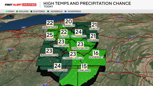
PITTSBURGH (KDKA) - A few remnant snow showers continue across our area early Thursday morning as weak northwest flow aloft continues to transfer cold air above relatively warm lake waters.
As a weak and short-lived ridge of high pressure settles into the region, most of these snow showers should end by midday except in the areas along the I-80 corridor.
WEATHER LINKS:
Current Conditions | School Closings & Delays | Submit Your Weather Photos
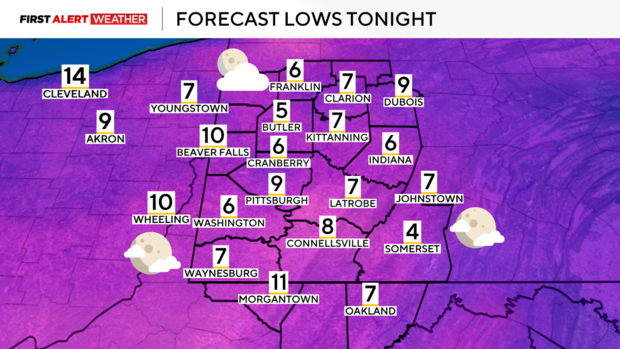
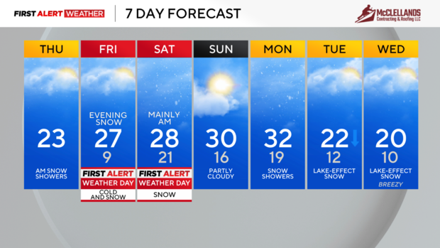
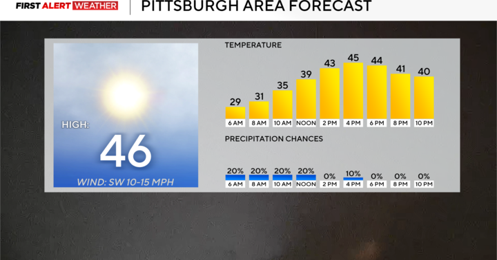
Skies will be partly cloudy to mostly clear this afternoon and temperatures will reach single digits into the night. Winds will be very light due to the high pressure overhead, air temperatures will be certainly cold but without strong wind gusts. Record breaking cold is not expected tomorrow morning and wind chills will not be at a dangerous to promote frostbite within a short time.
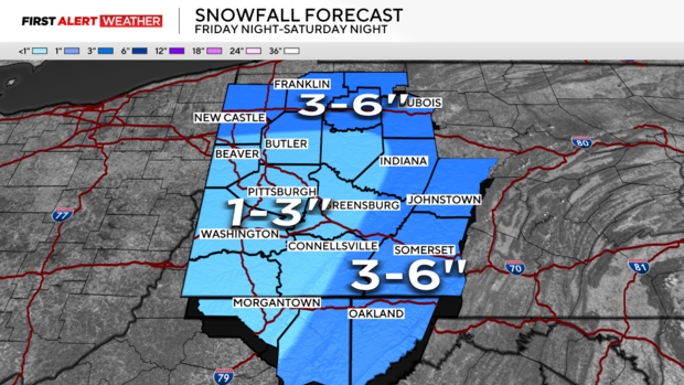
Friday morning will begin with mostly sunny skies, then clouds will increase ahead of another storm system that will arrive Friday going into the night. This system is in two parts—a northern stream wave of low pressure coming out of Canada/Northern U.S. and a southern stream wave of low pressure coming out of the Southern U.S. This will produce a widespread area of moderate snow that will impact all of Western PA and Northern WV. The snow will begin around or after sunset Friday and last into the mid-morning hours of Saturday.
Lingering snow showers will continue into the afternoon hours of Saturday, especially from Pittsburgh and points north, but the bulk of the steady and accumulating snow will occur during the predawn hours. A widespread 1-6 inches is anticipated across our coverage area with the highest amounts in the areas near and north of I-80 and in the Laurel Highlands and Ridges. Some lingering snow flurries are expected under cloudy skies Saturday night into Sunday morning with clearing skies Sunday.
Another quick hitting disturbance will produce more snow showers on Monday. This will followed by several days of weak disturbances and very cold air flowing aloft a relatively ice-free Lake Huron and Lake Erie which will result in more sporadic chances of lake-effect snow and cloudy skies into the middle of next week.
Stay up to date with the KDKA Mobile App – which you can download here!
