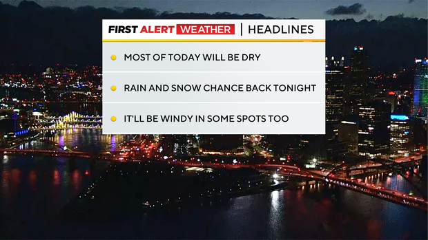
Most of the day will be dry with another mild afternoon expected later on
Any Alert Days Ahead? Nope.
Aware: We had a little bit of everything last night including rain, snow, severe thunderstorm warnings, and sleet.
The next 24 to 48 hours are going to be typical Western Pennsylvania with us continuing to see a little bit of everything. I don't think we will see another severe thunderstorm warning like we did Thursday night. But rain, snow, gusty winds, some winter mixing, and plummeting temperatures are all expected to occur. But first, we get to enjoy another mild day.
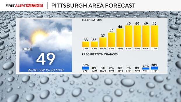
Morning lows dipped to the mid to low 30s in Pittsburgh Friday morning. Wind speeds of around 10mph pushed the wind chill down to the 20s so it was indeed a sweater weather and probably a moderate to heavy coat type of morning. Looking ahead, Friday will remain damp with cloudy skies for the morning hours and partly cloudy afternoon skies. Highs will be near 50 degrees again. Thursday we hit 49 for the daily high. I have us hitting 49 for Friday's high also. I have noon temperatures near 40 with our daily high not being hit until around 5 p.m. We should stay near 50 degrees for temperatures through midnight. That's when things start getting a little hectic.
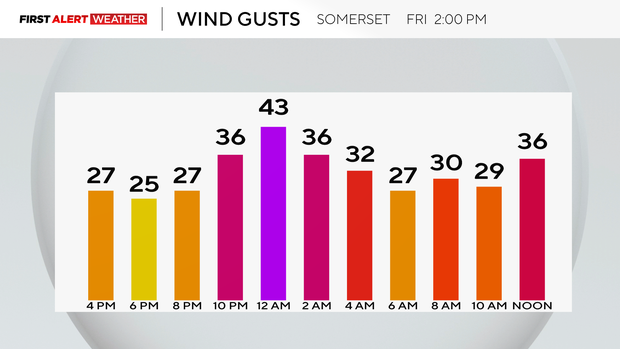
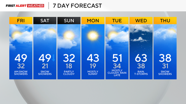
Temperatures will begin to plummet around midnight, just behind another round of isolated showers. Rain and eventually snow chances will go up in the wake of the mid-level low that will sweep by to our north. The trough and upper low that's situated to our north will pull in much colder air that will be in place both Saturday, Sunday, and Monday. Saturday temperatures will plummet with temperatures in the 30s for most of the day, and it'll also be windy overnight as cold air rushes in. By the end of the day on Saturday, temperatures will be down to nearly 20 degrees in Pittsburgh. I have Sunday morning's low now down in the mid-teens with clear skies. Sunday highs will only get back to near 32 degrees. Expect another cold start with temperatures in the teens on Monday morning. Temperatures will then increase to the low 40s for highs on Monday. Tuesday of next week will be the best day of the week, with highs in the mid-50s and rain chances staying away until after sunset. Temperatures will be even warmer on Wednesday. I am forecasting a high of around 62 for Pittsburgh (we will probably beat that to be honest). There will be rain around for the morning and then again returning that evening. Temperatures will be dropping through the morning on Thursday with highs met at midnight.
WEATHER LINKS:
Current Conditions | School Closings & Delays | Submit Your Weather Photos


