Unseasonable warmth arrives for Pittsburgh with rain looming mid-week
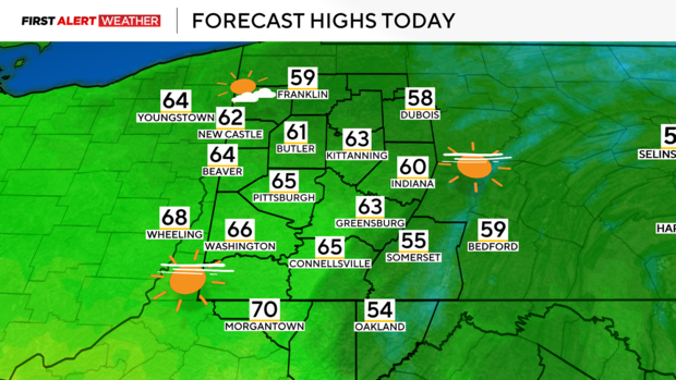
PITTSBURGH (KDKA) - Surface high pressure parked to our northeast along with clear skies and light winds through the overnight hours have led to a chilly start across Western PA. Most areas are down into the low to mid-30s this morning but expect a quick recovery in temperatures this afternoon as winds aloft in the atmosphere begin to transport warm air in from the southwest and low-level winds descend the higher terrain out east.
WEATHER LINKS:
Current Conditions | School Closings & Delays | Submit Your Weather Photos
Outside of some passing high-level clouds, today should be mostly sunny with highs in the mid-60s.
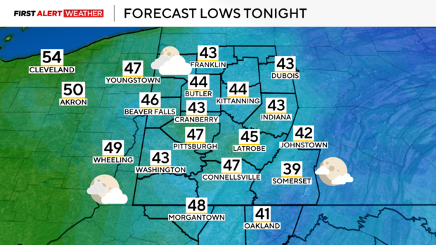
Overnight, a southeast wind in the wake of a warm front will prevent temperatures from dropping as much with lows in the mid to upper 40s. There will also be more clouds and a very slim chance of an isolated shower across our far northwest counties, however, a layer of very dry air in the low-middle levels of the atmosphere will prevent how much rain reaches the surface.
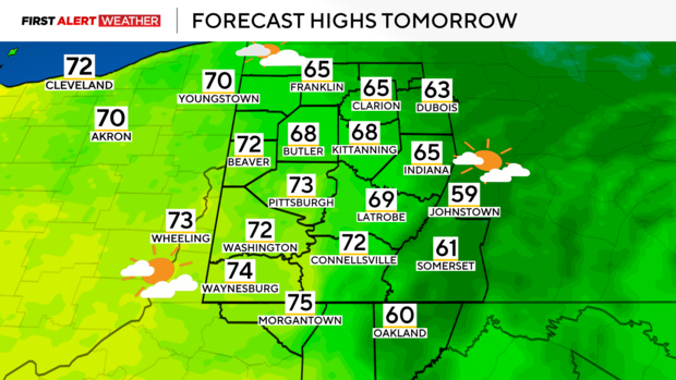
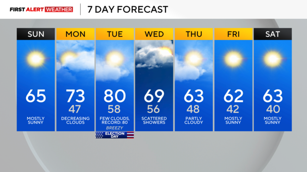
Skies will begin mostly cloudy before clearing up Monday afternoon leading us into another stretch of well above average temperatures. An unusually strong ridge of high pressure working in conjunction with upper-end levels of warm air advection a few thousand feet above the ground will lead to temperatures near record territory by next Tuesday afternoon.
Right now, highs are forecasted to reach the upper 70s to near 80. If Pittsburgh hits 80 degrees on Tuesday, that will tie the record high of 80 set in 1948 and would also tie as the latest calendar date to reach 80 degrees.
A cold front will move in from the northwest late Tuesday night into Wednesday bringing a few showers and possibly a thunderstorm or two, but rainfall amounts will be fairly light—generally around 0.1" to 0.25".
A slightly cooler air mass will move in from the Great Lakes and Canada by Thursday and Friday. Despite this, temperatures will still be above normal. High pressure will lead to dry conditions and clear skies toward the end of the week.
There are signs by the second full week of November the pesky ridge of high pressure that has deflected storm systems and moisture from our region may begin to break down resulting in a more active and stormier pattern in our region.
Stay up to date with the KDKA Mobile App – which you can download here!
