Certain areas of Pittsburgh will see snow Friday morning as a cold weekend lies ahead
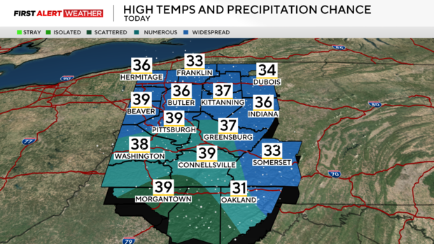
PITTSBURGH (KDKA) - Friday morning begins with a range of temperatures from the upper 20s across Northwest PA to low-mid 30s across Northern WV as a warm front bisects our area in half.
WEATHER LINKS:
Current Conditions | School Closings & Delays | Submit Your Weather Photos
The warm front is attached to an area of low-pressure across Northern Illinois that will slowly drift southeast toward West Virginia through the next 6-12 hours.
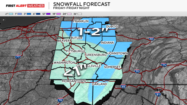
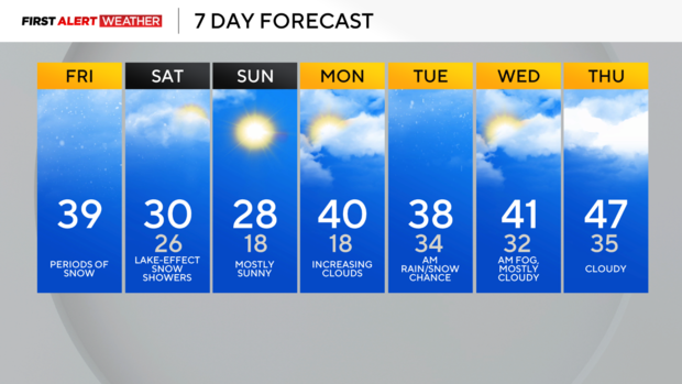
Rising air ahead of the low and north of the warm front will lead to spotty areas of snow through the early morning to early afternoon hours, especially north of Pittsburgh toward HWY 422 and I-80 corridors. A quick 1-2" is possible, especially from HWY 422 and points before temperatures slowly rise above freezing by early to mid-afternoon hours.
Pittsburgh and points south and east will only see a dusting up to 1/2" today. Any snow that occurs will melt by late afternoon and evening as temperatures rise above freezing.
A few snow flurries and overcast skies are expected this evening and overnight. Colder air will start to advect from the northwest as the low pressure departs to our east.
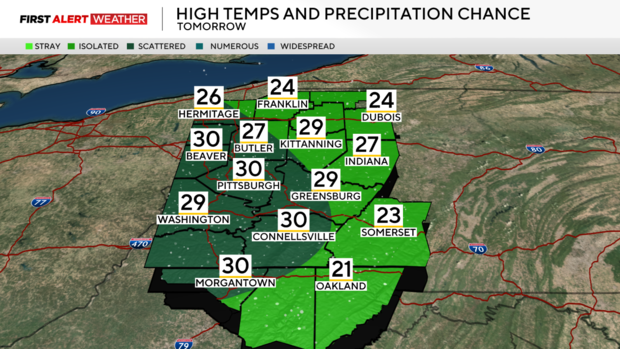
The high of 30 degrees for Pittsburgh on Saturday will occur around midnight with steady and falling temperatures through the day. With very cold air aloft moving over Lake Erie and Superior which have water temperatures in the mid-30s to low 40s along with a disturbance aloft in the atmosphere, a lake-effect snow band will likely setup tomorrow from Cleveland to Pittsburgh which could lead to some brief visibility reduction along with a narrow zone of light accumulations.
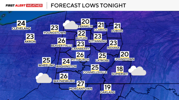
High pressure at the surface will settle in Saturday night into Sunday leading to clearing skies by Sunday. Under clear skies and light winds, Sunday morning and Monday mornings will be the coldest with temperatures dropping into the teens.
High pressure will move to our east by Monday and Monday night leading to southeast and southerly winds allowing the return of warm air in the low levels. Warm air will also move from the west to the upper levels, warming temperatures by Monday afternoon with highs in the low 40s. Moisture return accompanied by warmer air and weak disturbances will lead to another chance of rain and snow Monday night and Tuesday morning.
By Christmas Day, high pressure will be in place leading to generally tranquil and mild weather. Some fog is possible on Christmas morning as well. There is a high probability that above-average temperatures will linger into the end of the year.
Stay up to date with the KDKA Mobile App – which you can download here!
