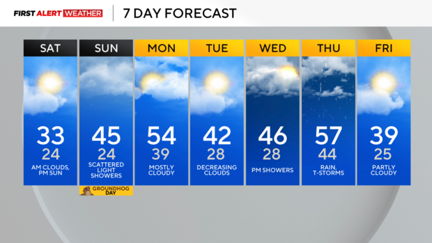
Clearing skies and cooler Saturday ahead of milder temperatures next week
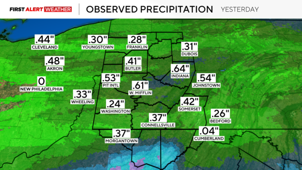
PITTSBURGH (KDKA) - Rainfall amounts varied yesterday with most spots receiving between 0.25 inches to 0.75 inches. Pittsburgh ended with 0.53 inches of measurable precipitation, which is right about what we were expecting for the city and is the most measurable precipitation we've received in one event in about a month.
WEATHER LINKS:
Current Conditions | School Closings & Delays | Submit Your Weather Photos
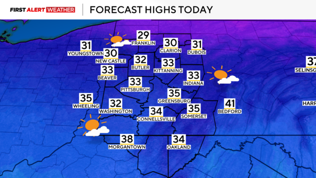
Today, expect some clouds early this morning with clearing skies leading to a mostly sunny afternoon and evening. High temperatures have already occurred just after midnight today, but most of Saturday will see temperatures reside in the low-mid 30s before temperatures drop into the mid 20s late in the evening.
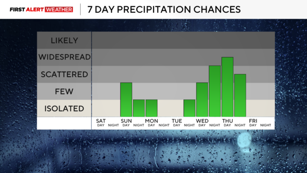
Winds will shift back to the south and southwest late Saturday night and Sunday, resulting in another minor warming trend to start next week. A weak disturbance moving in from the west will graze our area Sunday midday and into the afternoon hours, resulting in mostly cloudy skies along with some scattered light rain showers. It is possible that some snow or sleet pellets will mix in for areas along I-80 during the midday hours at the onset of this system, but with temperatures warming through the day, no major issues are expected in terms of wintry weather. The best precipitation chance will generally be north of Route 422 toward I-80. Skies will vary between partly to mostly cloudy Sunday night through the day Monday.
Warmer winds out of the southwest will push temperatures into the mid to upper 50s Monday afternoon. A cold front will push south into the region on Monday, and ultimately stall out to our southwest on Tuesday. This will result in a cooler day Tuesday with temperatures generally in the low 40s. That cold front will quickly return back to the north as a warm front on Wednesday into Wednesday night ahead of a stronger system poised to arrive on Thursday. Rain and cloudy skies will accompany this warm front on Wednesday with temperatures rising into the 50s late in the day. On Thursday, it is possible that temperatures spike to the mid 50s to near 60 depending on how strong the surge of warm air is from the southwest. This unseasonable warmth would be accompanied by rain and possibly a few thunderstorms, followed by another cold front and surge of colder air to end next week.
Stay up to date with the KDKA Mobile App – which you can download here!