Chilly and cloudy Sunday ahead of an active week of weather
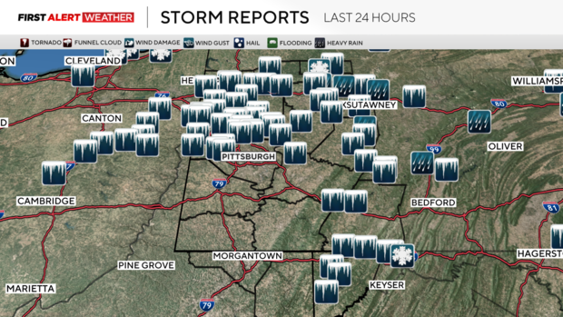
PITTSBURGH (KDKA) - Saturday's freezing rain event went according to forecast with ice being reported over northern suburbs of the Pittsburgh metro area and points north to Route 422/I-80 and in the Laurel Highlands. The greatest ice reports we've received so far as of Sunday morning have been 0.2 inches in Somerset and 0.3 inches in Clymer in Indiana County which led to snapped tree branches and low hanging utility lines. According to outage data, there are a few hundred customers with outages in Butler and Armstrong counties just before sunrise Sunday morning.
WEATHER LINKS:
Current Conditions | School Closings & Delays | Submit Your Weather Photos
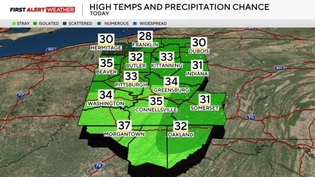
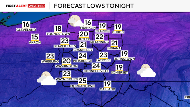
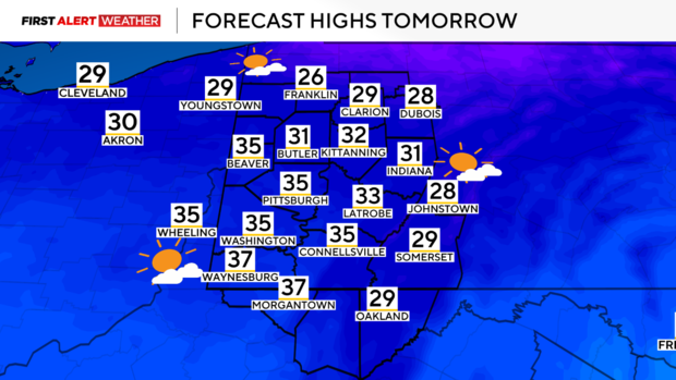
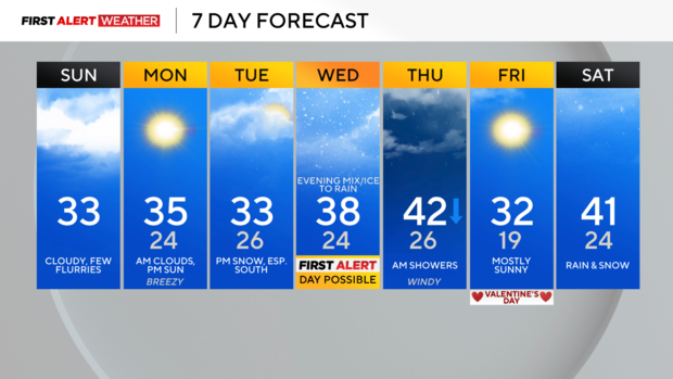
In the wake of yesterday's system, strong wind gusts are moving through this morning, but will diminish as the afternoon and evening progress. Peak wind gusts today have been as much as 35-40mph in some places. Skies will remain mostly cloudy to overcast with a few flurries and light snow showers possible through early evening. The high temperatures for today will stay in the low 30s for most of the afternoon. Clouds will slowly decrease tonight into tomorrow morning, leaving us with a mostly sunny afternoon and evening. Temperatures tonight will range from the upper teens to mid 20s, with highs tomorrow afternoon reaching the low to mid 30s.
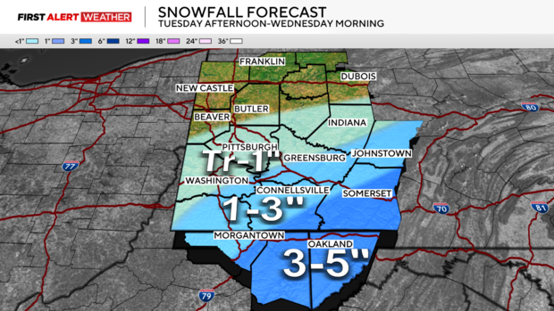
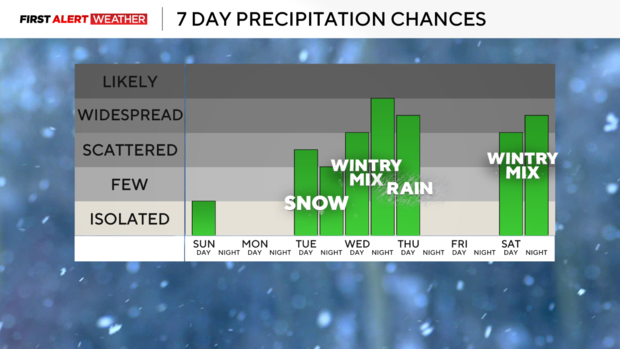
After a brief lull in the active weather to start the week, our large scale weather pattern will turn busy toward the middle and end of this upcoming week. Several disturbances will traverse the Ohio Valley and Lower Great Lakes States moving from southwest to northeast bringing various types of precipitation to Western Pennsylvania and Northern West Virginia pending their track. From Tuesday afternoon to Wednesday morning, a weaker disturbance will likely pass just to our south, but will carry a band of light accumulating snow that will impact the southern third of our coverage area. Early forecasted snowfall amounts are expected to range from less than an inch in and around Pittsburgh to locally near 5 inches in portions of Somerset and Garrett counties. Minor shifts in the track of this system may result in changes to the snowfall forecast.
On the heels of Tuesday night into Wednesday's system will be a much stronger storm system with a stronger area of low pressure moving up from the southwest. Widespread precipitation will accompany this system beginning late Wednesday afternoon into the predawn hours of Thursday. With regards to precipitation type, the setup looks fairly similar to the last two recent events where a mix of freezing rain and sleet will be possible at the onset, but warmer air will result in a changeover to rain, especially by Thursday morning over most of Western Pennsylvania and Northern West Virginia. Gusty winds and falling temperatures are expected on the backside of this system as the cold front moves through on Thursday. High pressure will settle in on Friday leading to clear skies and a fresh surge of cold air. This lull will be brief as another potent system looks to arrive by Saturday into Sunday next weekend with all precipitation types possible once again.
Stay up to date with the KDKA Mobile App – which you can download here!