NASA
This satellite image from Oct. 29, 2003 shows smoke from the California fires accumulating over northwest Arizona after the winds changed direction.
NASA
NASA's Terra Satellite captured this image of plumes from the California wildfires on Oct. 29, 2003.
NASA/CBS
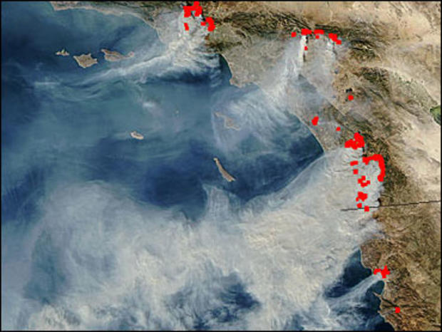
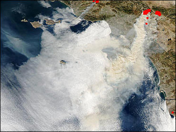
This satellite photo shows the smoke plumes rising from the fires in southern California. Active fires, as of Oct. 27, 2003, are shown in red.
NASA/CBS
Again, active fires are marked in red.
NASA/CBS
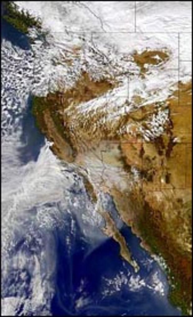
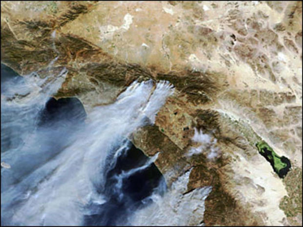
This is now the Grand Prix Fire and Piru Fire near Los Angeles looked on Oct. 25, 2003.
NASA/CBS
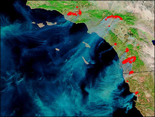
In this satellite image, plumes of smoke caused by wildfires are seen moving off the coast through southern California, Oct. 26, 2003. Fires burning are, at left, Simi Valley and Moorpark; center, the combined Grand Prix and Old Fire, north of San Bernadino and Rancho Cucamonga/Ontario; bottom right, the Scripps Ranch fire in the San Diego area.
NASA/CBS
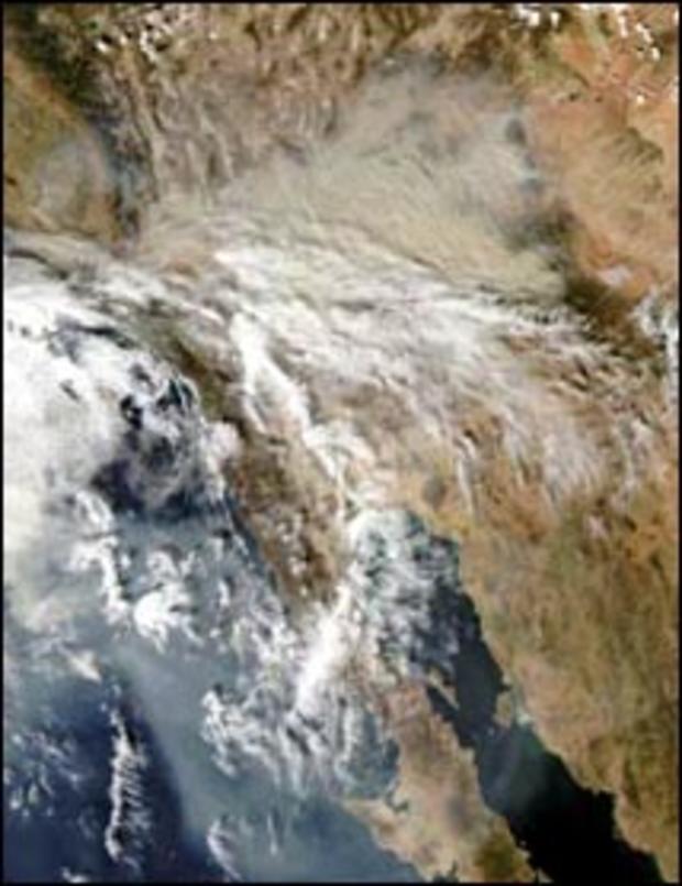
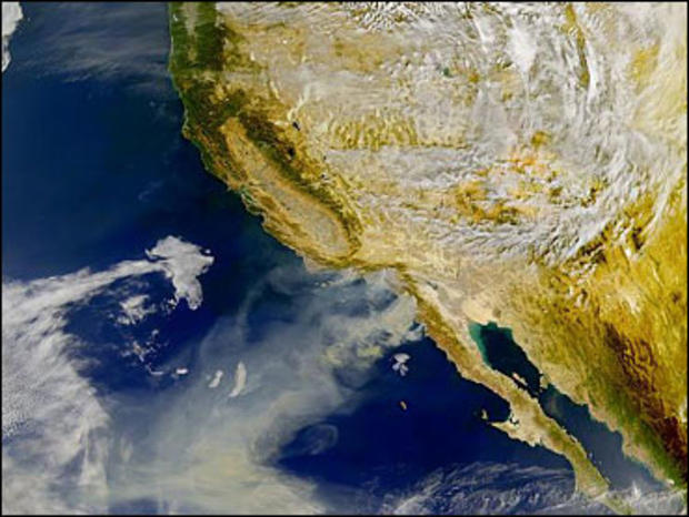
NASA's Sea-viewing Wide Field-of-view Sensor aboard the Orbview-2 satellite gets a wider view of the area. In this image, the smoke plumes extend the entire length of the Baja peninsula, several hundred miles.
NASA/CBS
NASA's Moderate Resolution Imaging Spectroradiometer aboard the Aqua satellite constitutes a vital part of the National Interagency Fire Center's management tool kit for monitoring and controlling wildfires.
NASA/CBS
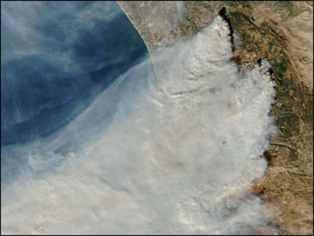
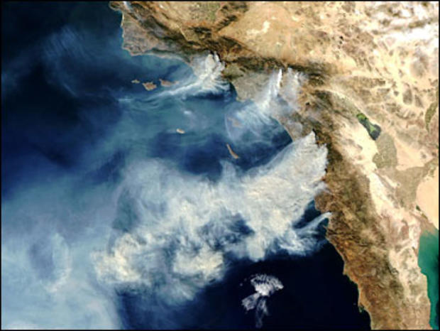
This image from Oct. 27, 2003, shows plumes of smoke extending miles out over the Pacific Ocean.
NASA
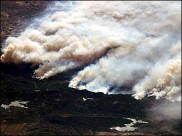
The crew of the International Space Station photographed the wildfires ravaging southern California from its unique perspective 240 miles above Earth.