NASA/JPL
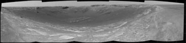
This 180-degree view from Opportunity's navigation camera is the first look inside "Endurance Crater," measuring about 430 feet in diameter. The view is a cylindrical projection constructed from four images.
NASA/JPL
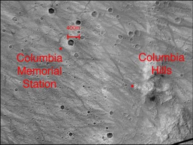
This image highlights the beginning, at the Columbia Memorial Station, and possible end, at the Columbia Hills, of the Mars Exploration Rover Spirit's journey. NASA announced on April 28, 2004, that both rovers had completed their originally planned missions and were tackling extra-credit assignments. The image was taken by the camera on NASA's Mars Global Surveyor orbiter.
NASA/JPL
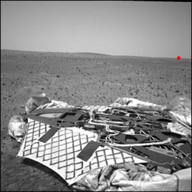
Spirit took this navigation camera image on Feb. 5, 2004. In the foreground is the lander, and the untouched surface of Mars lies beyond. Spirit has since traversed across this landscape, and as of April 19, 2004, sat about 1,640 feet away on the horizon, as indicated by the red dot. The elevated crest on the left side of the image is the rim of "Bonneville" crater, which Spirit passed on its way.
NASA/JPL
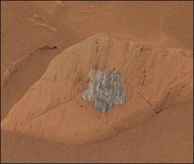
This composite image from Spirit's panoramic camera, taken April 15, 2004, gives an approximately true-color rendering of a daisy-like pattern of brushed circles that Spirit produced on a rock called "Route 66." The purpose for these large brushings is to create a large enough patch of treated surface area for the miniature thermal emission spectrometer to analyze.
NASA/JPL
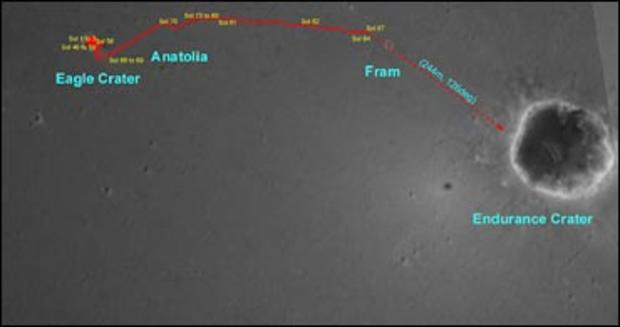
This overview map illustrates the path that Opportunity has taken on the red planet. Starting at its "Eagle Crater" landing site, the rover moved onto the plains of Meridiani Planum, stopping at a curious trough and a target within it called "Anatolia." Next, it approached and remotely studied the rocky dish called "Fram Crater." As of April 26, 2004, the rover sat about 525 feet from the rim of "Endurance Crater."
AP/NASA/JPL
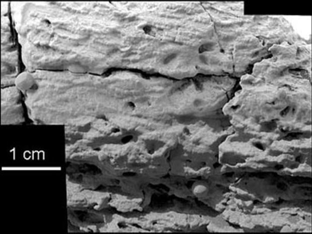
This microscopic mosaic image of the rock named "Last Chance," taken by the Mars Opportunity Rover and released by NASA March 23, 2004, shows textures that scientists say provides evidence sediments forming the rock were laid down by flowing water. Mars once had a briny pool of standing water on its surface that could have supported life in the now-frozen planet's distant past, the NASA scientists said.
NASA/JPL
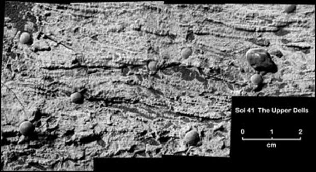
Opportunity took this magnified image of a portion of a martian rock called "Upper Dells." According to NASA the rock, like the one called "Last Chance," preserves evidence for trough cross-lamination, likely produced when flowing water shaped sinuous ripples in underwater sediment and pushed the ripples to migrate in one direction.
NASA/JPL
This approximate true-color image taken by the panoramic camera on the Opportunity rover shows a region at the end of the rock outcrop lining "Eagle Crater." The sphere-like grains, or "blueberries," dotting the rocks in the outcrop can also be seen above the rocks, suggesting that these geologic features have origins beyond Eagle Crater.
NASA/JPL
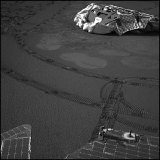
This image from Opportunity's navigation camera shows the lander which was its temporary home for the six-month cruise to Mars. Opportunity is situated about 20.3 feet from the lander, and rover tracks zig-zag along the surface. Bounce marks and airbag retraction marks can also be seen.
NASA/JPL
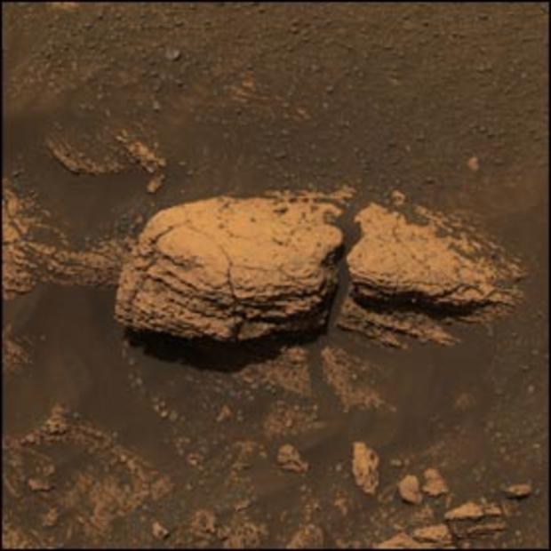
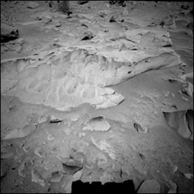
Spirit took this navigation camera image of the 6.6-ft. wide rock called "Mazatzal" on March 21, 2004. The rock stood out to NASA scientists because of its large size, light tone and sugary surface texture. It is the largest rock the team has seen at the rim of the crater informally named "Bonneville."