NASA's Goddard Space Flight Center, MODIS Rapid Response Team
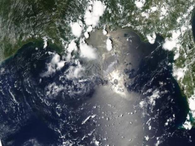
Not so happy a 4th of July. The oil appears as an uneven light gray shape east-southeast of the delta.
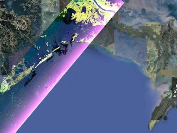
UAVSAR Maps the Gulf Coast Oil Spill
NASA/JPL--Google
NASA's Uninhabited Aerial Vehicle Synthetic Aperture Radar (UAVSAR) flew over the Gulf of Mexico to image the Deepwater Horizon oil spill on June 22-23, 2010.
Oil Slick Around Mississippi Barrier Islands June 27
Rebecca Lindsey/NASA's Earth Observatory/NASA's Goddard Space Flight Center
Petit Bois Island (top right) and the eastern end of Horn Island (top left) on June 26. In general, oil-covered waters are silvery and cleaner waters are blue-gray.
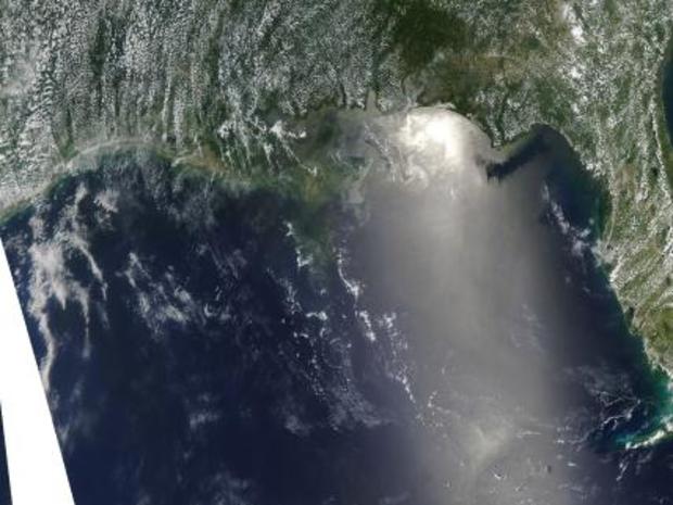
Oil Offshore of Alabama and Florida's Western Panhandle
Rebecca Lindsey/NASA's Earth Observatory/NASA's Goddard Space Flight Center
In this image, eastern areas of the slick are more visible than western areas. Heavy concentrations of oil in the vicinity of the leaking well, which is about 75 kilometers (47 miles) southeast of the Mississippi Delta (beyond the left edge of the image.)
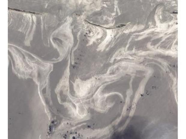
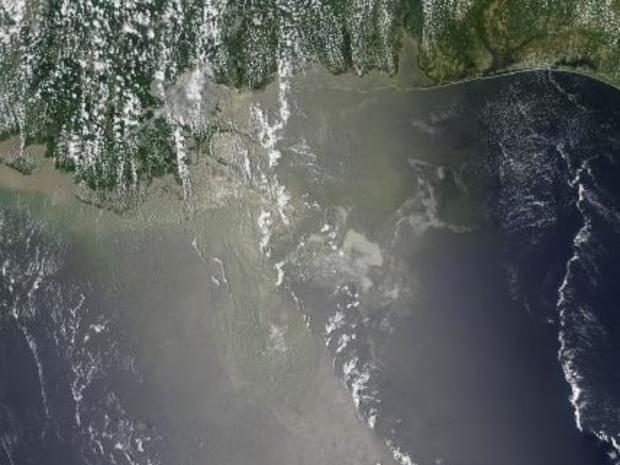
Oil Spill Seen as Silvery-gray Ribbons, June 19
ebecca Lindsey/NASA's Earth Observatory/NASA Goddard Space Flight Center
On June 19, 2010, oil spread northeast from the leaking Deepwater Horizon well in the Gulf of Mexico. The oil appears as a maze of silvery-gray ribbons in this image.
June 12 Image of Oil Spill
Rebecca Lindsey/NASA's Earth Observatory/NASA's Goddard Space Flight Center
In this image, taken June 12, the oil appears to have reached beaches and barrier islands in Alabama and the western Panhandle of Florida.
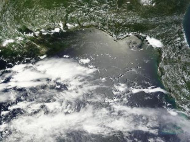
NASA's Aqua Satellite Saw Oil Slick in Sunglint on June 10
Rob Gutro / Holli Riebeek, NASA's Goddard Space Flight Center
In the thickest part of the slick, oil smooths the water, making it a better "mirror." Areas where thick oil cover the water are nearly white in this image.
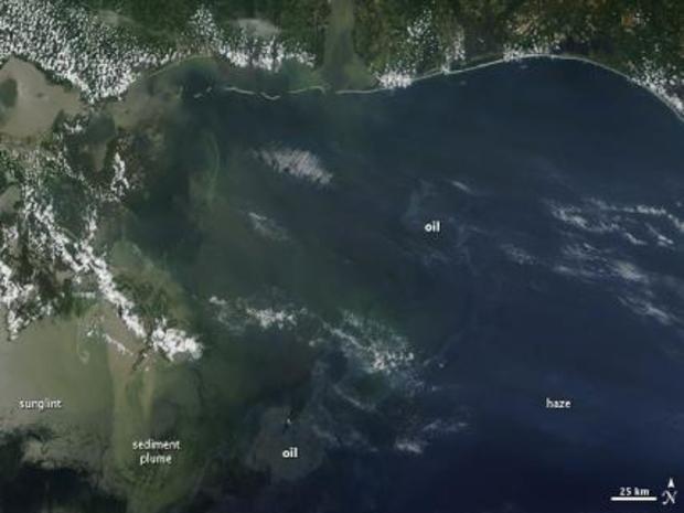
The Different Appearances of Oil in June 7
NASA Goddard MODIS Rapid Response/Holli Riebeek
Part of the oil slick is identified in this image by the pale gray color. A large swath of oil is southeast of the Mississippi Delta, at the site of the leaking oil rig. Traces of thick oil are also visible farther north.
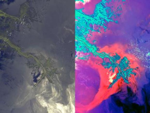
Leaking Oil Invades Louisiana Wildlife Habitats
NASA/GSFC/LaRC/JPL, MISR Team
Using multiple cameras, NASA's Terra spacecraft created two unique views of oil moving into Louisiana's coastal wetlands.
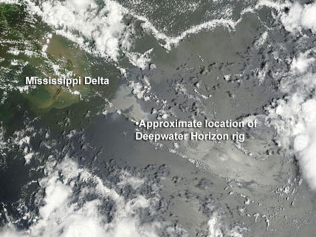
The Day it All Began: April 20, 2010
NASA/MODIS Rapid Response
BP's Deepwater Horizon oil rig exploded in the Gulf of Mexico on April 20, resulting in the deaths of a dozen workers. Oil began gushing into the water and the nation soon faced what would shortly become an environmental catastrophe.