Look back: The Mount St. Helens Eruption
At 8:32 a.m. Pacific Daylight Time on May 18, 1980, a 5.2 magnitude earthquake struck below the north face of Washington's Mount St. Helens. The earthquake triggered the largest debris avalanche in recorded history, wiping out the northern summit of the volcano and exposing its core.
It was the largest eruption to rock the volcano in 123 years. Fifty-seven people were killed.
Early Eruption
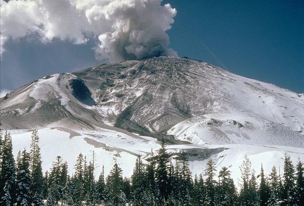
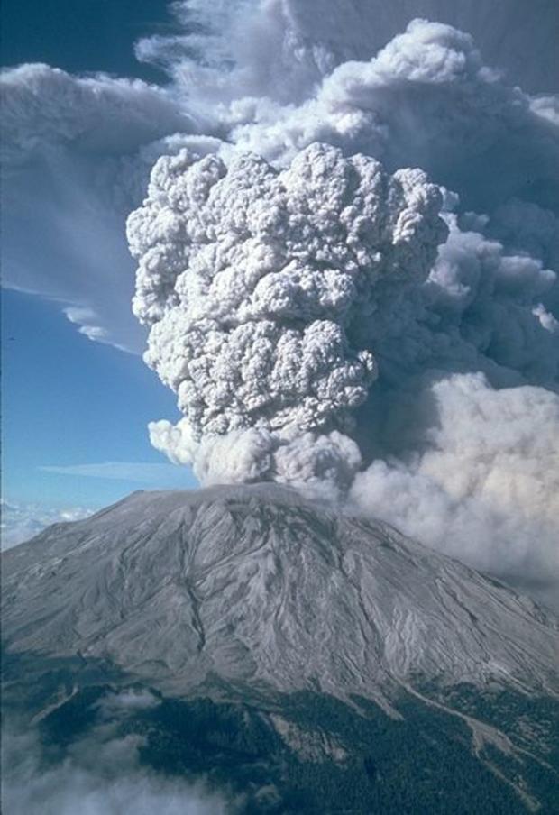
On March 20, 1980, after a quiet period of 123 years, earthquake activity once again began under the Mount St. Helens volcano. Seven days later, on March 27, small steam explosions began. This view is from the northeast.
Early Eruption
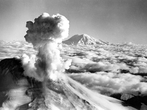
Black smoke and ash drift skyward as Mount St. Helens erupts on March 30, 1980, sending a mushroom-shaped cloud more than 16,000 feet into the atmosphere.
Monitoring
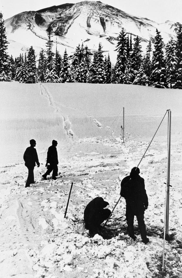
Scientists check equipment that monitors volcanic activity near the base of Mount St. Helens Monday, April 7, 1980.
Eruption
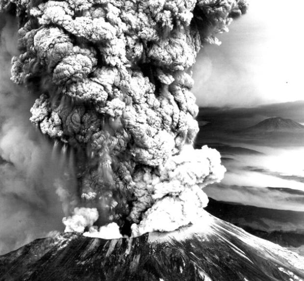
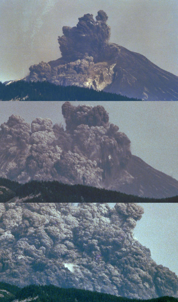
This series of photos captures the massive eruption of Mount St. Helens on May 18, 1980. The blast triggered the largest landslide in recorded history, flattening trees for 220 square miles in a cloud of smoke, ash and pumice.
Another View of Eruption
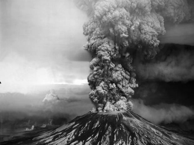
The May 18, 1980 blast destroyed 230 square miles of forest.
Close-Up of Ash Plume
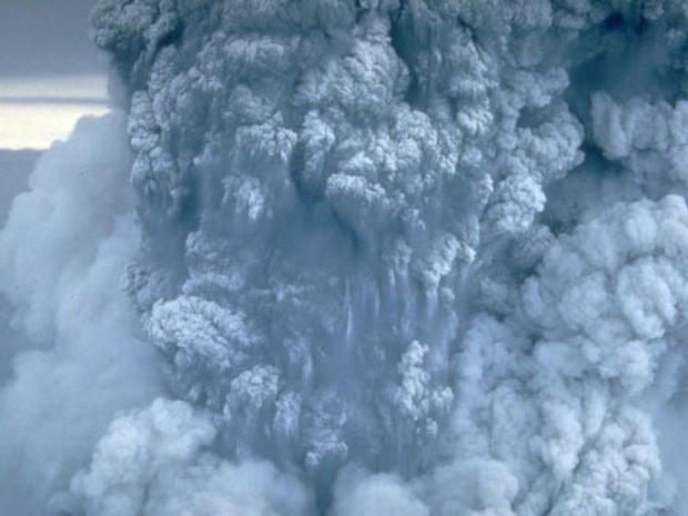
For more than nine hours a vigorous plume of ash erupted, eventually reaching 12 to 15 miles above sea level.
Mount St. Helens
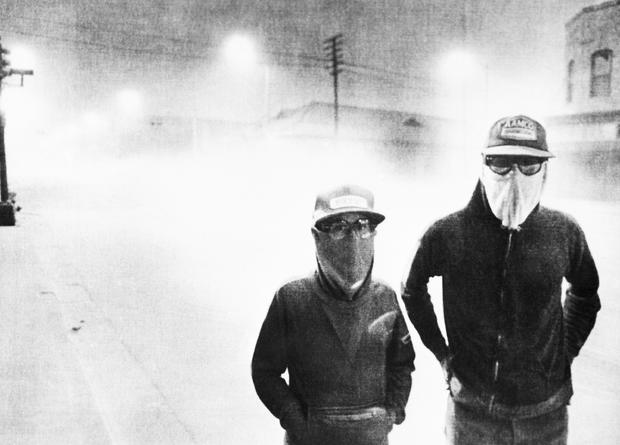
The streets of Yakima, Washington are dark at 3:00 p.m. after an eruption at Mount St. Helens, May 18, 1980. White volcanic ash covers the streets and passersby wear protective masks.
Mount St. Helens
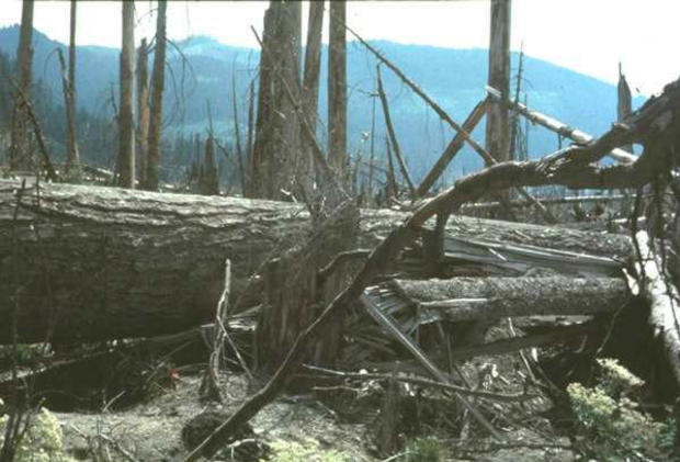
Trees knocked down by the May 18, 1980 eruption of Mount St. Helens are shown along a logging road near the south fork of the Toutle River in Washington state.
Destruction
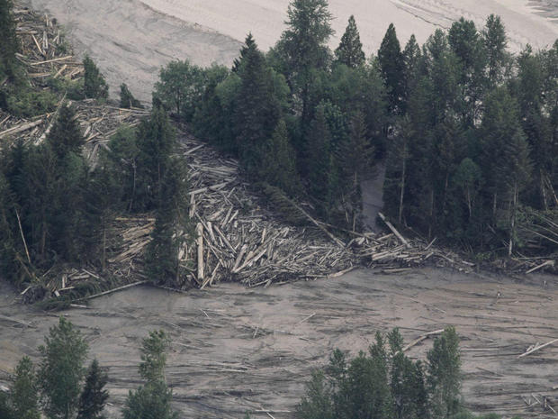
Logs are piled like sticks in the aftermath of the eruption of Mount St. Helens in Washington state, May 19, 1980.
Mount St. Helens
Bob Brown, left, and his brother John attempt to lead three horses to safety out of the Weyerhaeuser 19 mile yard log in Kid Valley, Wash.
The yard was flooded by the Toutle River following the eruption of Mount St. Helens.
Mount St. Helens
John Brown is covered with mud and exhausted following his unsuccessful rescue attempt of three horses in a log yard flooded by the Toutle River after the eruption of Mount St. Helens, Washington state, May 19, 1980.
Although Brown was helped by at least three other individuals, all efforts to save the horses failed.
Mount St. Helens
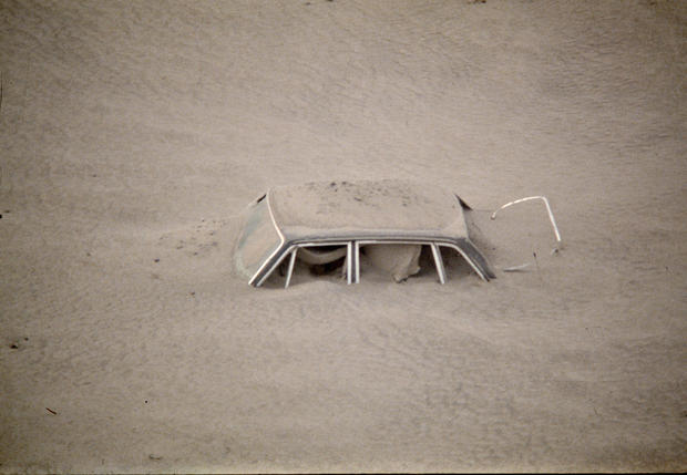
A car is shown submerged in ash in this May 20, 1980 from the Mount St. Helen eruption in Washington State.
Mount St. Helens
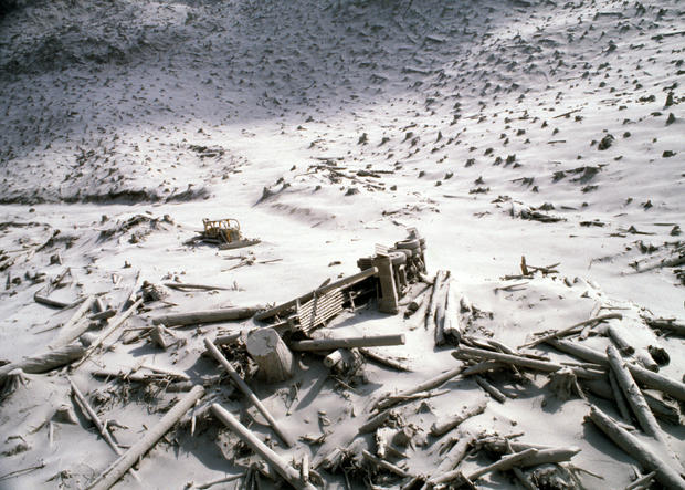
The aftermath of the Mount St. Helen eruption is seen May 20, 1980 in Washington State.
A wrecked logging truck and crawler tractor are shown amidst ash and downed trees near Mount St. Helens two days after an explosive eruption that killed 57 people.
Deforestation
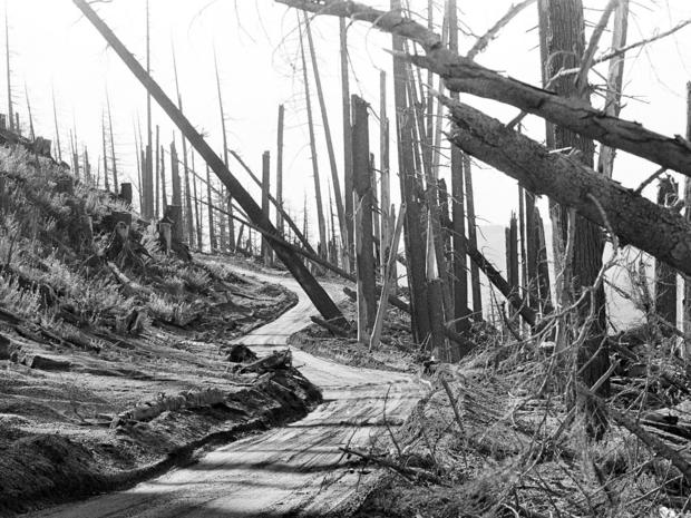
A road snakes through destroyed timberland and the fallout of ash around Mount St. Helens, March 23, 1982.
Mount St. Helens
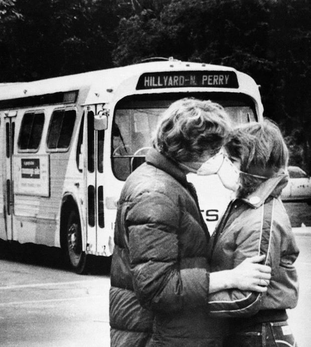
Fifteen-year-old Heidi Havens gives Allen Troup, 16, a kiss as he prepares to board a Spokane City bus, May 27, 1980.
Spokane residents have had to wear face masks while outside because of possible health threats from volcanic ash sprayed over the area by Mount St. Helens.
Secondary Eruption
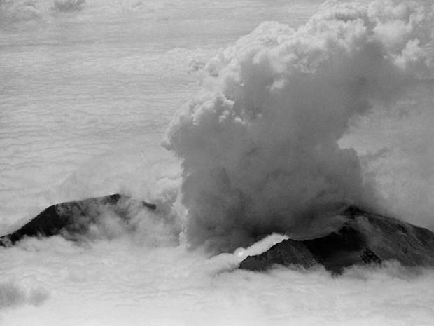
Mount St. Helens erupts on May 29, 1980, sending a plume of steam and ash skyward.
Mount St. Helens
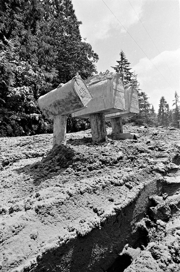
Mud from the Toutle River rises about four feet in this area as residents started digging out, May 31, 1980, after the area was hit by flash flooding in the wake of the May 18 eruptions on Mount St. Helens.
More Eruptions
After May 18, five more explosive eruptions of Mount St. Helens occurred in 1980, including this spectacular event of July 22.
This eruption sent pumice and ash 6 to 11 miles into the air, and was visible in Seattle, 100 miles to the north. The view here is from the south.
Plume
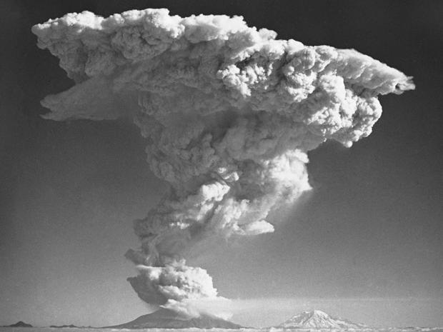
Mount St. Helens roared to life again on October 17, 1980, sending a plume of smoke and ash skyward an estimated 50,000 feet into the air. Also seen is Mount Rainier, a dormant volcano.
Eruption's Aftermath
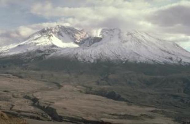
The eruption formed a deep north-facing horseshoe-shaped crater. Small eruptions from 1980 to 1986 built a lava dome. The lava dome can be seen here steaming within the crater.
Devastated Landscape
All traces of the pre-eruption forest were erased by the fiery flows (1,300 degrees Fahrenheit) that emanated from the crater.
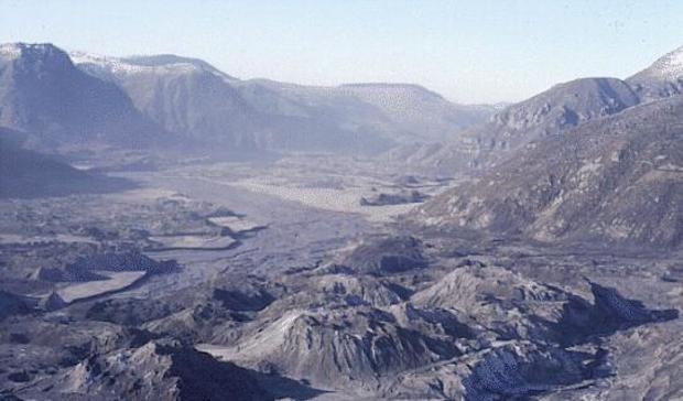
North Fork Toutle River Valley
A November 1983 view downstream of the North Fork Toutle River Valley, north and west of Mount St. Helens, shows part of the debris avalanche that slid from the volcano on May 18, 1980.
Life Returns
Plant life slowly returned to the blown-down forest, but, because individual plants were few and far between, the landscape still looked mostly gray three years after the eruption in this 1983 photo. Countless seeds drifted into the blast zone but only a few took root on the sun-baked ash surface.
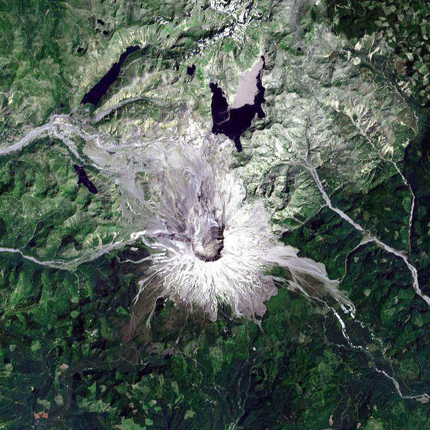
Destruction and Rebirth
This image was acquired by Landsat 7 on Aug. 22, 1999. It was produced at 30-m resolution using bands 3, 2, and 1 to display red, green, & blue, respectively ("true color").
Some of the effects of the massive eruption on May 18, 1980, can still be seen clearly, especially on the northern and eastern flanks of Mount St. Helens, which are still mostly barren (shades of white and gray). The crater is in the center of the image. On other parts of the mountain, the rejuvenation process is obvious. Ash deposits have supplied minerals which have accelerated vegetation growth (various shades of green).
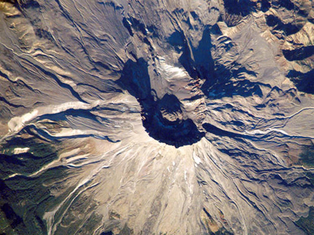
View From Space
The devastating effects of the eruption are clearly visible in this 2002 photo from the International Space Station.
2004
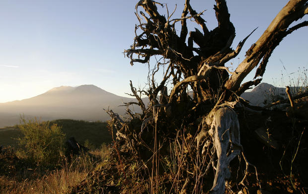
The stump of a tree destroyed in the 1980 eruption is bathed in the dawn sun as small trail of steam exits the crater of Mount St. Helens, October 7, 2004.
2015
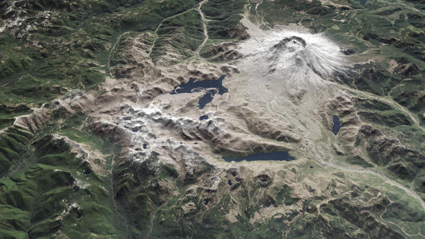
Mount St. Helens, in southwest Washington state, is seen in an image assembled from data acquired April 30, 2015 by the NASA Operational Land Imager on Landsat 8 and the Advanced Spaceborne Thermal Emission and Reflection Radiometer (ASTER) on the Terra satellite.
Memorial
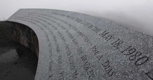
A memorial to those who lost their lives in the May 18, 1980 eruption of Mount St. Helens is seen near the Johnson Ridge Observatory at the Mount St. Helens National Volcanic Monument in Washington state in this May 18, 2010 file photo. The observatory is named after U.S. Geological Survey volcanologist David Johnston, who died while monitoring the volcano during its eruption.
