Lava flows on Hawaii's Big Island
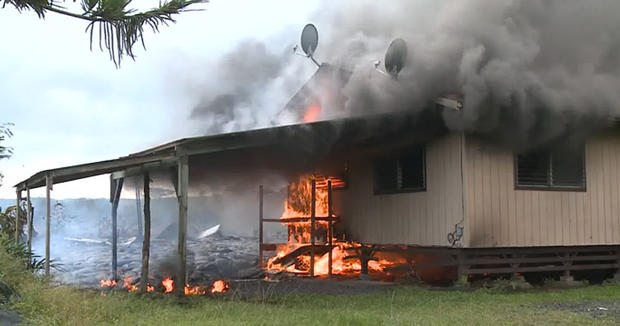
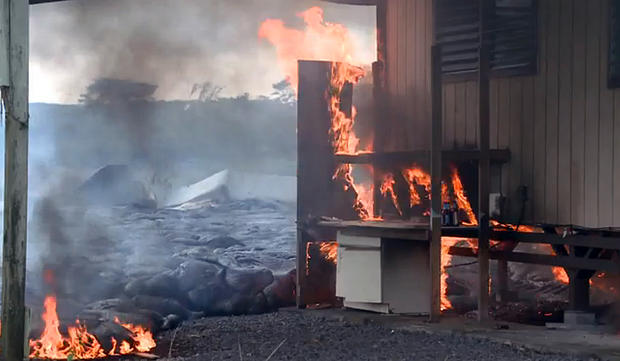
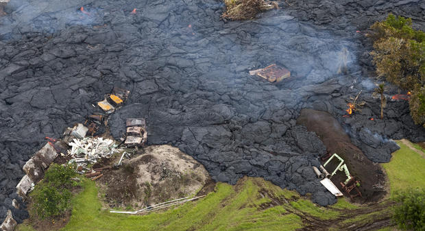
In this video still lava flowing from the Kilauea Volcano burns down a house Nov. 10, 2014, in Pahoa, Hawaii. Officials made arrangements for homeowners to watch homes burn as a means of closure and to document the destruction for insurance purposes.
Kīlauea
In this video still lava flow from the Kilauea Volcano sets a house on fire Nov. 10, 2014, in Pahoa, Hawaii.
Kīlauea
Lava flow from the Kilauea Volcano closes in on a home near Pahoa, Hawaii Nov. 10, 2014. A stream of lava set a home on fire in this rural area that has been watching the slow-moving flow approach for months.
Kīlauea
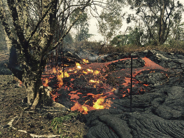
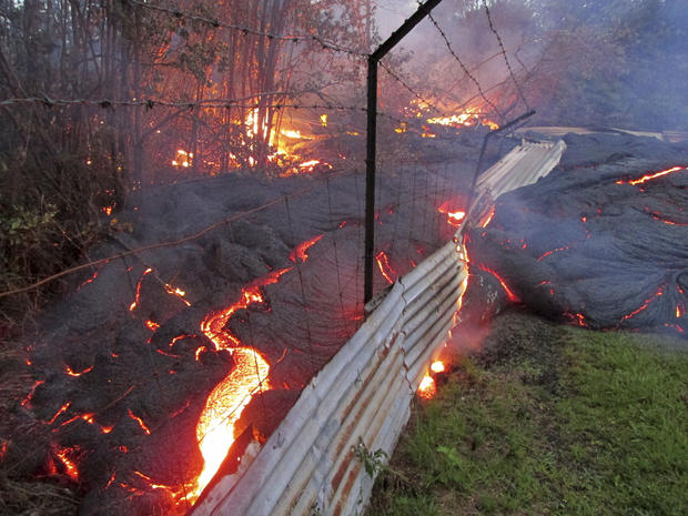
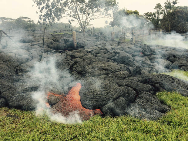
A small breakout of lava from the Kilauea Volcano pushes past a fence near the village of Pahoa, Hawaii, Nov. 6, 2014. New video footage of the Puna Lava flow from the Kilauea volcano released on Thursday shows the front of the lava flow remained stalled but officials continue to monitor other potentially active areas where the lava has branched out.
Kīlauea
The lava flow from the Kilauea volcano moves over a fence on private property near the village of Pahoa, Hawaii Oct. 31, 2014. The lava flow from the Kilauea volcano has been slithering toward the Big Island village of Pahoa for weeks.
Kīlauea
Burning debris can be seen in the lava flow from Mount Kilauea that is inching closer to the village of Pahoa, Hawaii Oct. 29, 2014. The slow-moving river of molten lava from the erupting Kilauea volcano crept over residential and farm property on Hawaii's Big Island after incinerating an outbuilding as it threatened dozens of homes at the edge of the former plantation town. Marco Garcia/REUTERS
Kīlauea
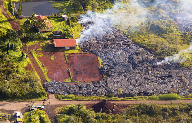
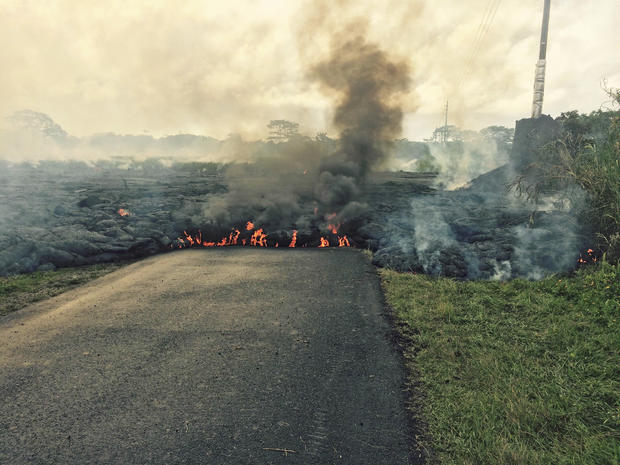
The lava flow from the Kilauea Volcano near the village of Pahoa, Hawaii Oct. 26, 2014. Authorities said they're preparing to evacuate about 4,000 people living in the area, as it could reach homes in a few days. The lava began flowing from the Kilauea Volcano on June 27 and as of October 24 the flow front was 0.7 miles (1.2 km) from Pahoa Village Road, according to the U.S. Geological Survey.
Kīlauea
The lava flow from the Kilauea Volcano near the village of Pahoa, Hawaii Oct. 25, 2014. Approximately 4,000 people live in the residential communities that the lava is approaching.
Kīlauea
The lava flow from the Kalauea Volcano is split into two separate lobes in this aerial picture taken near the village of Pahoa, Hawaii Oct. 24, 2014.
Kīlauea
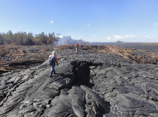
Hawaii Volcano Observatory (HVO) geologists walk over the surface of a lava flow from the Kilauea Volcano to track surface breakouts near the village of Pahoa, Hawaii Oct. 22, 2014.
Kīlauea
Geologists from the Hawaiian Volcano Observatory survey the lava flow from the June 27th flow from the Kilauea volcano in Pahoa, Hawaii. On Tuesday, Sept. 16, 2014, Hawaii County spokesman Kevin Dayton said the slow-moving lava is expected to bypass homes in the Kaohe Homesteads subdivision, and that the lava is about 19 days from reaching Pahoa Village Road.
Kīlauea
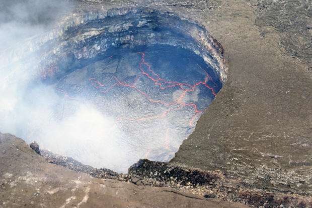
The lava lake at Kīlauea's summit. The lake was roughly 53 meters (170 feet) below the floor of Halemaʻumaʻu Crater the morning of Sept. 17, 2014.
Kīlauea
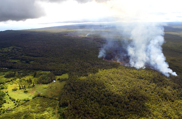
Lava flow from the Kilauea volcano passes near the Kaohe Homesteads in Pahoa, Hawaii, Sept. 15, 2014.
Kīlauea
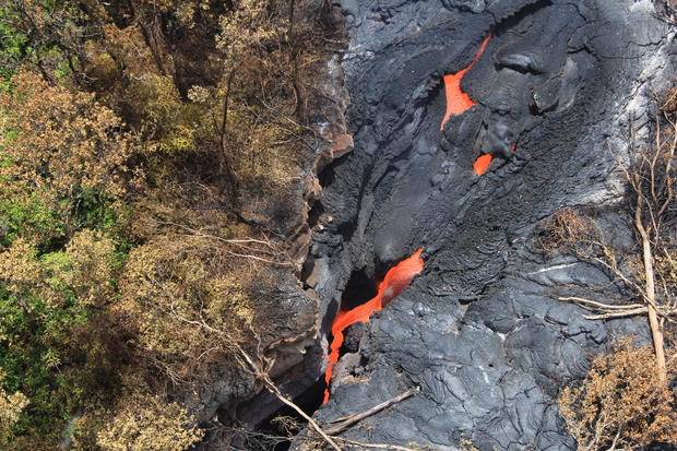
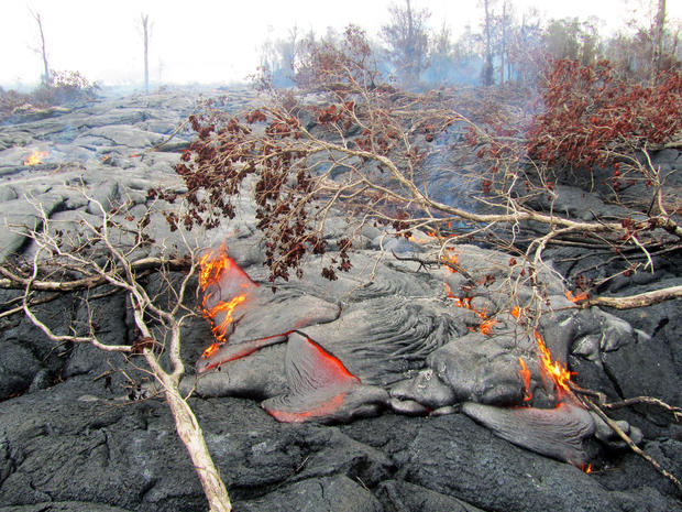
Fluid lava streams from the June 27 lava flow from the Kilauea volcano in Pahoa, Hawaii, Sept. 1, 2014.
The June 27 lava flow is named for the date it began erupting from a new vent.
Kīlauea
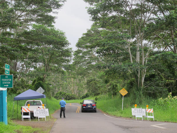
A guard stands at the entry to the Kaohe Homesteads community in Pahoa, Hawaii where only residents are allowed to enter because of threat of lava flows, Sept. 8, 2014.
Those who live on the slopes of Kilauea volcano know lava could start creeping their way at any time but the area is still a powerful draw for many who value its community and affordability.
Kīlauea
Fluid lava streams from the June 27 lava flow from the Kilauea volcano in Pahoa, Hawaii, Sept. 1, 2014.
Kīlauea
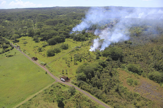
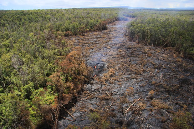
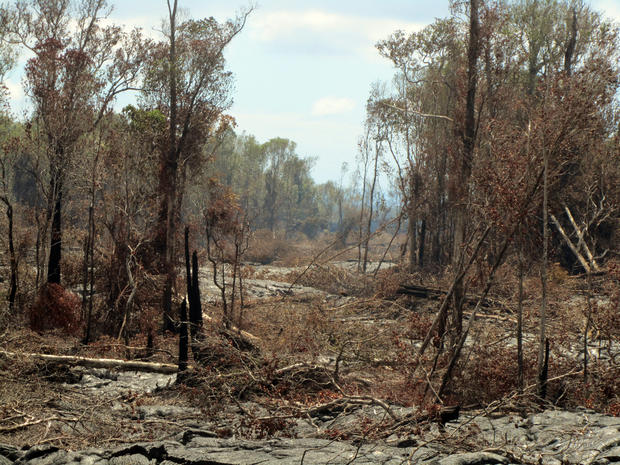
Surface flows cut a swath through thick forest from the June 27 lava flow from the Kilauea volcano in Pahoa, Hawaii, Sept. 6, 2014.
Kīlauea
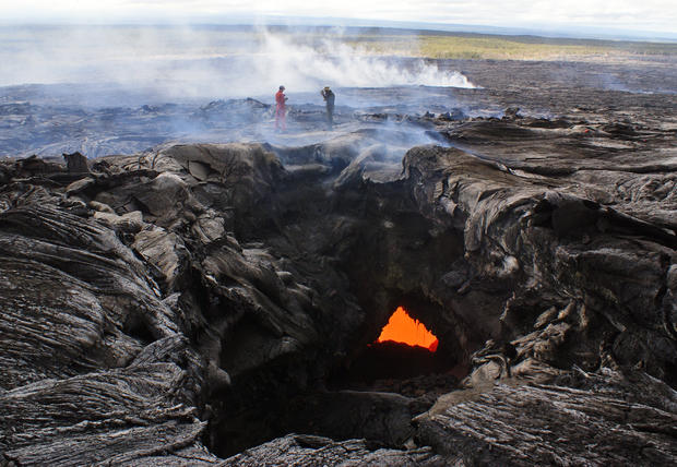
A close view of the surface activity from the June 27 flow from the Kilauea volcano in Pahoa, Hawaii, Sept. 15, 2014.
Kīlauea
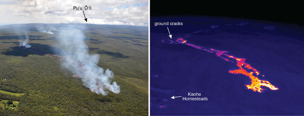
The photo on the left is compared here to a thermal image on the right, which provides a clear view of the flow front of the June 27 flow through the thick smoke.
The vent for the June 27th flow is on Puʻu ʻŌʻō, which can be seen at the top of the normal photograph. After pouring in and out of ground cracks in late August, the flow finally emerged from the cracks around Sept. 3 and began spilling out towards the north. The northwest portion of Kaohe Homesteads subdivision can be seen in the lower left of the images.
Kīlauea
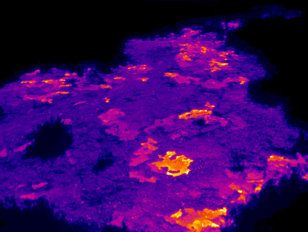
This thermal image published on Sept. 17, 2014 shows the scattered pāhoehoe lobes that are active near the front of the June 27 flow.
