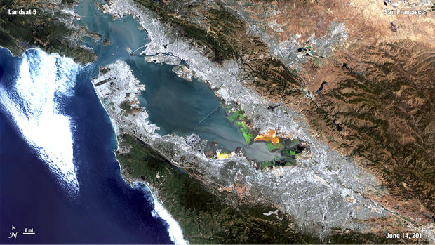
NASA/GSFC
The longest-running Earth-observation satellite program, Landsat, turns 40 this year. Landsat has taken many incredible images of our planet, this list showcases a few of the greatest. Seen here, San Francisco.
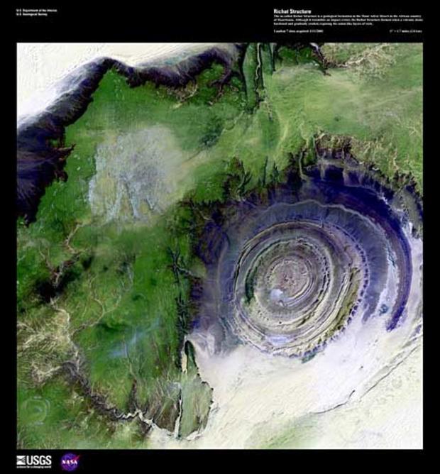
Mauritania's Richat Structure
USGS/EROS
As part of Landsat's 40th birthday celebration, NASA and the USGS have highlighted a handful of "earth as art" images. This one is a shot of the Richat Structure in the African country of Mauritania. It formed when a volcanic dome hardened and gradually eroded, exposing the dramatic rock layers.
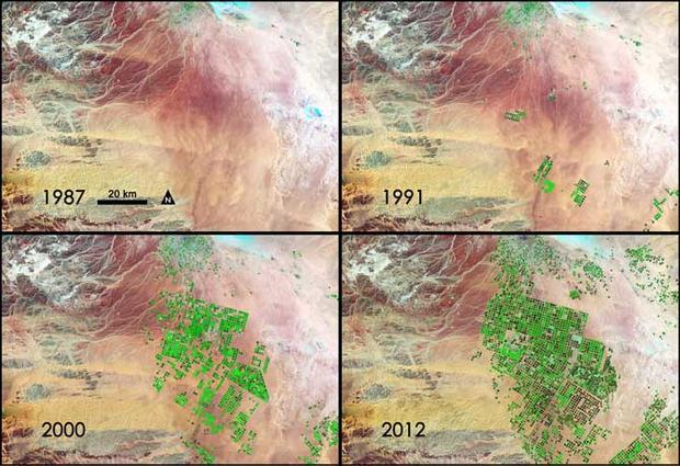
Seeing Saudi Arabia go green
NASA/GSFC
Landsat images from the past 25 years demonstrate how Saudi Arabia has turned its arid lands green through tapping underground aquifers. Healthy vegetation appears bright green while dry vegetation appears orange. Barren soil is a dark pink, and urban areas, like the town of Tubarjal at the top of each image, have a purple hue.
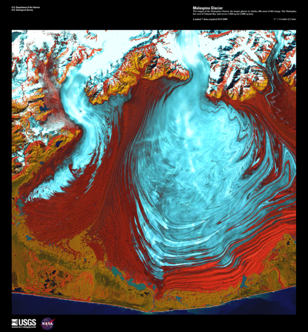
Alaska's Malaspina Glacier
USGS
Alaska's Malaspina Glacier as seen from Landsat, another from the "earth as art" collection.
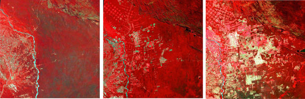
Bolivian deforestation
USGS
These images show the progression -- from left to right -- of agricultural development's encroachment into a tropical forest in Bolivia.
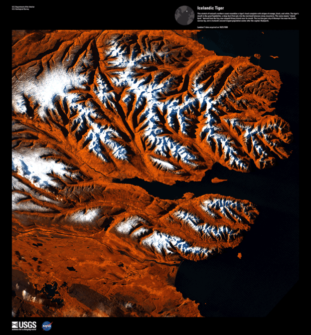
The Icelandic Tiger
USGS
When seen through Landsat's eye in the sky, Iceland's northern coast looks like a fierce tiger's head, right down to the coloration.
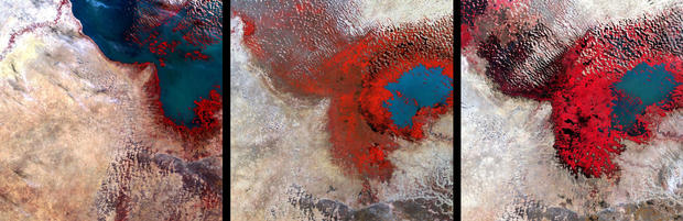
Shrinking Lake Chad
USGS
Between the first image on the left of Lake Chad -- taken in 1972 -- and the most recent taken in 2002 on the left, it's possible to see how much persistent drought has shrunken the body of water.
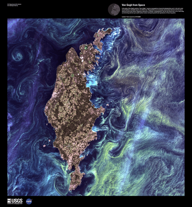
Real "Starry Night"
USGS
Another in the "earth as art" series, phytoplankton swirling in the waters around the Swedish island of Gotland mimic Van Gogh's classic "Starry Night."
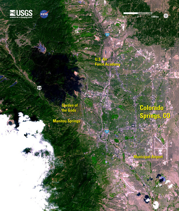
Waldo Canyon Fire
USGS
Landsat flew over the recent Waldo Canyon fire near Colorado Springs, showing the charred area in black.
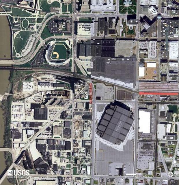
Super Bowl XLVI
USGS
Here's Landsat's view of Lucas Oil Stadium in Indianapolis, shortly before Super Bowl XLVI.
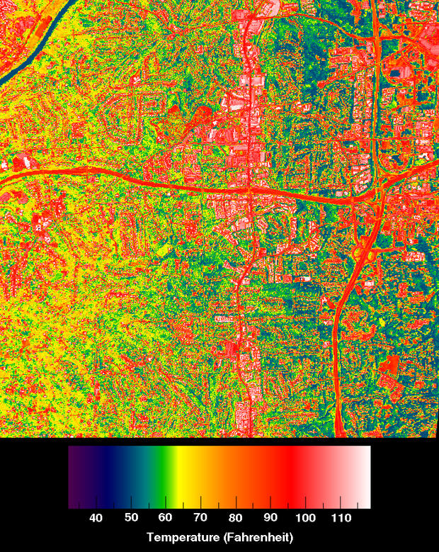
Suburban Atlanta heat map
NASA
Landsat captured these thermal images of suburban Atlanta. Compare with the next slide of urban Atlanta for an illustration of the heat island effect.
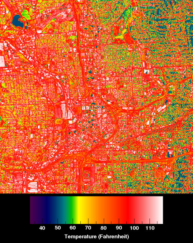
Urban Atlanta's heat island
NASA
These thermal images of urban Atlanta show the "heat island" effect, especially when compared with the previous slide of a cooler suburban area just outside the city.
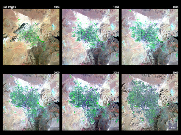
Las Vegas sprawls out
USGS
Landsat 5 spent more than 25 years chronicling the rapid expansion of the Las Vegas metropolitan area.
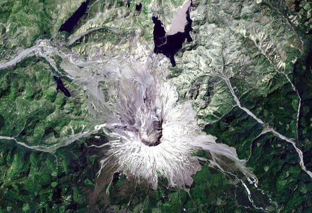
Mount St. Helens
USGS
This is a 1999 view of Mount St. Helens from Landsat.
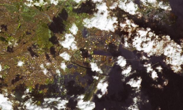
Tsunami invades Japan
USGS
Captured shortly after a massive earthquake and tsunami rocked Sendai, Japan, in 2011, this shot from Landsat shows only a portion of the damage and infiltration of the landscape made by the wave and accompanying flood waters.