Gorgeous abstract Martian landscapes
Normally thought of as the craggy, rocky red planet, Mars continues to reveal itself in all its wonder and (abstract) beauty.
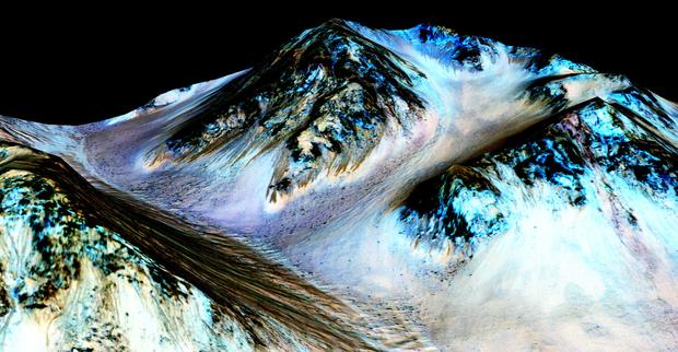
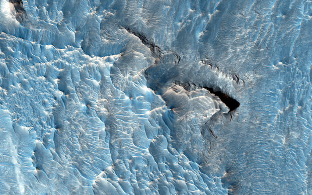
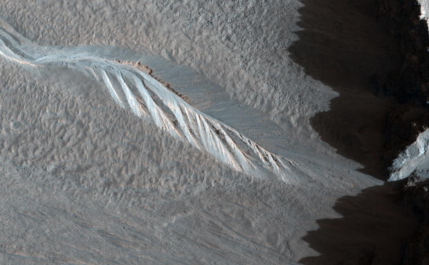
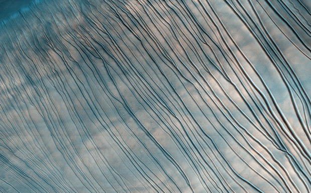
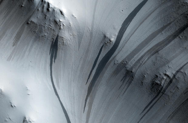
In this photo, the dark, narrow, 100 meter-long streaks called recurring slope lineae flowing downhill on Mars are inferred to have been formed by contemporary flowing water. The blue color seen upslope of the dark streaks are thought not to be related to their formation, but instead are from the presence of the mineral pyroxene.
NASA researchers confirmed intermittent water flows of salty water exist on Mars on September 28, 2015, based on data from a NASA satellite orbiting the red planet.
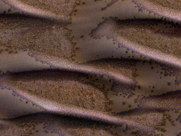
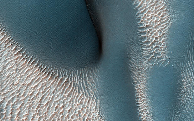
Mars - Defrosting sand dunes
It is late winter in the southern hemisphere of Mars, and these dunes are just getting enough sunlight to start defrosting their seasonal cover of carbon dioxide. Spots form where pressurized carbon dioxide gas escapes to the surface in this photo taken March 27, 2016 local Mars time by the HiRISE camera on NASA's Mars Reconnaissance Orbiter.
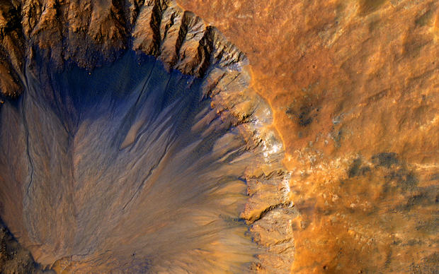
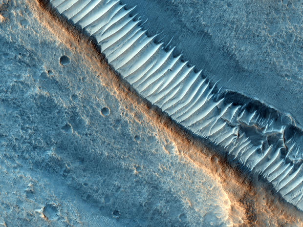
Mars - Impact crater
The High Resolution Imaging Science Experiment camera, known as HiRISE, aboard NASA's Reconnaissance Orbiter acquired this closeup image of a "fresh" (on a geological scale, though quite old on a human scale) impact crater in the Sirenum Fossae region of Mars on March 30, 2015.
This impact crater appears to be relatively recent since it has a sharp rim and well-preserved ejecta.
In many of these photos the colors have been enhanced by the HiRISE's software.
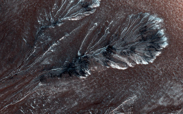
Frosty Gullies on the Northern Plains
Seasonal frost commonly forms at middle and high latitudes on Mars, much like winter snow on Earth. However, on Mars most frost is carbon dioxide (dry ice) rather than water ice. This frost appears to cause surface activity, including flows in gullies.
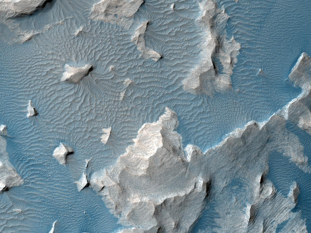
Mars - Aureum Chaos
The HiRISE camera aboard NASA's Mars Reconnaissance Orbiter acquired this closeup image of a light-toned deposit in Aureum Chaos, a 229-mile-wide area in the eastern part of Valles Marineris on January 15, 2015.
Mars - Gale Crater
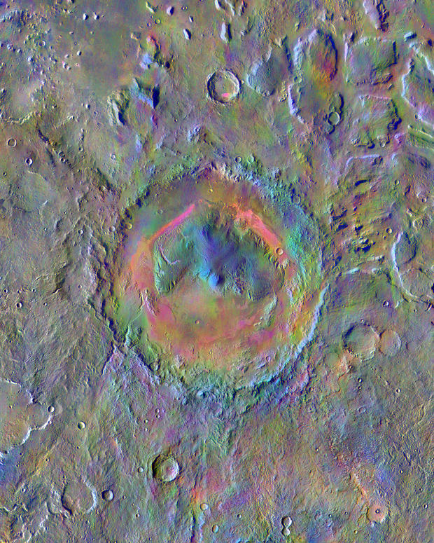
Gale Crater, home to NASA's Curiosity Mars rover, shows a new face in this image made using data from the THEMIS camera on NASA's Mars Odyssey orbiter. The colors come from an image processing method that identifies mineral differences in surface materials and displays them in false colors.
Mars - Scalloped dunes
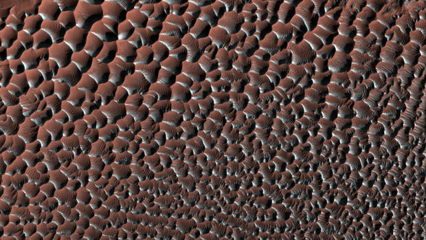
Scalloped sand dunes in the southern hemisphere of Mars are seen here, displaying seasonal frost on the south-facing slopes, which highlights some of the regular patterns, as the frost forms only on parts of the ripples.
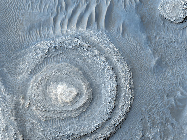
Mars - Layers and dark dunes
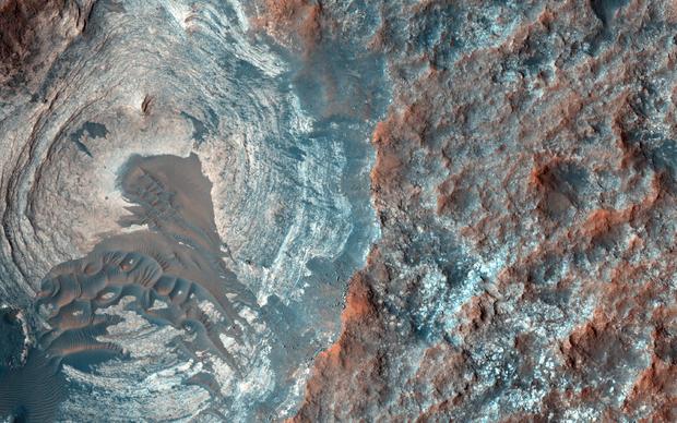
A circular depression on the surface of Mars, January 5, 2015.
Mars - Herschel Crater
Dunes in the Herschel Crater on Mars as seen by the HiRise camera on the Mars Reconnaissance Orbiter (MRO), August 2, 2012.
Mars - Layered deposit
A layered alunite-kaolinite deposit near Cross Crater on Mars as seen by the MRO Mars High Resolution Imaging Science Experiment, July 12, 2012
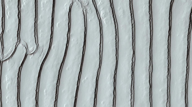
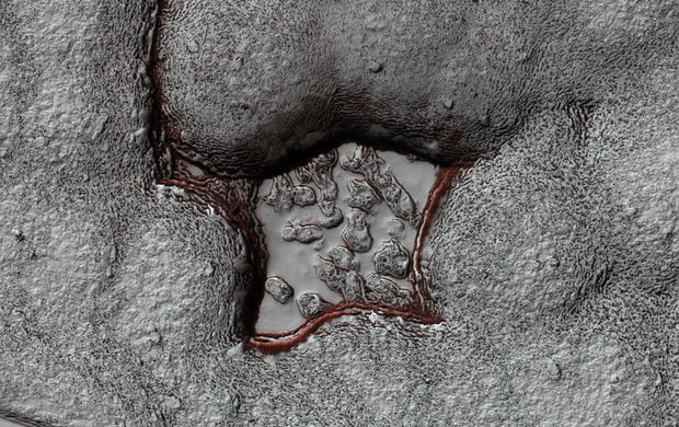
Mars - Carbon dioxide ice
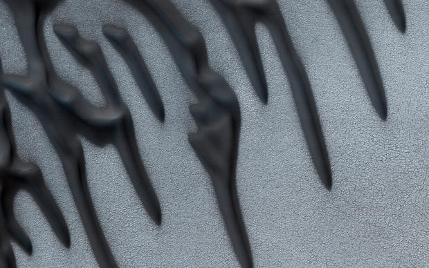
A sawtooth pattern in carbon dioxide ice in Mars' south polar region.
Mars - Syrtis Major
A dark spot on Mars at Syrtis Major as seen by the MRO Mars High Resolution Imaging Science Experiment, July 12, 2012.
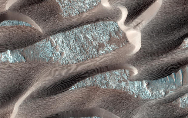
Mars - Sand migration
Nili Patera is a region on Mars in which dunes and ripples are moving rapidly. HiRISE continues to monitor this area every couple of months to see changes over seasonal and annual time scales. The monitoring has shown that Nili Patera, and other regions on Mars, are areas of active sand migration and landscape erosion.
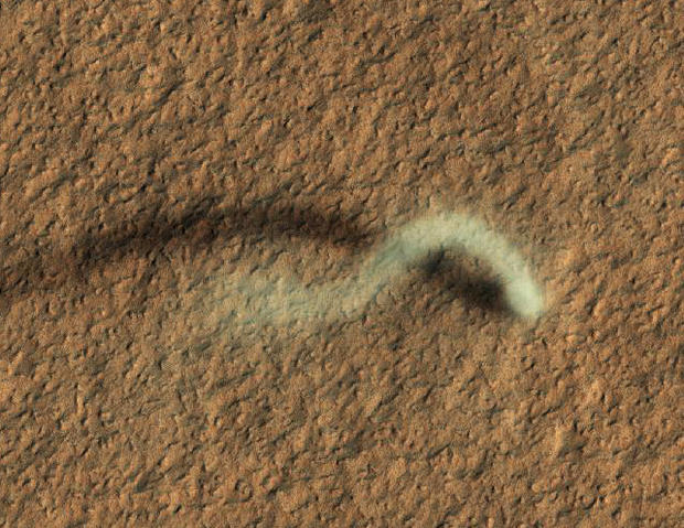
Mars - Dust devil
The 800-meter-tall plume of a dust devil casts a long shadow on the surface of Mars in this image from the HiRISE camera aboard NASA's Mars Reconnaissance Orbiter, March 8, 2012.
Mars - Argyre Region
Exposed rock layers on Mars in the Argyre Region, July 12, 2012
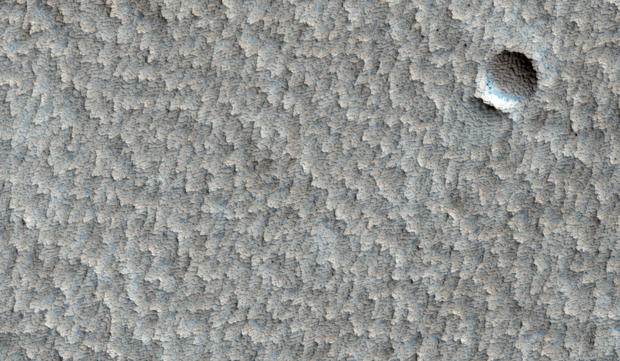
Mars - Eroded crater
An eroded crater in a larger plain with a scalloped appearance near Pavonis Mons.
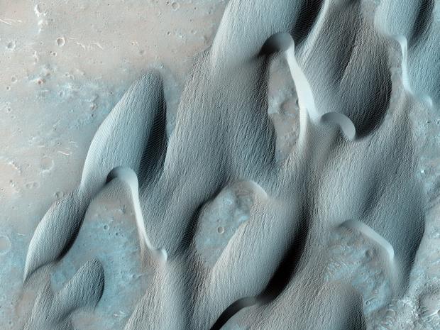
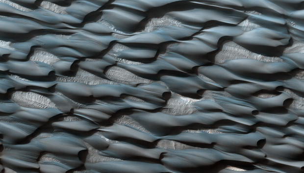
Mars - Abalos Undae dune field
These formations are part of the Abalos Undae dune field. The sands appear blueish because of their basaltic composition, while the lighter areas are probably covered in dust.
Martian South Polar Cap
A portion of the Martian South Polar Cap, showing stratified layers exposed by a long process of sublimation.
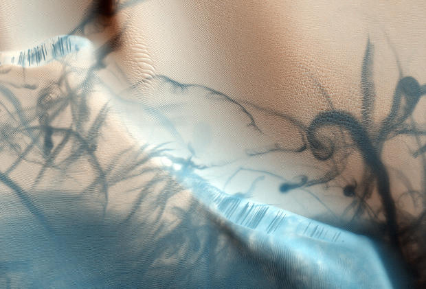
Mars - Dust devils
Intersecting swirling trails left by the earlier passage of dust devils across sand dunes, as they lifted lighter reddish-pink dust and exposed the darker material below. Also visible are darker slope streaks along dune edges, formed by a process which is still under investigation.
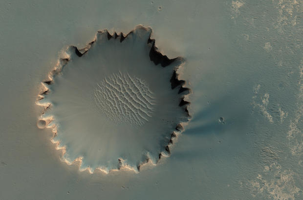
Mars - Victoria Crater
Victoria Crater at Meridiani Planum. The crater is approximately 800 meters (about half a mile) in diameter. Layered sedimentary rocks are exposed along the inner wall of the crater, and boulders that have fallen from the crater wall are visible on the crater floor. NASA's Mars rover Opportunity explored this crater and its walls in 2006.
Mars - Western Hale Crater
A gully along the inner wall of Western Hale Crater, shadowed by a raised crater rim.
Mars - Russell Crater Dunes
Gullies, streaks, ripples and dust devil tracks on Russell Crater Dunes.
Mars - Sand dunes
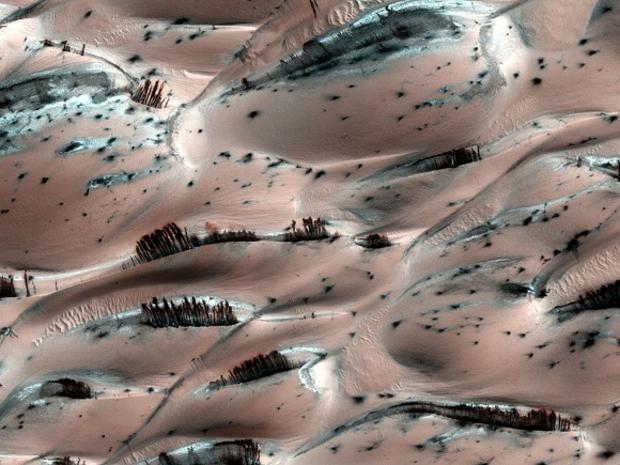
Mars has seasons just like our planet, but thanks to its distance from the sun, Mars experiences horrifically cold winters. So cold, in fact the very air freezes. Frozen carbon dioxide lies scattered over the majestic sand dunes, only to evaporate in the spring. Sand and dust loosened by this rolls down the sides of the dunes, exposing the darker underlying material. This was happening as this image was made.
The numerous dark blobs scattered across the landscape are sites where underground carbon dioxide has erupted as geysers, carrying darker material to the surface.
Mars - North Polar Region
Linear dunes in the North Polar Region of Mars. Polygons formed by networks of cracks cover the substrate between the linear dunes may indicate that ice-rich permafrost is present or has been present geologically recently in this location.
Mars - Noctic Labyrinthus
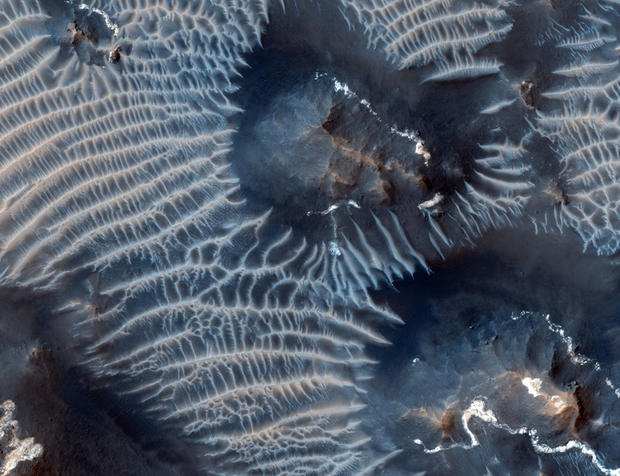
This colorful scene is in the Noctis Labyrinthus region of Mars, perched high on the Tharsis rise in the upper reaches of the Valles Marineris canyon system. Targeting the bright rimmed bedrock knobs, the image also captures the interaction of two distinct types of windblown sediments. Surrounding the bedrock knobs is a network of pale reddish ridges with a complex interlinked morphology. These pale ridges resemble the simpler "transverse aeolian ridges" (called TARs) that are common in the equatorial regions of Mars.
Mars - Terra Cimmeria
The workings of the Martian winds are visible in this image of sand dunes trapped inside an unnamed crater in southern Terra Cimmeria.
Mars - Chryse Planitia
Layers of rock exposed in the wall of one crater about 5 kms in diameter and several smaller ones in Chryse Planitia, a relatively flat region pockmarked by impact craters large and small. Each of the layers may represent sedimentary layers. Rays of ejecta are observed radiating out from the large crater.
Mars - Iani Chaos
Rocks on the floor of Iani Chaos, a region of collapsed and disorganized terrain.
The chaotic terrains on Mars may have been the sources of floodwaters that carved the giant outflow channels. They typically contain irregular hills like the one in the center of this image. The rocks here are light-toned, and have dark low patches which are likely a thin cover of wind-blown sand. A variety of processes could have contributed to forming these rocks, from volcanic eruptions to lake deposition or accumulation of wind-blown sand.
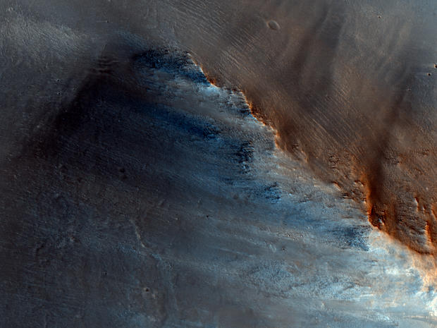
Mars - Arabia Terra
Sloped streaks of Arabia Terra possibly caused by dust avalanches. Streaks are generally small features, and have an interior roughness that is finer than the width of the streak itself.
Studying these streaks can shed light on the "life cycle" of a streak and the geologic processes that created them.
