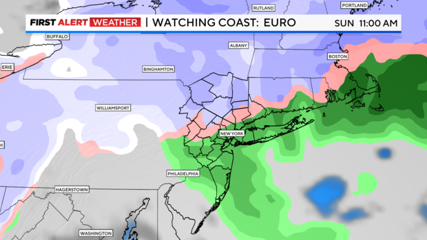
First Alert Forecast: Here's when and where to expect rain and snow across the Tri-State Area.
A Red Alert is in effect from Saturday evening into Sunday for a mix of rain and snow across the Tri-State Area.
Alerts
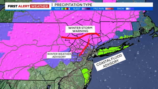
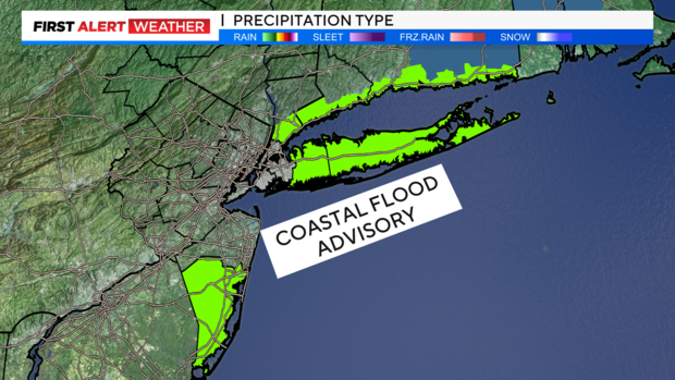
Winter Weather Alerts have been upgraded and expanded, as expected. Winter Storm Warnings and Winter Weather Advisories are now in place. Coastal Flood Advisories have also been issued for much of Long Island and parts of the New Jersey coastline.
Timeline
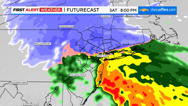
Noon to 4 p.m. Saturday: Rain, snow, mix push into our area. We can expect snow off the top of this storm in New York City before changing over to a mix and eventually all rain.
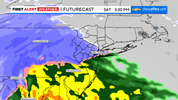
4 - 8 p.m. Saturday: Heavier bouts of rain and snow arrive. The rain/snow line migrates north. Heavy snow will be falling in the Hudson Valley over to Fairfield, Connecticut, and northern New Jersey. All snow in the SUDS. All rain down at the New Jersey shoreline.
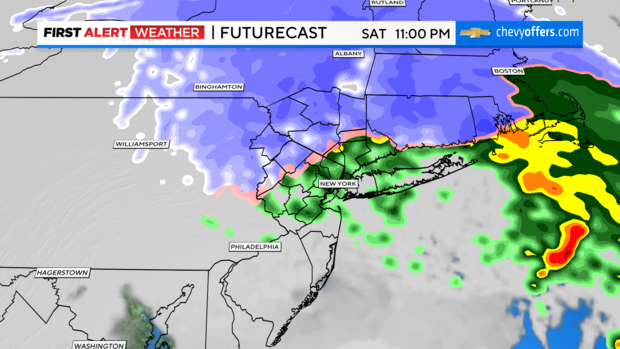
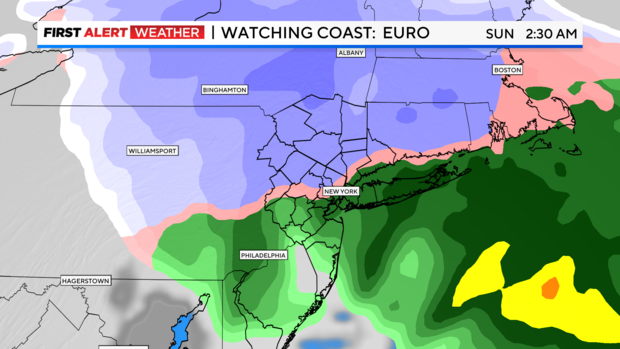
8 p.m. Saturday - 5 a.m. Sunday: Heavy snow and rain continue. Models differ some on when the brunt hits but is basically during this time frame. Winds are gusting over 35 mph at our coastlines. The rain/snow line pushes even farther north into Westchester County.
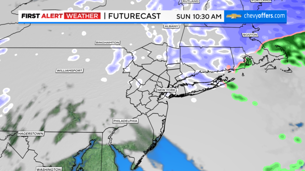
5 a.m. - 2 .m. Sunday: System starts to pull northeast exiting the Tri-State. Colder air will be funneled into the area, and we can expect leftover clouds and some snow showers Sunday.
Wind
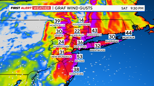
Wind Advisories might be issued at our coastline. Minor coastal flooding possible, peaking overnight Saturday. Still strong, however, where there will be snow. Blowing snow with low visibility could be a hazard in northwest New Jersey -- Morristown over to Sparta.
Snow Totals
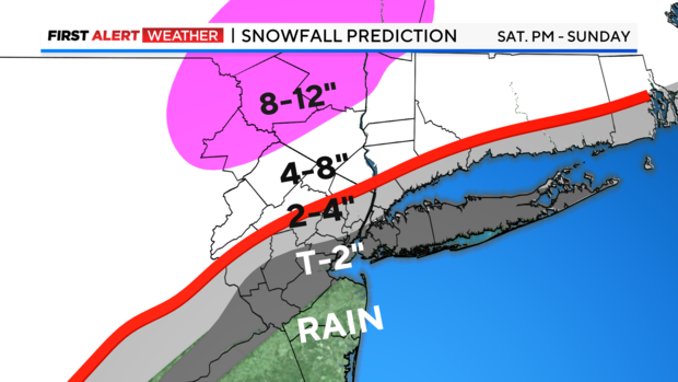
Areas north and west of the city could see 8-12 inches. Totals get lower closer to the city, with a trace to 2 inches expected in the city and across Long Island.
Rain
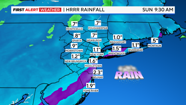
This storm is bringing in 1.5 - 2.3 inches of rain according to our High Res model. This could cause some flood issues on its own.
We are, however, in a 10% risk for flash flooding, but no official alerts yet.
Looking Ahead
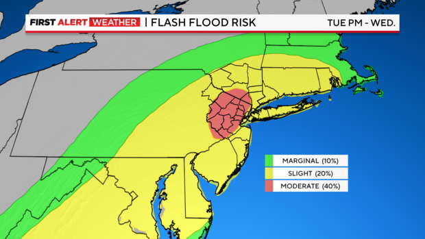
We have already issued a Red Alert for a storm Tuesday evening into Wednesday. 2-4 inches of rain is possible.
It looks like a significant risk for river flooding as well as moderate to possibly major coastal flooding.
Winds look potentially damaging with gust forecast near 60 mph. High seas and big waves are likely as well.