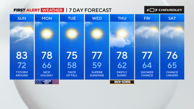
Isolated storms likely Sunday in Tri-State Area. Here's the Labor Day weekend First Alert Forecast.
Saturday night
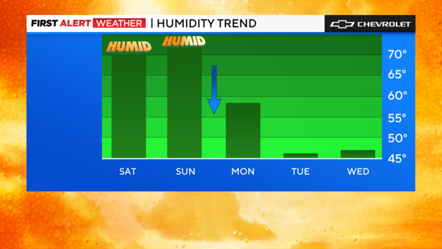
Although skies looked threatening for the majority of Saturday, it now appears that the atmosphere was just bluffing, as the chance of storms has diminished greatly. A few showers are still possible, but they look to be on the lighter side. Lows will get into the upper 60s and low 70s, with an increasingly muggy feel to the air.
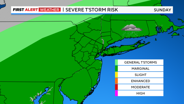
Sunday
Widely scattered thunderstorms are likely on Sunday, and while the threat of severe storms is marginal at best, a few storms may produce some heavy rain and gusty winds. Some breaks of steamy sunshine will help temperatures rise back into the 80s for many locations.
Labor Day forecast
For those looking for a perfect day this holiday weekend, Labor Day itself looks like the clear winner, with lots of sunshine, lowering humidity, and pleasantly warm temperatures in the mid to upper 70s.
As we go through the first week of September, things look mainly quiet with abundant sunshine and cool, crisp mornings. Afternoon highs will be in the 70s. After this weekend, our next rain chance looks to hold off until late next week.
Have a safe and enjoyable weekend!