Isolated showers and thunderstorms Wednesday near NYC and in N.J. prompt Yellow Alert
We're on Yellow Alert Wednesday due to high heat and humidity, plus the threat of severe thunderstorms in the afternoon and evening.
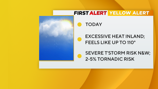
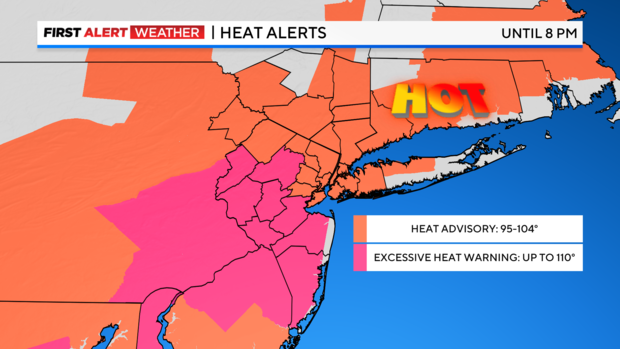
Thermometers are again expected to fall just shy of 90 this afternoon, but when you factor in the humidity it will feel more like 95-104. For that reason, much of the Tri-State Area remains under a Heat Advisory; an Excessive Heat Warning is now in effect for Central and South Jersey where it could feel as hot as 110.
Even the immediate coast will climb into the 80s today, but be mindful, beachgoers, there's a high risk of rip currents along south facing New York beaches this afternoon.
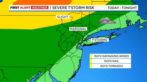
All the while, a strong storm or two can't be ruled out across interior sections, but really it's the line of storms late this evening that we'll have to keep an eye on. They should mainly impact our distant northwest suburbs, but they'll be capable of producing heavy rain and gusty winds, so that's a concern. But as they dissipate and move eastward, the remainder of the area should only expect a passing shower or two overnight with that sticky feel in the air.
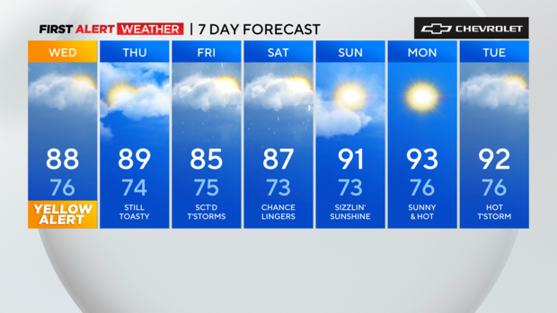
Thankfully, with the exception of a couple of leftover showers south and east, the bulk of the area should stay dry Thursday. However, it will be another hot one with highs approaching 90. The good news is the humidity shouldn't be quite as noticeable, so that will be nice.
Friday looks to be the most active of the next few with showers and thunderstorms likely.
Get the latest forecast and alerts and check maps of the area from the First Alert Weather Team.