Unseasonably warm temperatures break records in New York. Here's when cooler weather returns.
NEW YORK — Tuesday's unseasonably warm temperatures broke records in parts of New York.
Temperatures across the region were more typical of late August and early September, rather than late October. The well-above-average warmth was even record-breaking in some locations, and portions of central New Jersey were close to 90 degrees.
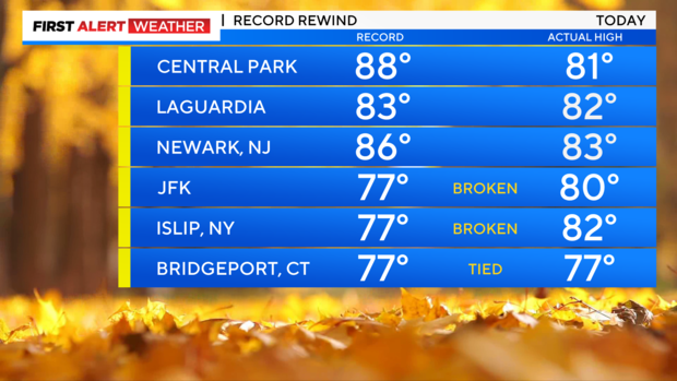
At John F. Kennedy International Airport, temperatures hit 80 degrees, breaking the previous record of 77 set in 1984. Temperatures were even higher in Islip, reaching 82 degrees. The previous record in Islip was also 77 degrees, set in 1979.
The high of 82 degrees at LaGuardia Airport fell one degree short of breaking the record, and Central Park's high of 81 degrees was 7 degrees cooler than the record of 88 degrees.
In Bridgeport, Connecticut, the high was 77, tying the previous record set in 1975.
The high in Newark, New Jersey was 3 degrees shy of the record – 83, compared to 86.
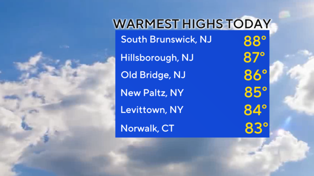
Warmest temperatures in the Tri-State Area
South Brunswick, New Jersey saw the warmest temperatures in the Tri-State Area, hitting a high of 88 degrees. The nearby townships of Hillsborough and Old Bridge hit 87 and 86 degrees, respectively.
The warmest temperatures in New York were in New Paltz, which hit 85 degrees, and Levittown, which hit 84.
Norwalk was the warmest in Connecticut at 83 degrees.
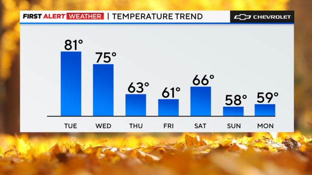
Mild weather continues before temperatures start dropping Thursday
Tuesday night, temperatures will remain milder than normal for October, with lows mostly in the 50s in the suburbs to the low 60s in the city.
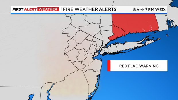
One more mild day is in store for Wednesday, as highs climb back into the 70s and low 80s with a mix of sun and clouds. Breezy conditions will be in place as well, which would enhance the threat of wildfires, given the desert-like dry pattern we've been in.
A Red Flag Warning is in effect for all of Connecticut from 8 a.m. through 7 p.m. Wednesday.
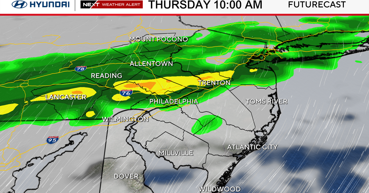
A very slim chance of a rain shower or two is possible late Wednesday night and early Thursday, but mainly for areas north of the city.
For the city, getting into the top 10 list for most consecutive days without measurable precipitation is highly likely by Thursday. It's been 22 days since we last had measurable precipitation. The city's 10th longest dry spell, back in 1995, lasted 24 days. The longest dry spell on record was 36 days in 1924.
Temperatures return to more normal levels for October by Thursday and Friday.