Heat index could hit 100 today for parts of NYC area. Map shows where it will feel hottest.
Get ready for a stretch of hazy, hot and humid days along with the threat of thunderstorms - and they may impact your weekend.
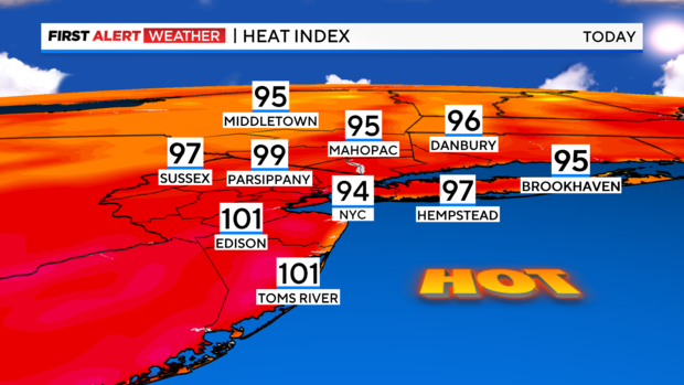
After a balmy, gorgeous start to the day, sizzling sunshine will prevail this afternoon with heat index values of around 95 to 100. That said, the National Weather Service has allowed the heat advisory to remain in effect until 8 p.m. Friday for a good portion of the area. Regarding any active weather, a shower or thunderstorm can't be ruled out, but it looks like the bulk of the area should stay dry.
Tonight will be rather warm and muggy with just a stray shower out there. Expect temperatures to only fall into the 70s in the city with a few 60s north and west.
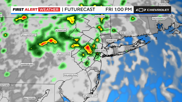
Tomorrow will be another hazy, hot and humid day with heat index values of 95 to 100 again. Unfortunately, there's a better chance of showers and thunderstorms, but odds are better inland across New Jersey and parts of the Hudson Valley. So, the threat will be present, but you'll be in better shape if you head east.
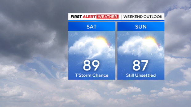
As for this weekend, expect a tropical feel with the threat of showers and thunderstorms both days.
Stay cool and stay dry!