NYC weather looks hot and humid with threat of thunderstorms. Map shows flood watch this week.
The hot and humid weather sticks around this week, along with the chance of thunderstorms. Plus, we're tracking Hurricane Debby and how it might impact the Tri-State Area.
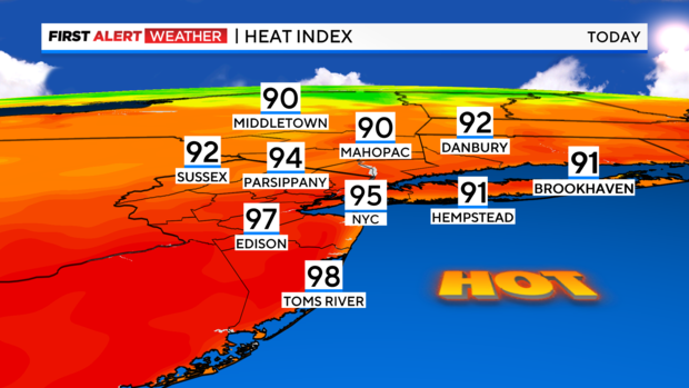
After a damp, grey Sunday we're turning things around with copious amounts of sunshine for the area. We're taking the temperatures up a notch, too, so plan on the low 90s with feels-like temps in the mid-90s.
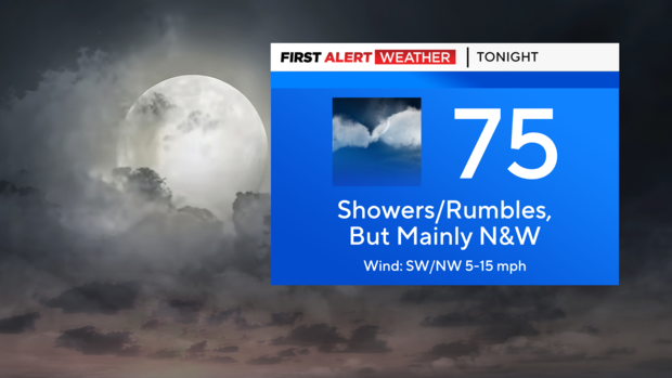
A cold front will deliver some showers and thunderstorms tonight, but mainly across our northwest suburbs and late. These storms should be mainly non-severe, but we can't rule out an isolated damaging wind gust here and there before the night's out.
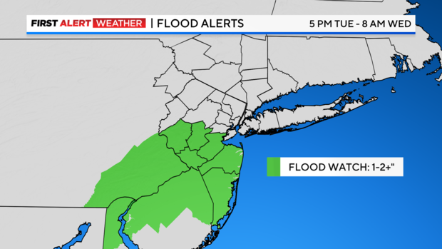
Tomorrow's looking active behind the front as it gets hung up to our south and delivers another round of showers and thunderstorms. For this reason, the National Weather Service has issued flood watches across central and southern New Jersey that will go into effect at 5 p.m. Tuesday and remain in effect until 8 a.m. Wednesday.
The anticipated rainfall amount for these areas is 1-2 inches, but locally we could see even more.
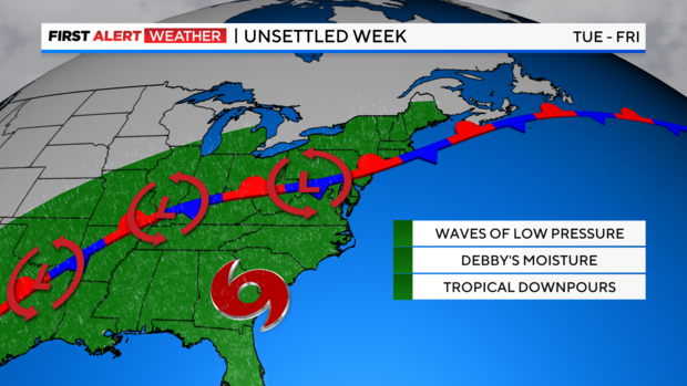
The rest of the week will remain unsettled with the stationary front off to our south. Then our eyes turn towards Hurricane Debby as it interacts with the front. The question at this point is, where exactly does the heavy rain fall? Over our area? Offshore? There's still a bit of uncertainty regarding all of this, so we'll need to monitor things closely.
In the meantime, stay cool and stay dry!