NYC weather looking warmer, but snow back in the mix this week
NEW YORK -- New York City's weather is warming up this week, but snow is also back in the forecast.
We're easing into the work week with seasonal sunshine, but there are a couple of hiccups in store this week.
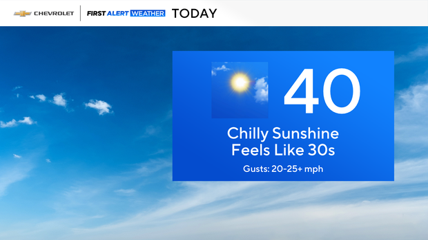
We got off to another cod start this morning, with wind chills in the 20s and teens. Thankfully, we'll climb to around normal this afternoon — although, the building breeze will make it feel like the 30s.
This evening looks rather quiet, but isolated snow showers will push through our northwest suburbs overnight.
Tomorrow will kick off with an early snow shower, or two. After that, temperatures will hold steady (if not fall), with wind chills stuck in the 30s and 20s the remainder of the day.
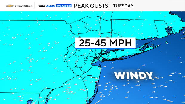
Speaking of the wind, it will be gusting to over 40 mph at times, so hold onto that hat.
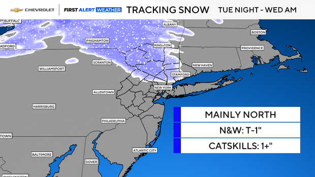
A more organized round of snow showers will swing through our northern suburbs tomorrow night into Wednesday morning.
This will likely produce a dusting to an inch or so north and west, with up to several inches possible across the Catskills.
Ironically, after all that clears out, afternoon temperatures will climb into the 40s to nearly 50° south and west.
Stick with our First Alert Weather team for the latest forecast, live radar and weather alerts.