Maps show how much snow is expected to fall around NYC today
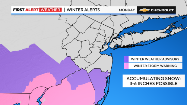
NEW YORK -- A winter storm is bringing snow to New York City and the surrounding area today, with New Jersey expected to see the highest totals.
New York City public schools are in session Monday, while New Jersey has declared a state of emergency for southern counties and may have some local closings. Families should check with their school districts for the latest updates.
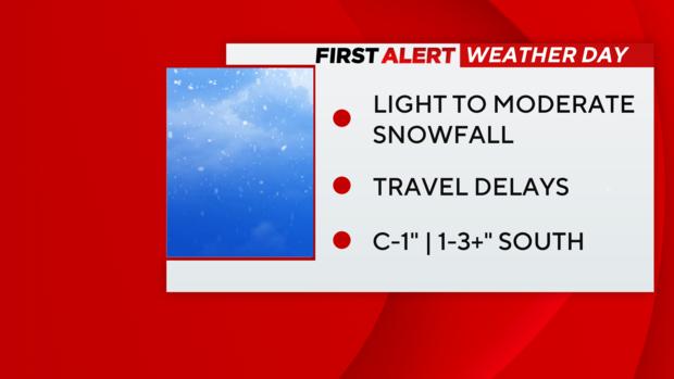
It's a First Alert Weather Day with accumulation expected around the area. Here's a look at when the storm will start, and how much snow is expected to stick.
Winter storm blowing into NYC area
After a cold and dry weekend, the Tri-State region is set to receive our next winter storm on Monday. This storm has already proved to be problematic, with numerous reports of ice, snow and even a tornado for portions of the central and southern states.
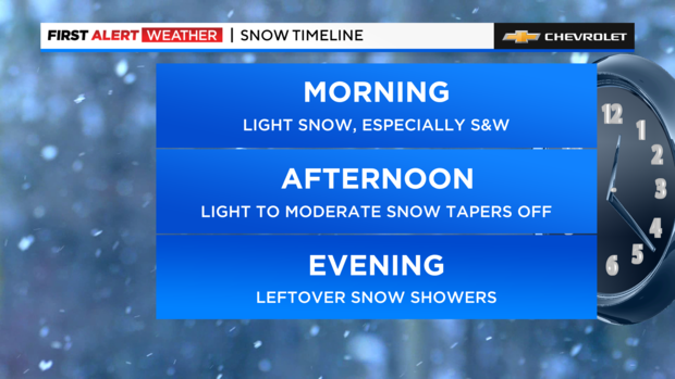
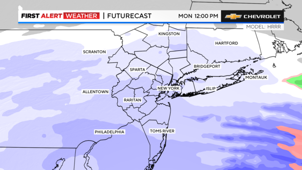
As the storm migrates to our region of the country, only snow is expected for us. That storm gets here in the early hours of Monday morning and will continue into Monday evening, ending by Monday night.
This will not be a major snowstorm by any means, but some areas could see some decent snow totals. Forecast models have been consistent that this storm will take a southerly track, leaving the region on the northern fringe of it.
That would lead to higher totals of snow south of the city, while some areas to the north may see nothing at all. A scenario like this is fairly uncommon around here, as the northern suburbs usually tend to see the highest snowfall amounts.
How much snow are we talking?
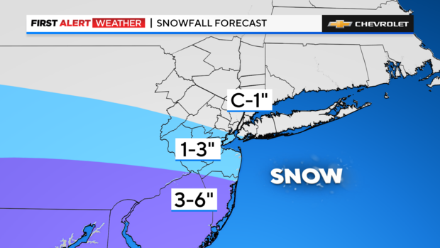
Light to moderate snow will fall throughout the day on Monday. It appears that Ocean County will be the big winner this go around, with a solid 3-6 inches likely there. As for the rest of New Jersey, the central counties, including Monmouth, could see 1-3 inches, while in northern New Jersey, only a trace to 2 inches is expected.
The Hudson Valley, Connecticut, as well as Long Island, are also anticipated to only see a trace to 2 inches. The south shore of Long Island may have slightly higher totals there.
Within NYC, a sharp cutoff between snowfall totals is very likely. Overall, the city is expected to receive 1-2 inches. The highest totals are most likely be found in Staten Island, along with southern portions of Brooklyn and Queens.
In contrast, the northern Bronx may get just a dusting. Once the storm moves out, bitter cold and strong winds move in for Tuesday. And with this cold air not going anywhere anytime soon, neither will the snow that falls on Monday.
The rest of the week looks dry, windy and cold. Highs each day will struggle to reach the freezing mark.
Live radar shows latest storm track
Stick with our First Alert Weather team for the latest forecast, live radar and weather alerts.
