Rainy weather to start the week. Here's when it will be heaviest around the NYC area.
It's a rainy start to the work week for New York City and the surrounding area.
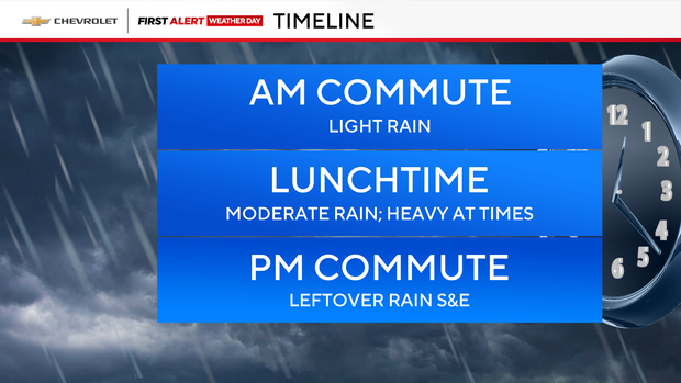
We saw light rain for the morning commute, but it started to pick up into the lunch hour and could still be heavy at times. Thereafter, the rain will gradually taper off from west to east, so the trip home shouldn't be so bad.
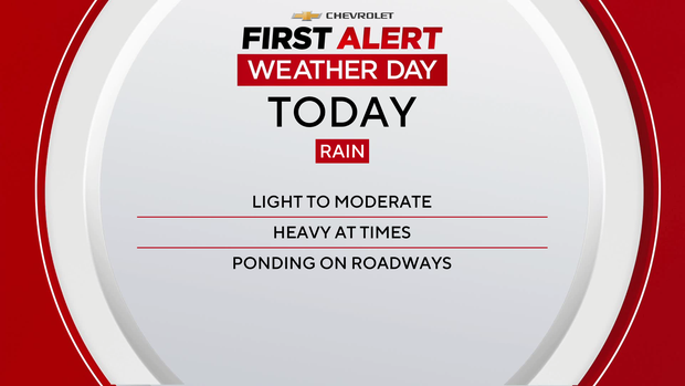
It's a First Alert Weather Day for the moderate to heavy rain, gusty winds and wintry weather north and west of the city.
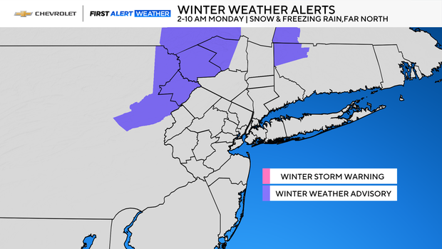
Sullivan and Ulster counties were also under a winter weather advisory from 2 a.m. to 10 a.m. due to a chance of snow and some freezing rain early.
Tomorrow is brighter and blustery, so don't forget the shades. Temperature-wise, we'll climb into the mid to upper 50s.
Things will dry out tonight under partly cloudy skies. Expect temperatures to fall into the 40s, 30s and 20s.
On Wednesday, after an early shower, it should be quiet the remainder of the day. It will be a little cooler, as well, with highs only around 50.
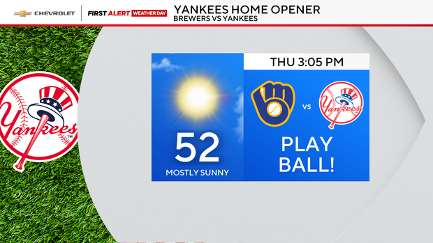
As for Thursday, it looks like the Yankees' home opener will go off without a hitch, with sunshine and highs in the low 50s.
Timing out today's rain
- Around 2 a.m.: Rain moved in from west to east. In our northwestern suburbs, where temperatures were in the lower 30s, a mix of snow and freezing rain was expected to change over to plain rain after sunrise. Sullivan and Ulster counties had the highest chance of accumulating snow and ice.
- Between 5 a.m. and 2 p.m.: Moderate to heavy rain can be expected for all areas. Ponding may occur on roadways during the morning commute, and a few isolated thunderstorms could develop closer to lunchtime. In addition to the rain, winds may gust between 25-35 mph at times.
- After 2 p.m.: Rainy conditions start to wind down, except for eastern Long Island and the Jersey Shore, where rain is expected to linger into the early evening hours. In terms of rainfall totals, .50-1" should be the average, with the highest totals found south and east of the city. Despite a washout of a morning, high temperatures will be warmer than they were on Sunday, reaching the mid-to-upper 50s.
Once the rain clears out by Monday evening, an overall dry week can be expected, with only a minor chance of rain and snow on Wednesday morning. Temperature-wise, no wild swings are anticipated, as highs will be at or slightly above average, in the low-to-mid 50s.