Light rain arrives in New York on Sunday before storms move in Monday
For a good portion of Saturday, summer was in full swing as temperatures surged into the low to mid 80s across the Tri-State Area.
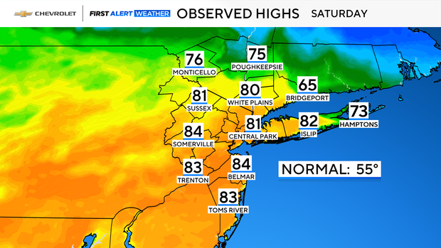
Then, just as quickly as they arrived, the warm temperatures were replaced by much cooler readings. Between 5-6 p.m., the temperature in Central Park went from 79 to 53 as a cold front swung through. That's a 26-degree drop within just an hour.
Now that the summer tease is over, overnight temperatures will dip into the 40s, and even some 30s, with periods of light showers.
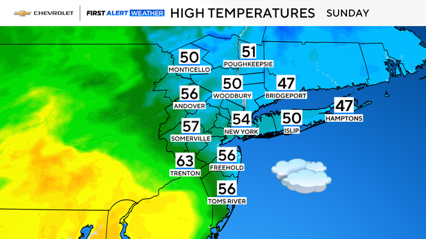
Sunday will feature lots of clouds, drizzle and light rain at times.
Although temperatures will be much cooler than they were on Saturday, highs on Sunday will actually be right around average, ranging from the low to mid 50s.
First Alert Weather Day for heavy rain, thunderstorms Monday
Another warm front will move through on Monday, bringing some morning showers, and then pushing temperatures into the upper 60s to mid 70s.
The mild temps will come with higher humidity levels, laying the groundwork for the threat of strong to severe thunderstorms by Monday afternoon and evening as a strong cold front approaches the area.
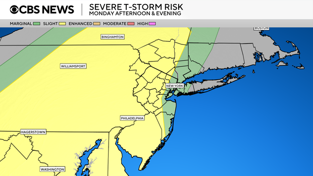
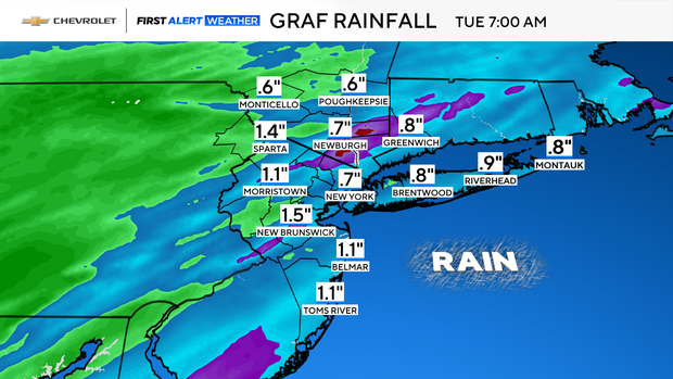
Heavy rain, localized flooding and damaging winds are the greatest hazards associated with this system. Rainfall totals could reach over an inch in many locations.