Heavy rain could impact the New York City area Sunday. Get the First Alert Forecast.
Sunday will be a First Alert Weather Day in the Tri-State Area due to the potential for some heavy rainfall, especially east of New York City.
A coastal storm that will impact the region on Sunday. Latest data from forecast models is now suggesting that lower rain totals are likely, as the impending coastal storm is expected to track farther east than initially thought.
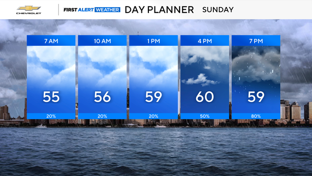
Mostly cloudy skies will be in place to begin Sunday. A few spotty showers are possible in the morning, but the bulk of rain activity moves into the region from south to north on Sunday afternoon and evening. Before the main batch of rain moves in, highs will be able to reach the low to mid 60s.
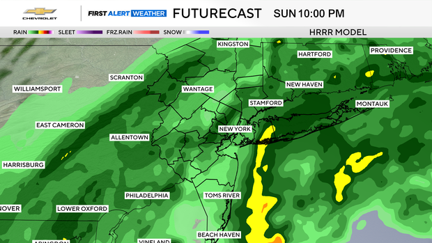
The rain will be at its heaviest on Sunday night, around 10 p.m. There may be some isolated instances of flash flooding, mainly for Long Island, where the axis of the heaviest rain is anticipated to be.
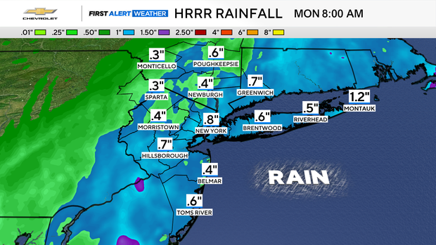
Despite being a quick mover, the coastal storm will likely put down between .5-1 inch of rain, before tapering off by early Monday morning. Higher totals are likely to the east of the city, while areas far north and west could see little to no rainfall at all.
Although the storm won't be that strong, gusty winds are still expected from Sunday night into early Monday morning. Gusts will range from 25-40 mph, with higher gusts possible along the immediate coastline. Some minor coastal flooding may transpire during the high tide cycles.
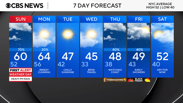
Chances are increasing for another coastal storm on Thanksgiving. That one may prove more formidable than Sunday's event, and temperatures will be stuck in the 40s all day.


