More rain, flooding possible in Tri-State Area on Monday. Here's the First Alert Forecast.
Today
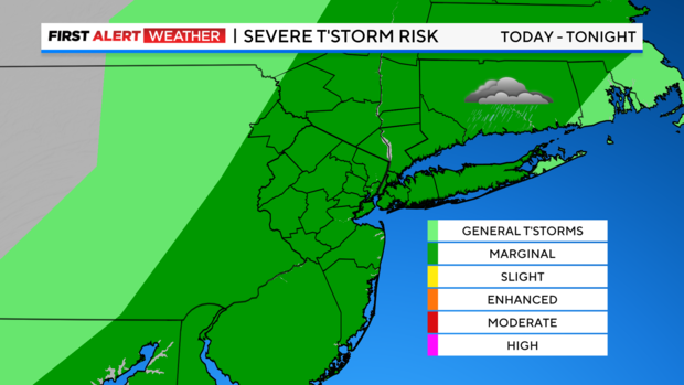
More torrential rain and flooding could cause problems in the Tri-State Area Monday, after a damaging storm hit on Sunday.
After a generally quiet start to the day, showers and isolated thunderstorms will develop in the afternoon across the interior and gradually work their way toward New York City.
Interactive Weather Radar
The main threats will be isolated instances of flash flooding, although a strong or even severe thunderstorm can't be ruled out. Thankfully, widespread heavy rainfall will not be an issue, but up to an inch or more could fall in a short period of time in some spots. This would only add insult to injury where there's saturated ground and residual flooding. So be on the lookout!
Tonight
Conditions will improve this evening as showers and thunderstorms weaken and push east. The rest of the night should be pretty uneventful, outside of a stray shower toward dawn.
Looking ahead
More stray showers are possible tomorrow, especially in the morning and east of NYC. But it should be a quiet day for the most part. Plus, it won't be quite as warm – and certainly not as humid. So Tuesday should be a rather enjoyable day.
Wednesday, a little hiccup is anticipated as a couple of showers brush the northwest suburbs. Currently, this looks like more of a nuisance than anything more significant
After that, there's nothing but sunshine!