NYC could have its second heat wave of the year on Sunday. Here's how the city is helping New Yorkers stay cool.
NEW YORK -- Because of high heat and humidity this weekend, New York City pools will be open late, despite a citywide shortage of lifeguards.
Outdoor Olympic and intermediate outdoor pools will be open until 8 p.m. Saturday and Sunday, closing one hour later than usual.
Some pools are being forced to limit their capacity, however, because they don't have enough lifeguards on hand.
John Jay Pool on the Upper East Side can hold almost 300 people, as long as five lifeguards are on duty, city Parks Department officials say. Saturday, there were only three lifeguards, so the pool was operating under reduced capacity, and with high demand on a hot, humid day, the usual three-hour sessions were cut down to one hour and 15 minutes.
But there was nothing stopping pool-goers from getting back in line at the end of their session.
In addition to extended hours at pools, New York City has also opened its cooling centers across the Big Apple.
You know the drill by now: Take it easy, stay hydrated, and limit time in the direct sun.
Saturday night forecast
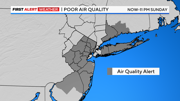
An Air Quality Alert is in place through 11 p.m. Sunday for most of New Jersey, Long Island and southwestern Connecticut.
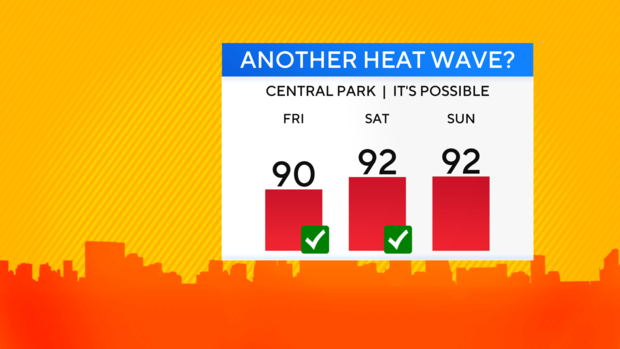
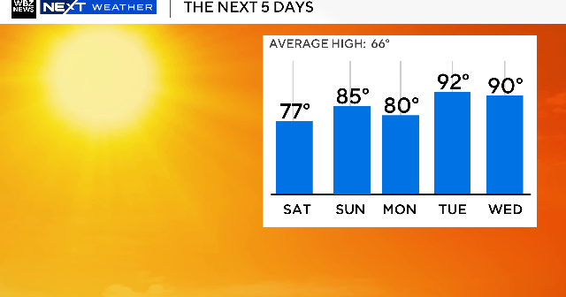
Saturday's high of 92 was the second straight day of 90-degree temps in the city, and if our high temperature reaches 90 again Sunday, we'll have our second heat wave of the year.
The actual temperatures have been hot enough, but the extremely high levels of humidity in place have pushed heat indices into the upper 90s and low 100s.
Saturday night, that sauna-like feel will linger as lows dip into the low and mid 70s. A stray shower or storm is possible, along with some patchy fog.
Sunday forecast
Luckily, we'll see a bit of relief from the "air you can wear" for Sunday into Monday.
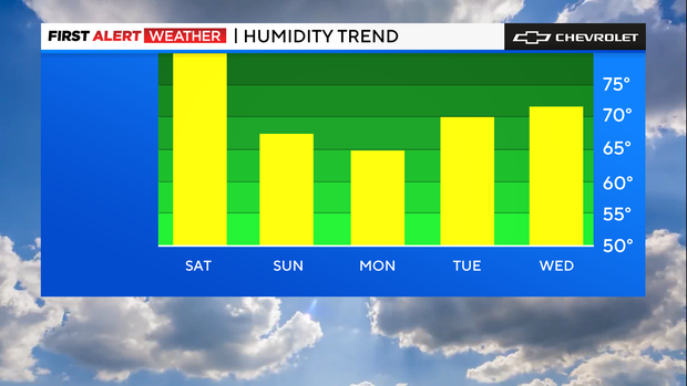
While it does appear that Sunday will feature less humidity than the last few days, it will still be on the humid side, just not as oppressive. There will also be a continuation of the hot temperatures as highs reach the low and mid 90s once again.
A decent amount of sunshine will be in place and thunderstorm chances look minimal.