Severe weather, storm threat returns to NYC area to end the weekend. Get the First Alert Forecast.
Severe weather and storm threats will return to the New York City area on Sunday night.
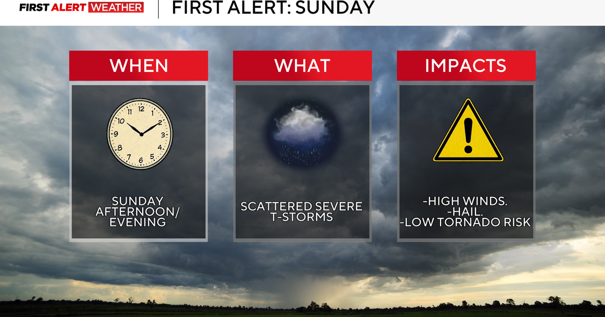
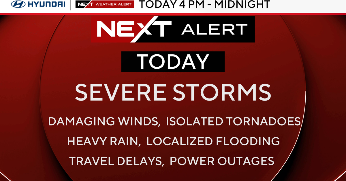
A First Alert Weather Day has been issued due to the threat of strong-to-severe thunderstorms.
Click here to check the latest weather watches, warnings and alerts.
Sunday forecast
Sunshine and low humidity was in place to begin Sunday, before higher humidity and more clouds moved in during the afternoon hours.
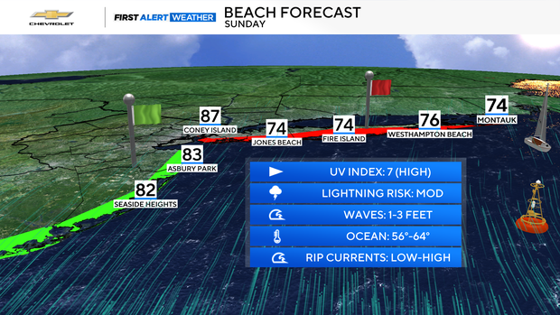
With highs in the mid to upper 80s, it was perfect for the beach, but caution was needed for people who ventured to any ocean beaches in New York, as a High Rip Current Risk was in place for south-facing shores of Brooklyn, Queens, Nassau and Suffolk counties on Sunday.
Storm risk Sunday
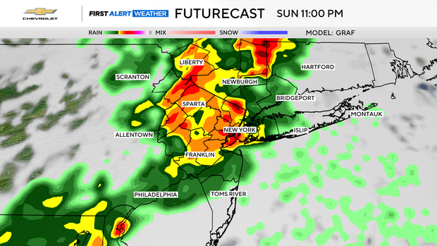
Despite the majority of Sunday being an overall decent day, the threat of severe storms returned for the evening and nighttime hours. Between 9 p.m. and 1 a.m. on Monday, there could be a few isolated showers and storms.
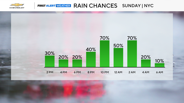
However, the bulk of activity should last until around midnight. During that timeframe, strong-to-severe storms are likely. The greatest hazards associated with these storms would be damaging winds, moderate to large hail, and torrential rains that could lead to flash flooding.
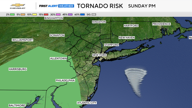
There is also a slim chance of a tornado developing, but that is mainly for areas in western New Jersey.
All storm activity should be done by early Monday morning.