NYC, N.J. prepare for soaking rain Saturday
NEW YORK - We're in for another soaking.
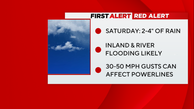
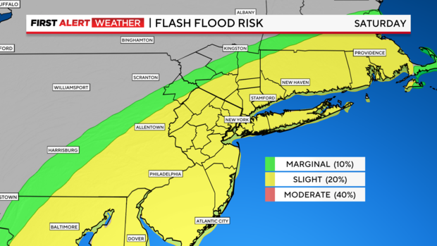
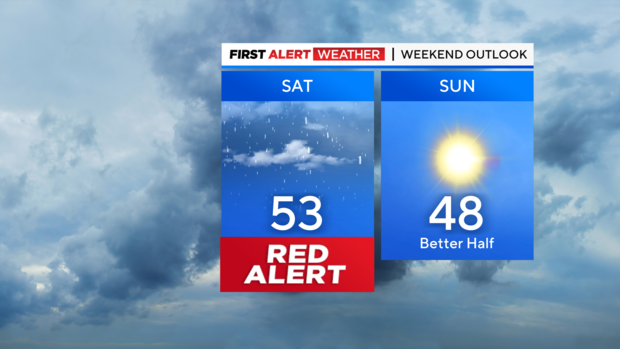
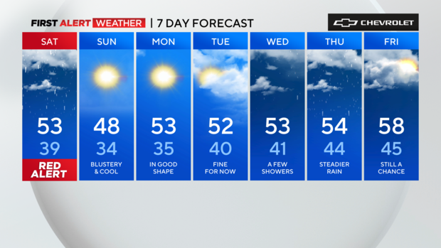
The First Alert Weather Team has declared a Red Alert for Saturday, with rain expected all day, and occasional heavy bouts that could cause flooding.
What to expect
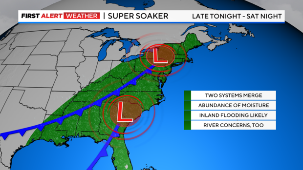
Another multi-faceted storm system is set to move into our area on Saturday. It will contain a variety of weather hazards including heavy rain, strong winds and even some snow.
Given our very wet pattern of late, more rain is the last thing we need, but that's exactly what we will be getting. This storm will be able to tap into some deep tropical moisture from the tropical Atlantic, leading to enhanced rainfall totals.
Two to 4 inches of rain is anticipated, and while totals like this would be problematic any time of the year, they are especially troublesome now because the region has not had a chance to really dry out completely from the storms earlier this month.
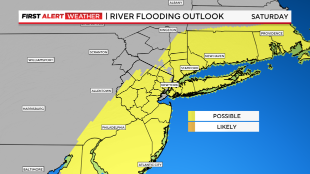
With that said, water tables are running high, and flooding is highly likely this weekend, especially over the river basins in northern New Jersey that typically flood, such as the Passaic
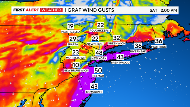
Strong winds gusting between 30-50 mph could also prove to be a challenge as they may take down trees and powerlines.
Thankfully, the system won't lingering around for several days.
Timing out the storm
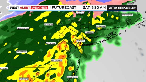
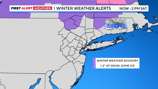
Friday night through 4 a.m. Saturday: Rain starts to envelope the region from west to east and becomes moderate. Winds will remain relatively tame, with gusts between 10-15 mph. Some snow is likely for the higher elevations of Sullivan and Ulster Counties. The snow will eventually transition over to a wintry mix. Temps in the 30s to around 40.
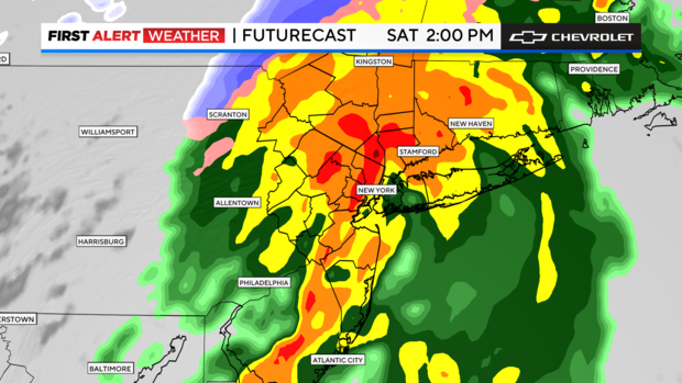
4 a.m. - 6 p.m. Saturday: Primetime for this event. During this timeframe, rain will get very heavy, making for a washout of a day. Some thunderstorms are even possible within the heaviest bands of rain.
Final rain totals are expected to reach between 2-4 inches. Isolated higher totals are possible, and many of our recent storms have overperformed.
Winds will ramp up, gusting between 30-50 mph at times. Highest gusts are likely at the coast. The saturated ground combined with the strong winds may topple trees. Coastal flooding is of minimal concern this time, but still capable of occurring in some locations. The wintry mix in the Hudson Valley changes over to plain rain, with 1-2 inches of snow/sleet falling before the changeover. Temps rise into the lower 50s.
Saturday evening and night: Most of the rain will be over by 7 p.m., except for eastern portions of Long Island, where it may linger a little longer. As the storm departs, winds will remain elevated. Gusts between 25-45 mph are likely, and some gusts over 50 mph can't be ruled out. Skies then clear out and temperatures drop back into the 20s and 30s. The stiff breeze will make it feel more like teens and low 20s though.
Sunday: Mostly sunny, but blustery and cool. Highs in the mid to upper 40s. Winds will stick around gusting between 20-45 mph at times, which will make it feel the 20s and 30s.
Looking Ahead: After a cool Sunday, temps will start to gradually moderate for the upcoming week.
You can always get the latest alerts and forecast from the First Alert Weather Team.
Alerts and advisories
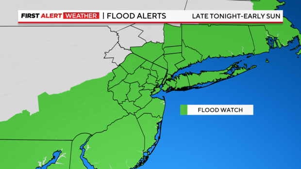
A Flood Watch is in place through Sunday morning for all of our counties except Sullivan and Ulster.
A Winter Weather Advisory is in place for western Ulster County and all of Sullivan County from Friday night through 2 p.m. Saturday.
MTA preparing subway system for storm
New York City is gearing up ahead of the storm. The MTA said resources will be in place to keep the subway system on track.
Crews were out placing heavy trench covers over subway vents, which will divert rain from the tracks. Catch basins were also cleaned to ensure any water that ends up in stairwells can flow out.
The MTA says it does not expect the storm to impact service on Saturday.
"It will be a lot of rain, but over a long period of time. It wont be strong downpours -- enough to overwhelm our infrastructure or subway system," Demetrius Crichlow of New York City Transit said. "So we anticipate having smooth sailing the entire time. You should be able to rely on us. But just in case, we'll have people in place at various locations throughout the system to make sure any issues, we're able to respond to. We'll have folks out there with pumps. We're going out today to even do prep work to make sure those pumps are functioning as they should."
If rain ends up overwhelming tracks, the MTA says crews can manually deploy pumps, similar to what they did during a water main break back in August.
