Downpours and flood alerts Saturday in the Tri-State Area, then more extreme heat. Here's the latest forecast.
Flood Watch
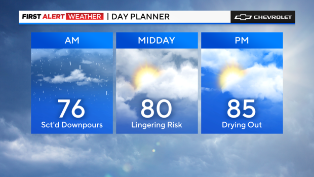
We'll be dealing with scattered downpours throughout Saturday morning, mainly. A Flood Watch remains in effect until early afternoon.
The heaviest and most widespread showers will be moving out by midday, and we'll see clearing skies from west to east as the day rolls on.
Saturday feels tropical
Meanwhile, temperatures will be right around average, but the humidity will really make it feel tropical. Expect highs in the mid 80s as conditions improve.
In this tropical air mass, we can't rule out a spotty shower or storm in the afternoon. But most of the area will stay dry in the second half of the day.
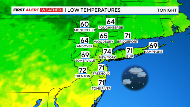
Saturday night will be partly cloudy and muggy with lows in the mid 70s around New York City and 60s in the northwest suburbs. Patchy fog is possible overnight and toward dawn.
Extreme heat returns
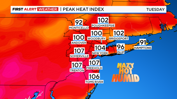
Intense heat returns on Sunday. We'll climb into the low 90s tomorrow and mid 90s on Tuesday and Wednesday next week. Tuesday will likely be the peak with afternoon "feels like" temperatures of 100-110 degrees.
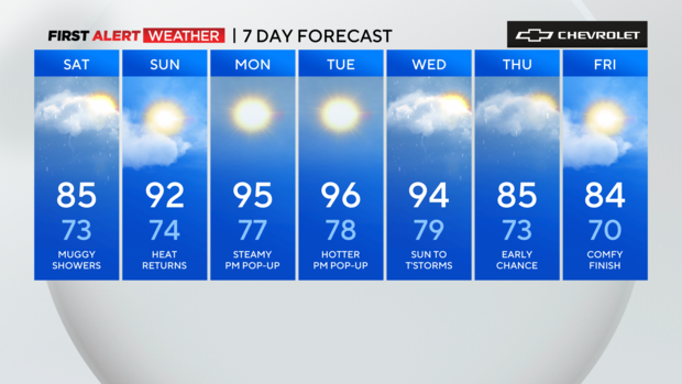
A spotty afternoon pop-up storm is possible any day next week, but the next widespread chance of showers and storms will come with a frontal passage on Wednesday.