Cold stretch continues around NYC area. Here's when temperatures warm up.
The cold weather persists Wednesday around the New York City area, but there are some changes for the upcoming snow forecast.
Tri-State weather today
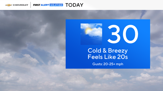
The day got off to another bitterly cold start with sub-zero and single digit wind chills. We'll have sunshine on our side this morning, but clouds will filter in through the afternoon. Expect highs near 30s with wind chills in the 20s.
There will be some clouds around tonight, otherwise, it looks pretty uneventful. Expect another cold one with wind chills in the teens and single digits.
Tracking snow Thursday
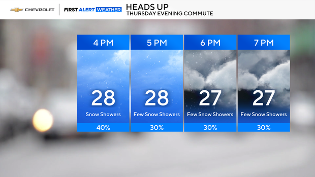
Then, our attention turns toward a coastal low that makes a safe pass to our south and east on Thursday. That said, the First Alert Weather Day for Thursday has been canceled.
However, some trailing energy will trigger a few snow showers during the evening commute, so don't be surprised if you see a few flakes out there.
Warm-up this weekend?
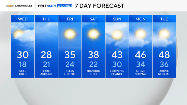
Jumping ahead to Friday, it will be sunny, cold and blustery with wind chills in the 20s.
Beyond that, it looks like temperatures will begin to moderate with 40s by this weekend.