More rain, snow to wrap up the week around New York. Map shows projected totals.
New York City and the suburbs are dealing with rainy weather to wrap up the week, and the Catskills may even see more snow.
Our First Alert Weather team is tracking a mix of precipitation Friday into Saturday.
Alerts/Advisories
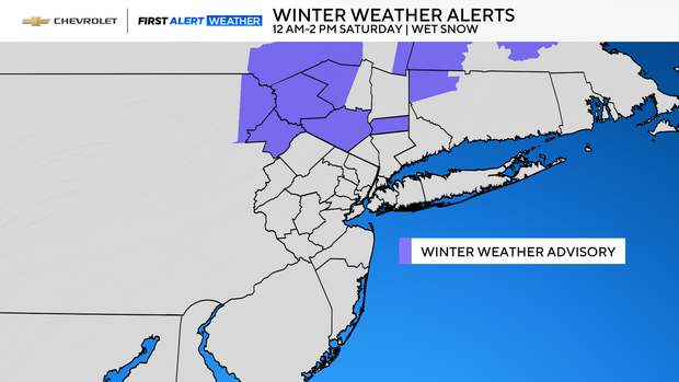
Winter Weather Advisory for Sullivan, Ulster, Orange and Putnam Counties from midnight until 2 p.m. Saturday.
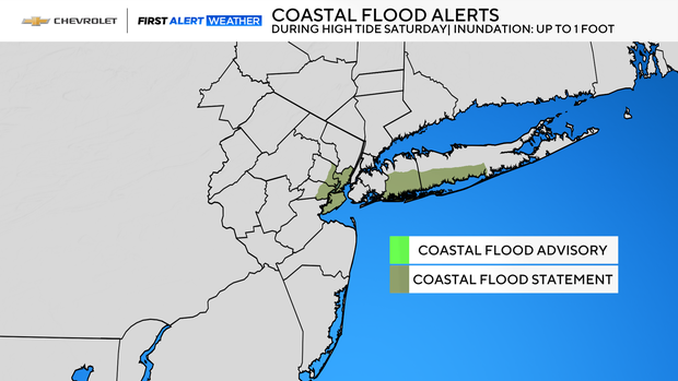
Coastal Flood Statement for the south shores of Nassau and Suffolk counties, as well as along the waterfronts of Richmond, Union, Essex and Hudson counties during the high tide cycles on Saturday.
Rain, snow falls overnight Friday into Saturday
Light rain fell for most of the day on Friday, with several more rounds of rain to come by early Sunday.
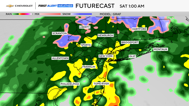
A coastal low has developed near the Virginia capes and will track northward up the coast through the weekend, bringing with it a mixed bag of precipitation. As this low deepens, heavy rain will move into the region throughout the overnight hours. It will be at its heaviest from around midnight through 4 a.m. Saturday morning.
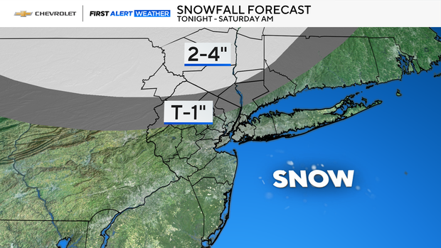
Most of the area will see just rain, but with low temperatures dipping into the 30s, wet snow is likely for our northwestern suburbs. The snow could last into the late morning hours, accumulating between 2-4 inches, mainly at the highest elevations. Isolated higher totals are also possible. Lower elevations may see an inch at best.
Lighter rain, mist, drizzle Saturday
Following the round of heavy rain and snow overnight into the morning hours, the rest of Saturday will feature periods of lighter rain, mist and drizzle.
With the low lingering offshore, winds will be active, gusting to between 20-35 mph at times, with gusts in excess of 40 mph possible at the immediate coastline.
Another effect of the coastal low being nearby will be the chance of some minor coastal flooding, especially along the south shore of Long Island, where up to one foot of inundation may occur.
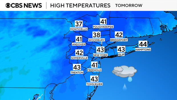
Despite already being in the middle of April, highs on Saturday will feel more like late February, only reaching the low 40s.
Clearing skies Sunday
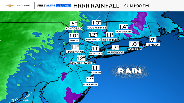
Although there will be a slight chance of additional showers early on Sunday, as the coastal low departs, the rest of Sunday should present improving conditions, with clearing skies and temperatures returning to near normal levels, in the upper 50s to low 60s. Total rainfall totals through Sunday morning will average between .75-1.50".