New York Weather: Thunderstorms Expected Thursday Afternoon
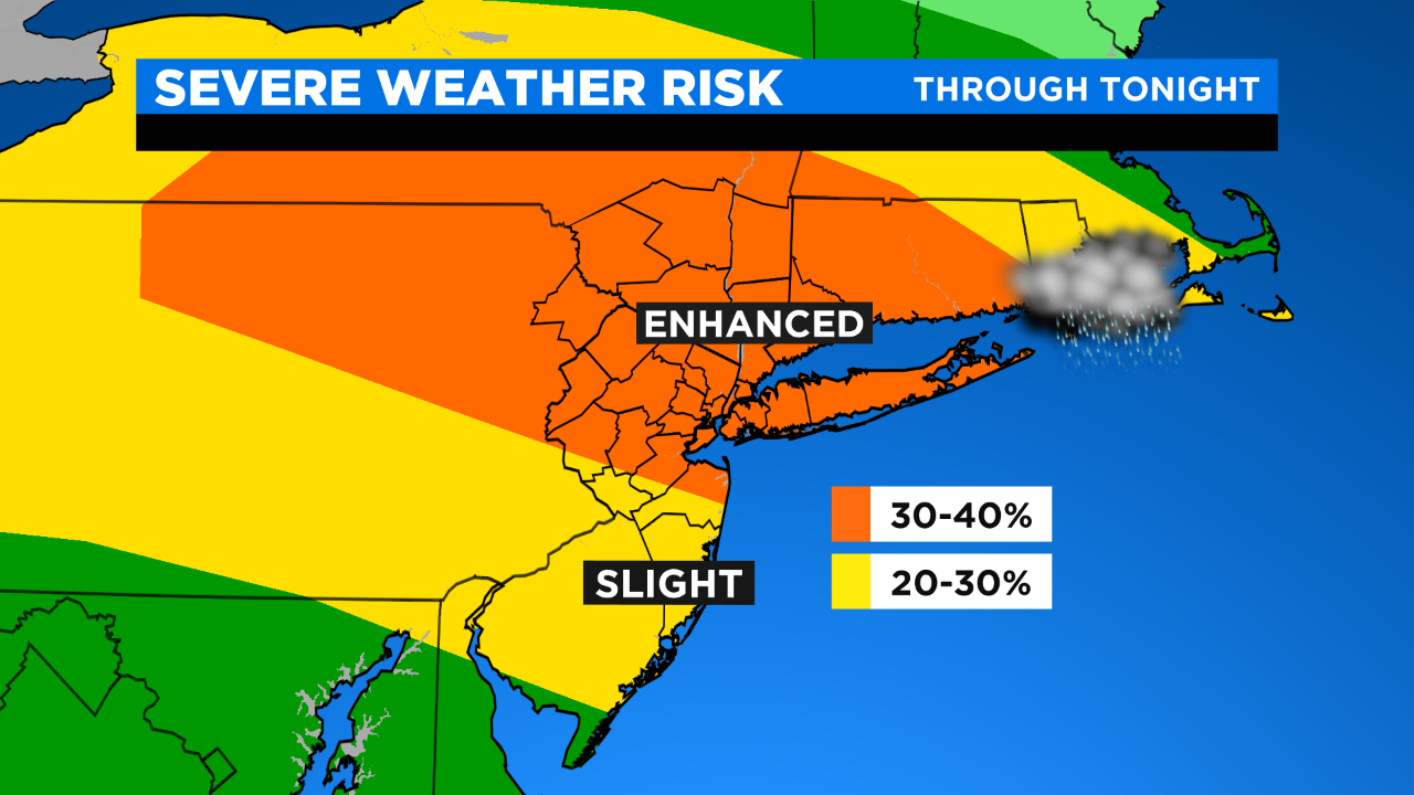
Showers and perhaps a rumble of thunder will swing through early this morning, then we should see some clearing thereafter. It's this afternoon, mainly after 1/2 PM, when we'll see showers/t'storms start to move in well to our north (Sullivan/Ulster/Dutchess) and gradually work their way down towards the city into the afternoon and evening hours. There is a widespread enhanced risk for severe t'storms today; this translates to potentially damaging winds and large hail, possibility an iso'd tornado. Otherwise, it will be mostly to partly sunny, hot and humid with highs in the upper 80s to around 90... feeling like the low 90s.
Things should wind down after 9/10 PM with some leftover showers and clearing expected the remainder of the night. Temps will only fall into the 70s.
For tomorrow, we won't see the severe risk we'll see today, though an isolated severe t'storm can't be ruled out... best bet will be south of the city. It will remain warm and sticky with highs in the mid 80s.
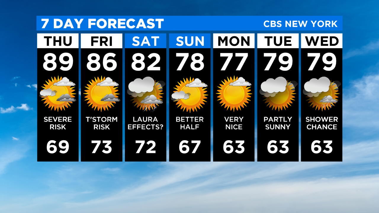
Saturday we'll be dealing with moisture from an approaching cold front and the remnants of "Laura". That said, showers/rain are likely. It will be warm and humid with highs in the low 80s.