First Alert Forecast: CBS2's 2/12 Saturday Morning Update
By Matt DeLucia, CBS2 Meteorologist/Weather Producer
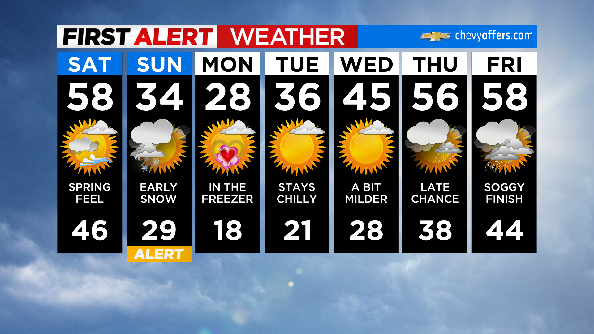
Happy weekend! You'll want to pay attention to the forecast as we're truly expecting a tale of two seasons over the next 24 hours. We're waking up to mostly to partly cloudy skies and mild temps in the 40s for most.
Today will be another spring-like day! Expect highs in the upper 50s to around 60 this afternoon under a mix of sun and clouds. A strong cold front then swings through this evening. Temps will crash into the 20s overnight and yes... a quick round of light snow!
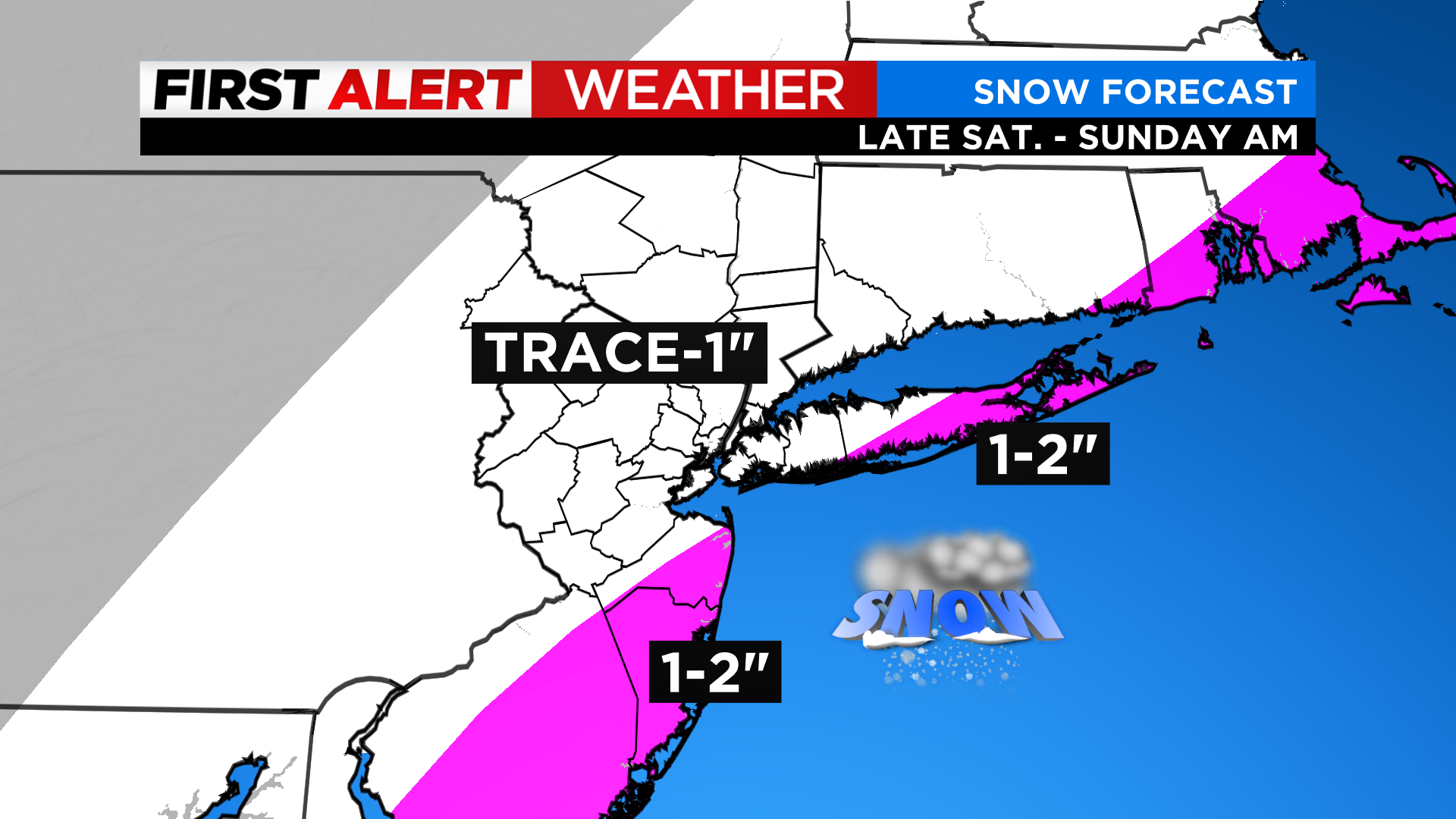
It looks to start after midnight in our southern areas and move to the northeast through sunrise Sunday. There's a chance that locations farther north and west see nothing more than some flurries. The most snowfall will occur along the coasts where 1-2 inches (even some isolated 2-3 inches) will be possible.
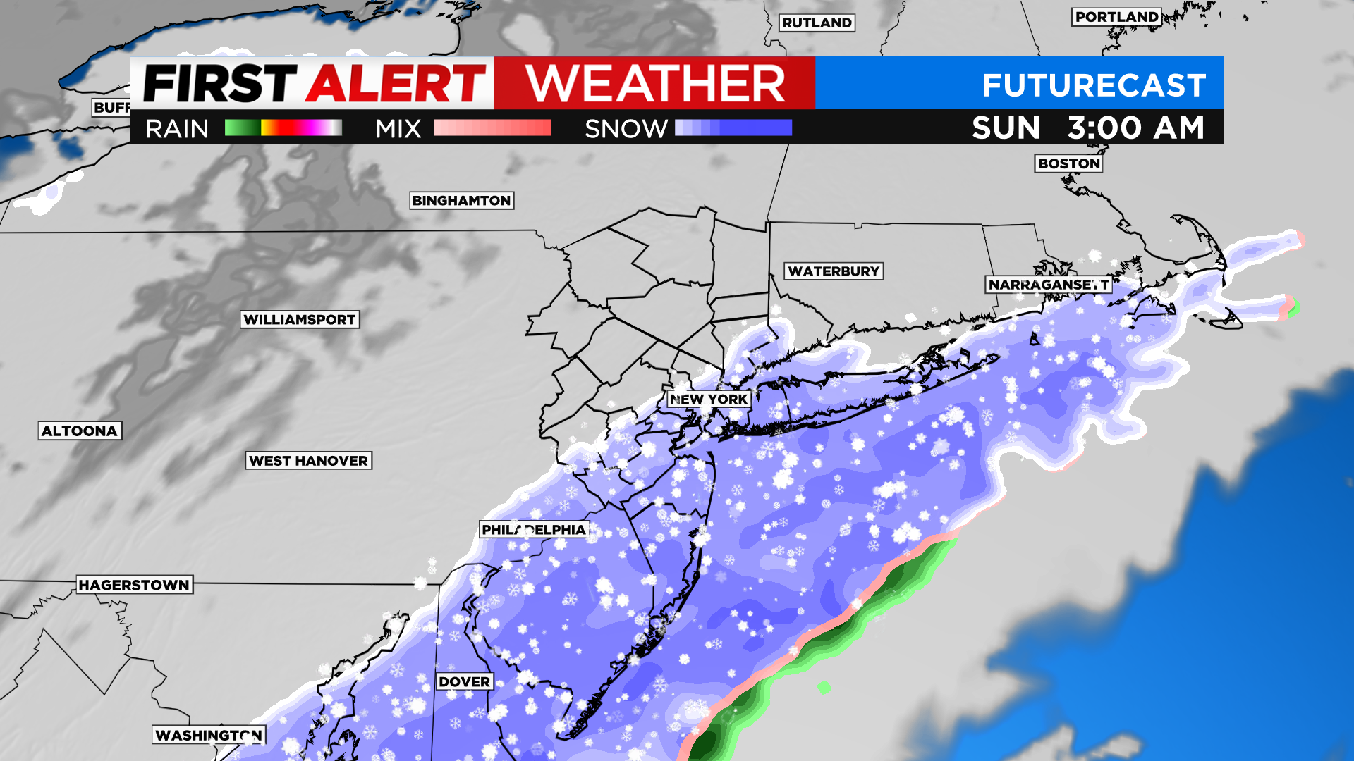
Any leftover flakes quickly exit by midday with breaks of sun into the afternoon. Highs Sunday will struggle to get above freezing with wind chills in the 20s all day. The core of the cold will be on Valentine's Day before temps climb again into next week.