New York Weather: 8/14 Saturday Afternoon Weather Headlines
By Matt DeLucia, CBS2 Meteorologist/Weather Producer
Happy weekend! We made it, and today will be a transition day from this week's oppressive heat and humidity. It's still a hot and humid day ahead, but it won't be as brutal as the past few days.
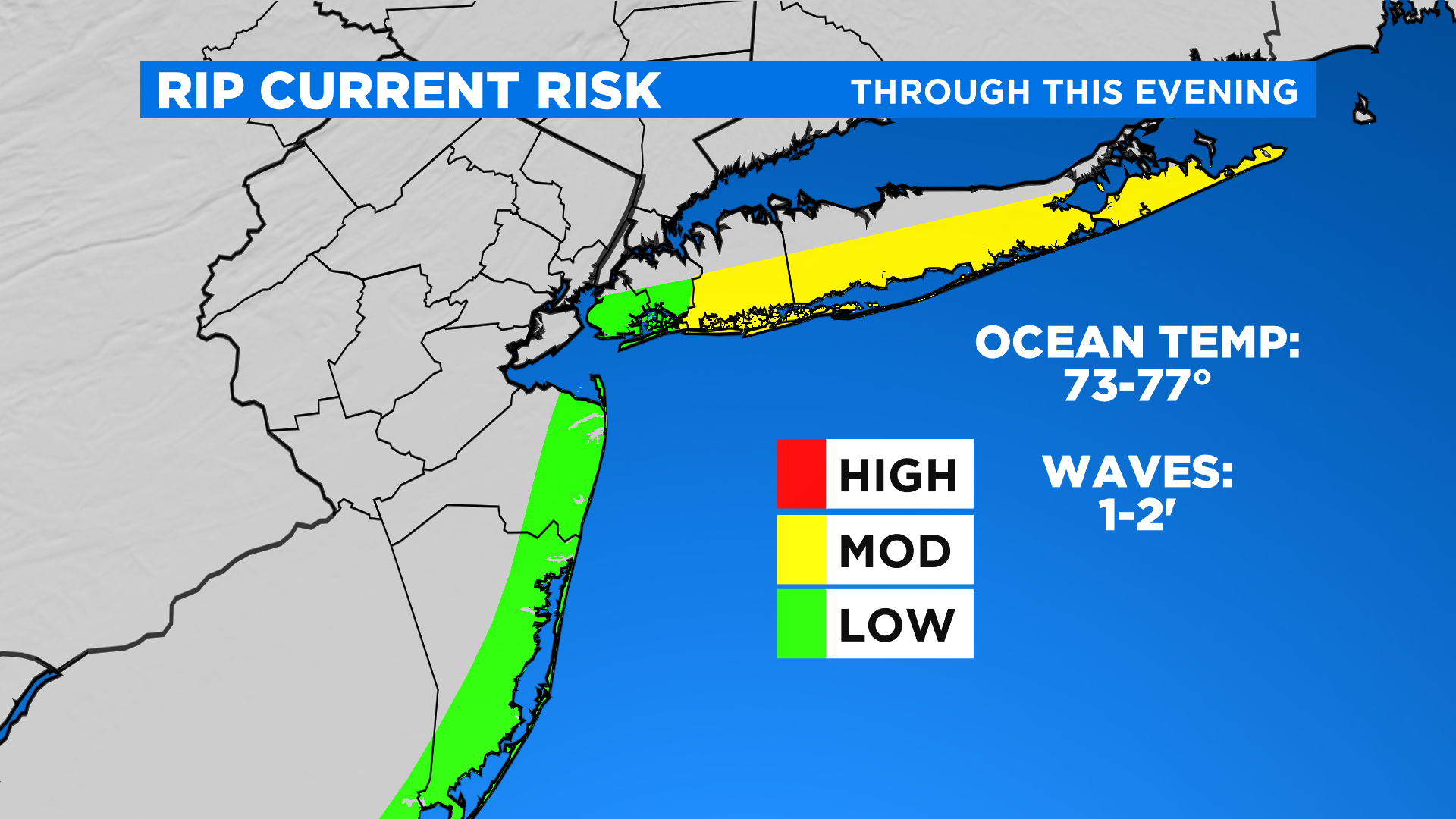
Temps this afternoon will top out in the upper 80s, feeling like the low 90s. Far north and west will feel the relief first as a cold front approaches. As we work to "break the heat" today, scattered showers and thunderstorms are possible. The best bet for some stronger storms will be along the coast where instability is highest. By no means is today a washout, just be prepared for brief interruptions. Heading to the beach? Just be mindful of a moderate rip current risk along the south shore and keep an eye to the sky for a t'storm.
After a leftover risk early on, especially south and east, things gradually clear out overnight as much drier air filters in. By dawn Sunday, we're sitting comfortable in the 60s around town and 50s to the north and west.
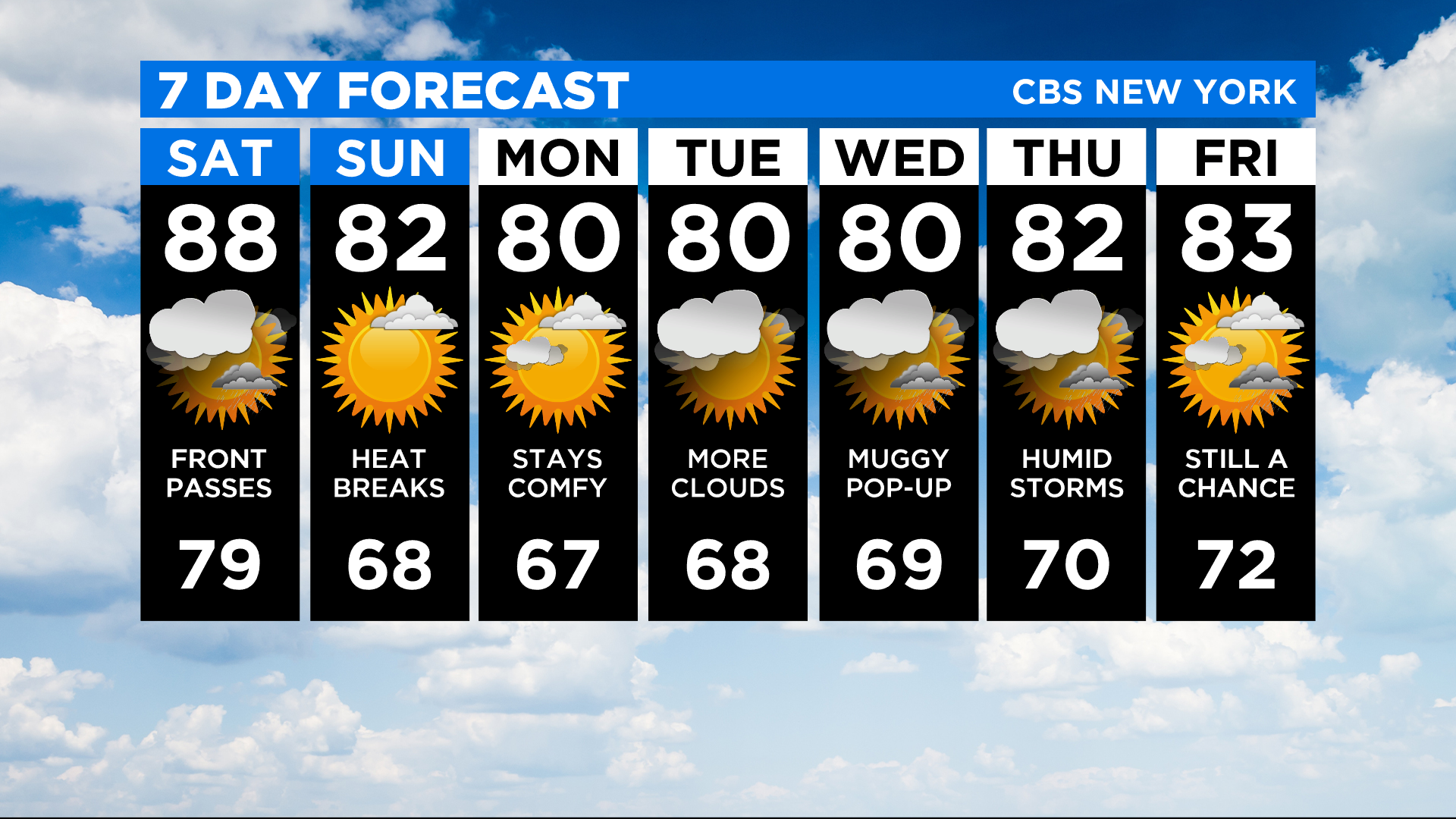
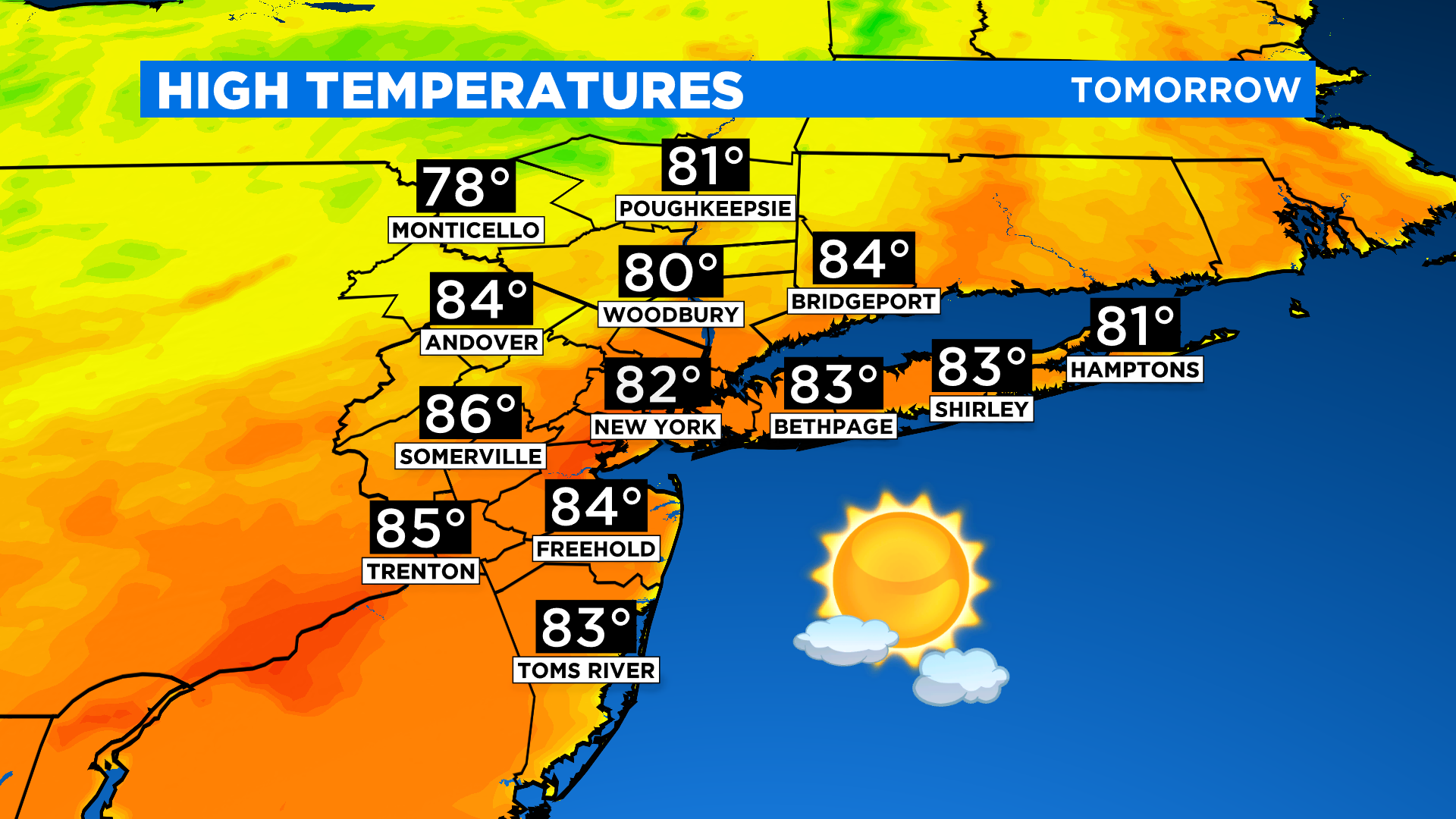
Tomorrow is the pick of the weekend! Expect mostly sunny skies, no humidity, and highs in low 80s. Doesn't get much better than that for mid-August around here! The nice weather continues into Monday before the humidity and storm risk gradually increases through next week.
Stay cool today and enjoy the comfy feel tomorrow. Have a great weekend!