First Alert Weather: Sunday begins bright before showers arrive
A Yellow Alert has been issued for Monday
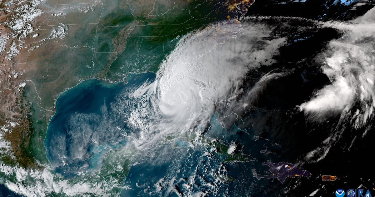
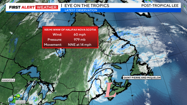
Post-Tropical Cyclone Lee, formerly known as Hurricane Lee, made landfall in Nova Scotia, Canada, around 4 p.m. Saturday with sustained winds of 70 mph. Though not the Category 5 monster he was late last week, Lee has delivered a potent blow to portions of eastern New England and Nova Scotia.
Lee's impacts have included heavy rain, gusty winds, coastal flooding, and pounding surf containing waves over 20 feet in some places. Throughout these locations, over 300,000 people lost power at some point due to the strong winds that gusted as high as 93 mph.

Luckily, Lee will be moving farther away into the Canadian Maritimes and losing strength while doing so. The effects brought to our area by Lee, such as high surf, minor coastal flooding and breezy conditions, will be diminishing as we progress through the night.

We really dodged a bullet with Lee. Last week at this time, forecast models were still not completely certain that Lee would miss us. At its closet point, the storm was around 275 miles from our area. Had Lee tracked farther west of that point, we'd be contending with some serious issues right about now.
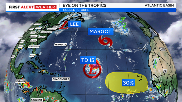
Elsewhere in the tropics, Tropical Storm Margot continues to swirl in the middle of the Atlantic but does not pose a threat to land. To the south of Margot lies the newly formed Tropical Storm Nigel, which is expected to become a hurricane by Tuesday. Nigel also poses no direct threat to land as of now.

As far as our weather goes, Saturday night looks to be clear and cool, as winds subside in the wake of Lee's passage. Lows will range from the upper 50s to the mid 40s.

Sunday will begin brightly, then by the late afternoon and evening, showers start to infiltrate the region, becoming steadier and heavier as the night goes on. Highs will top out in the mid to upper 70s, with the humidity making a subtle comeback.

The rain will last through Monday and may be heavy at times, with embedded thunderstorms. Rainfall totals should average between 1-2 inches, with some spots possibly seeing more. These totals, combined with grounds that are still a bit saturated from last week's rain, may lead to flooding, which is why we have issued the Yellow Alert.