More snow expected in Tri-State Area: How much snow will New York, New Jersey and Connecticut get Tuesday?
NEW YORK -- A good amount of snow appears to be heading to the Tri-State Area.
A Red Alert is in place from late Monday through Tuesday afternoon due to the threat of a winter storm.
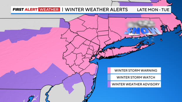
A Winter Storm Warning is in place for most of the Tri-State Area until 6 p.m. on Tuesday
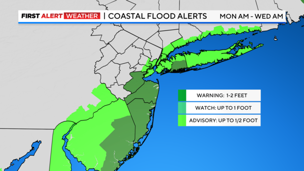
A Coastal Flood Warning is in place for the Jersey Shore through 3 a.m. on Wednesday
A Coastal Flood Advisory is in place for southern Nassau County through 10 a.m. on Tuesday
The Tri-State Area is on track for snow starting late Monday night and lasting through midday Tuesday. The quick-hitting frozen precipitation, paired with gusty winds, will make the Tuesday morning commute hazardous. It will be our highest impact winter event since January 2022.
We are dreadfully low on snow around here, with a mere 2.3 inches so far this winter, but that's going to change.
What's new?
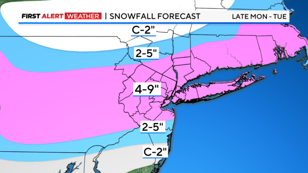
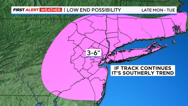
The latest track is a lot farther south than it was Monday morning. That means the potential for 12-16 inches, which the National Weather Service was forecasting as late as Monday morning, is no longer the case. The northern zones, Sullivan, Ulster and Dutchess counties, usually receive the lion's share of snow due to elevation, but with the continued southerly trend, the bigger numbers could end up closer to New York City and the I-95 corridor.
A "bull's-eye" given the latest modeling would be closer to West Milford, Morristown, Vernon, and Troy Hills and over to inland Rockland and Westchester counties around the same latitude. That will also drive the bigger numbers closer to the coastline and across parts of Long Island.
The takeaway from this latest track would be more uniform snow totals, but a little less.
Wind, lowered visibility
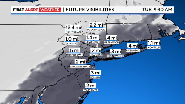
One of the concerning hazards will be travel Tuesday morning. The storm will come with high winds, featuring gusts up to 40 mph, and snow bands that could dump 1-2 inches per hour. The future visibility map reflects the tough driving conditions as it will be less than a quarter-mile by around 9 a.m.
Future winds
The toughest winds with be on the coasts, the Jersey Shore and South Shore of Long Island, possibly between 25 and 40 mph gusts.
Coastal impact
Higher water is expected as the nor'easter churns our seas. All coastlines will be impacted with a variety of potential flood impacts.
Stick with our First Alert Weather team for the latest track, timing and totals as the storm continues to develop.
