It's Technically Spring, But More Snow Is Coming This Week
NEW YORK (CBSNewYork/AP) -- The calendar says spring, but winter weather is not over for the Tri-State Area.
In fact, a nor'easter is bearing down, and is expected to bring more snow beginning Tuesday night. But the worst of the storm is not expected to strike the Tri-State Area.
CHECK: Radar | Forecast/Alerts
The National Weather Service said Monday that a powerful low pressure system will develop off the Mid-Atlantic coast Tuesday night. Where and how much snow falls will depend on the storm's track, according to the weather service. But cold temperatures and windy conditions will cover the Mid-Atlantic states north into New England.
CBS 2's Lonnie Quinn explained two storm systems – one over the midsection of the country and the other over the Gulf of Mexico – will combine to create the storm for the Northeast. The system over the Midwest will provide plenty of cold air, along with ample moisture from the Gulf System.
Quinn reported the two systems will likely combine for a "monster storm," but the storm will be out in the Atlantic Ocean and the Tri-State Area will only get clipped.
At 11 p.m. Monday, Quinn forecast a coating to 3 inches of snow the five boroughs of New York City, all of New Jersey, the northern suburbs, southeast Connecticut and most of Long Island. But the easternmost sections of Suffolk County could see 3 to 6 inches.
The New York City Department of Sanitation has issued a snow alert in advance of the storm, beginning at noon Tuesday.
The city is readying salt spreaders and attaching plows, preparing tire chains, and notifying supplementary personnel. The department was coordinating in advance with the Office of Emergency Management and the Department of Transportation for snow removal efforts.
And while the Tri-State Area is not expected to see the worst of the storm, the octopuses and the oysters will not be the only ones affected either.
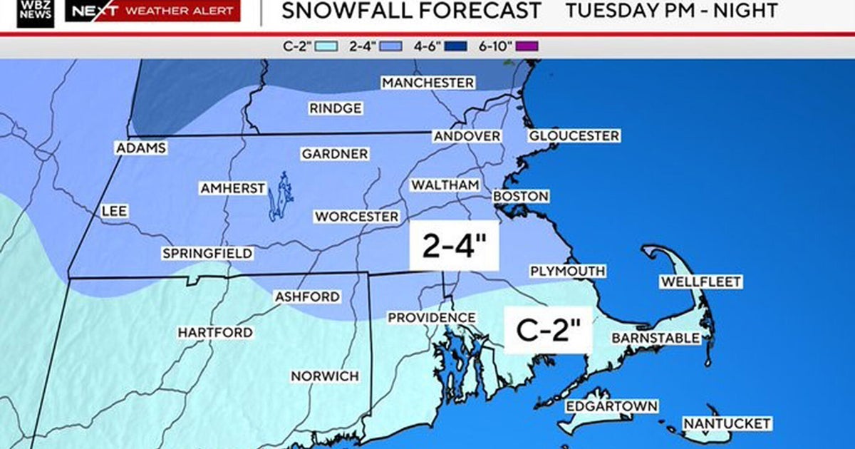
More than half a foot of snow is forecast to hit southeastern Massachusetts on Tuesday evening into Wednesday, and parts of coastal Maine could also see snow. The NWS also called for the potential of minor coastal flooding and some beach erosion along the Massachusetts coast.
Cape Cod, Martha's Vineyard and Nantucket are expected to be hit the hardest, starting Tuesday evening and lasting until Wednesday morning, National Weather Service spokesman Bill Simpson said. The heaviest snowfall is expected early Wednesday, and that could make it a rough commute into work, Simpson said.
A blizzard watch has been issued for parts of eastern Massachusetts, and Cape Cod and Martha's Vineyard and Nantucket could see up to a foot of snow, CBS Boston reported.
Check Out These Other Stories From CBSNewYork.com:
(TM and © Copyright 2014 CBS Radio Inc. and its relevant subsidiaries. CBS RADIO and EYE Logo TM and Copyright 2014 CBS Broadcasting Inc. Used under license. All Rights Reserved. This material may not be published, broadcast, rewritten, or redistributed. The Associated Press contributed to this report.)

