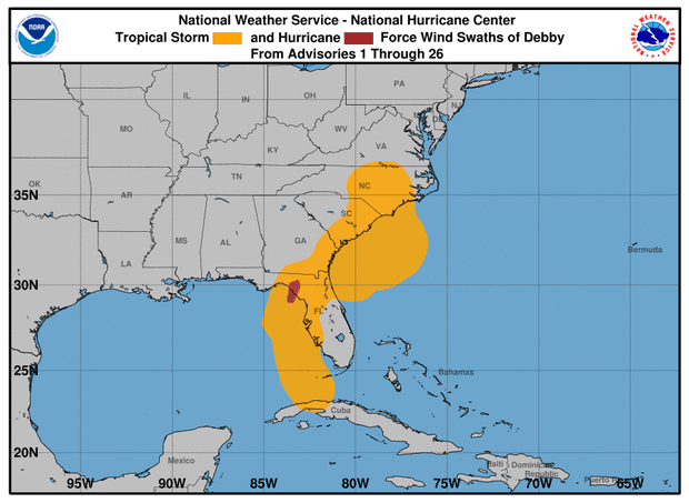
Maps show Tropical Depression Debby's path and forecast
Debby made landfall for a second time early Thursday as a tropical storm near Bulls Bay, South Carolina, the National Hurricane Center said. It weakened to a tropical depression later in the day and is forecast to move up the East Coast, spreading heavy rain and possible flooding through the mid-Atlantic and Northeast by the weekend.
Debby first made landfall as a Category 1 hurricane early Monday on Florida's Big Bend coast. As of 11 p.m. EDT Thursday, it had maximum sustained winds of 30 mph, the Miami-based hurricane center said. Debby's center was about 80 miles northeast of Charlotte, North Carolina, and some 90 miles northwest of Raleigh, North Carolina. It was moving north-northeast at 26 mph.
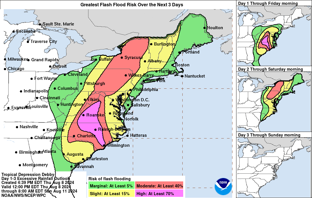
The storm's generally sluggish pace means Debby has been lingering for a long time in places it passes over, making flooding risks high across the regions in its path.
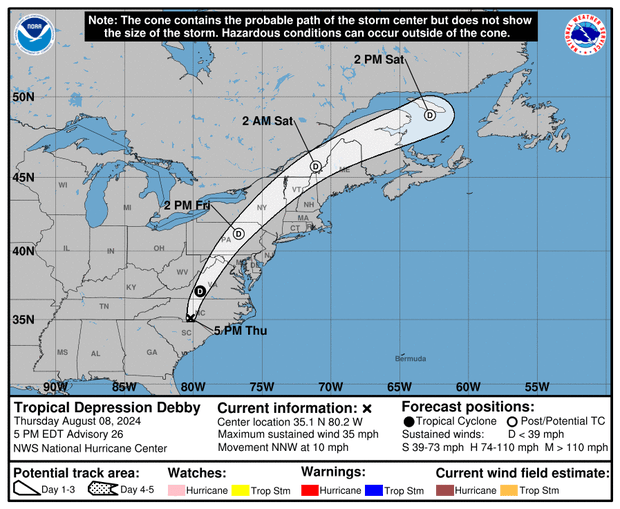
As the storm heads toward the Northeast, meteorologists said, Debby would most likely converge with a frontal zone farther up the East Coast — essentially meaning it will cross over an atmospheric threshold and into a different air mass — and become an extratropical cyclone as it dumps rain on places as far north as upstate New York and Vermont.
Tropical cyclone is an umbrella term that encompasses tropical depressions, tropical storms and hurricanes, which differ based on their strength. An extratropical cyclone can be as weak as a tropical depression or as strong as a tropical storm, but unlike tropical cyclones, they are cold at the core and therefore can't quickly grow into a hurricane.
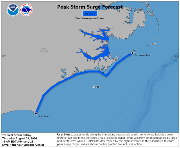
Storm surge forecast
The map below, updated Thursday morning, showed the highest potential peak storm surge heights, including tides. Forecasters noted that the timing of peak surge and high tide in a given area, and whether they coincide or not, will ultimately determine how destructive the inundation will be.
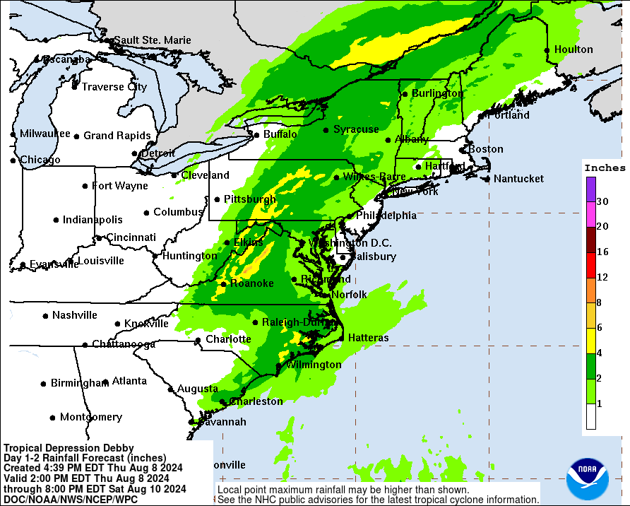
Heavy rainfall totals dominate the forecast
The hurricane center said Thursday that Debby "is expected to produce an additional 3 to 6 inches of rainfall with locally higher amounts across portions of southeastern North Carolina, leading to maximum storm total amounts as high as 15 inches," the hurricane center said. "Additional rainfall of 1 to 3 inches over portions of eastern South Carolina will bring maximum storm total amounts as high as 20 to 25 inches. Considerable flooding is expected across portions of eastern South Carolina and southeast North Carolina through Friday."
"From central North Carolina northward across portions of Virginia, 3 to 7 inches with local amounts to 10 inches, are expected through Friday," forecasters said. "This rainfall will likely result in areas of considerable flash and urban flooding, with river flooding possible."
"From portions of Maryland north through Upstate New York and Vermont, 2 to 4 inches, with local amounts to 6 inches, are expected through Friday night," the hurricane center said. "This will likely result in areas of considerable flash and urban flooding as well as river flooding."