First Alert Weather: Yellow Alert Day for scattered rain showers during morning and evening commutes
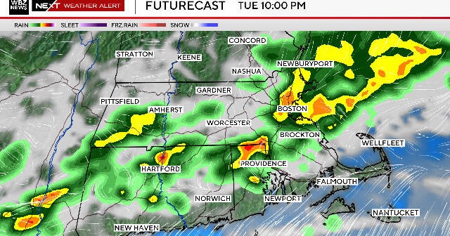
After some morning downpours around the area, coverage looks lower for the late morning and early afternoon period. Still, some more scattered showers/storms are possible through the day, with potentially an increase in coverage again by mid-afternoon into the evening. For that reason, we'll continue with the Yellow Alert today, focused mid-afternoon and onward.
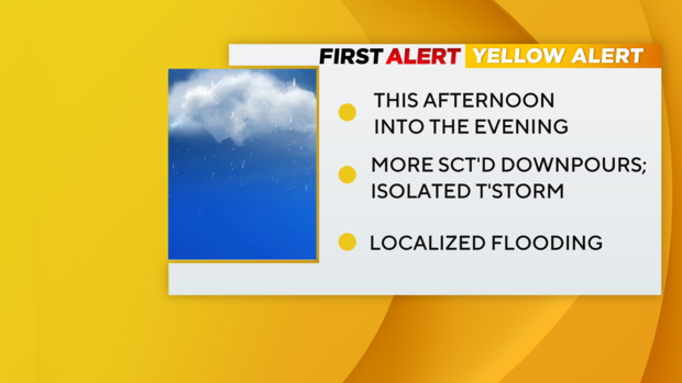
- Yellow Alert continuing for today, and mainly now for the PM commute
- Scattered downpours could lead to localized flooding where they do occur
- Now through early afternoon looks like a "lull" with higher coverage later in the day
- While not zero, the risk of severe weather (wind/hail) remains low again today
- Same story: not everyone will see showers/storms, but may move slowly where they do
- We finally lose this pesky front tonight, bringing in drier weather for tomorrow

Forecast
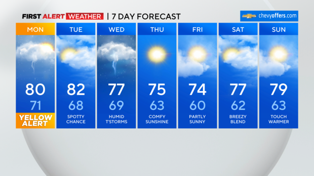
Today: Mostly cloudy with some more sct'd showers/storm around. Warm, humid. High: 80
Tonight: Lingering risk this evening, then drying out overnight. Low: 68
Tomorrow: Drier and brighter with just an isolated shower chance. Warm, still humid. High: 82
Looking Ahead:
Wednesday: Our next round of showers/storms with some more localized flooding possible. High: 77
Thursday: Behind the cold front, humidity is finally gone! Mostly sunny, cooler, comfy. High: 75
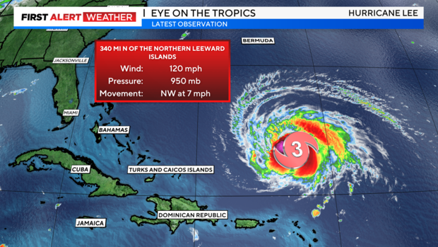
Watching Lee
Aside from intensity fluctuations over the weekend due to excessive wind shear, not much change in the forecast at this time. Lee is currently still over 600 miles southeast of Bermuda, slowly moving NW. It is back up to a Category 3 with maximum sustained winds near 120 mph. It will continue NW over the open waters over the next couple of days before turning northward sometime midweek. We are still 5 days or so away from Lee's closest pass to our shores. Rough surf, dangerous rip currents, and beach erosion will increase through the week and are a given. While the chances of direct impacts remain on the low side in our area, we need to monitor changes in the coming days as model guidance will continue to wobble a bit. As of now, New England into Atlantic Canada have the greatest risk of more direct impacts into next weekend. However, nothing is set in stone 5 days out. A closer approach would bring some rain and higher wind gusts, esp. into eastern Long Island. The bottom line right now is we are still in the "watching" phase and our thinking remains the same.... coastal impacts the greatest threat, more direct concerns from Cape Cod northward into Canada. We'll be updating all week with the latest and should have a better idea within the next 1-2 days once Lee makes the turn north and models continue to resolve the greater atmospheric setup.