First Alert Weather: Some light snow expected Saturday
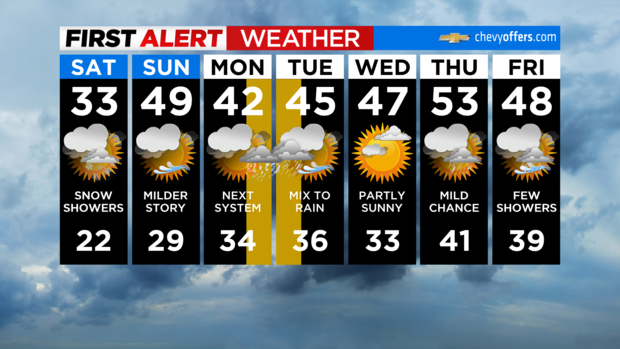
It's a cloudy and colder day and yes, there are some snow showers out there.
Don't expect much, but we could pick up a coating to half an inch or so in spots. No big deal, but a rarity as far as this season has been going! Highs will only be in the low 30s this afternoon with wind chills in the 20s.
Any leftover flakes wrap up into this evening with some decrease in clouds. Overnight lows will be in the 20s.
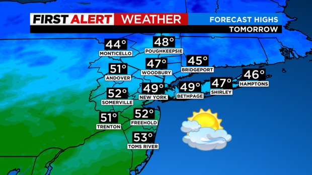
Then we have another quick rebound for the second half of the weekend. Morning clouds should give way to some sunshine with highs in the upper 40s and low 50s.
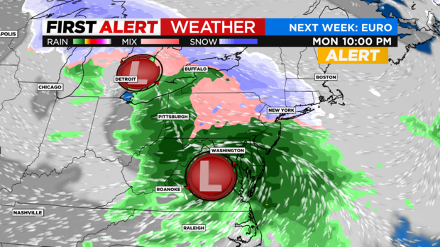
The next bigger system is currently affecting the west coast and heads our way late Monday into Tuesday. As of now, it looks like a secondary coastal storm will develop and intensify, but a bit on the late side to bring the entire region a snowstorm.
Current thinking is mainly rain to the south, a wintry mix around the city, and some plowable snow northward. Perhaps 3-6"+ into Orange and Putnam, with 6"+ possible in the mountains of Ulster and Dutchess. Again, this is a very early call and we'll fine tune that as it gets closer.
Have a great weekend and enjoy the snow showers around today!