First Alert Weather: Red Alert for rain and season's first snowfall Tuesday night
Alert: Red Alert late Tuesday into early Wednesday morning.
Reports: We've had reports of 1.2 inches of snow in High Point, New Jersey, and 1.4 inches in Wantage Township, New Jersey, around 8 p.m. before the rain started to erode the numbers. Mt. Pocono, Pennsylvania, reported 3.2 inches.
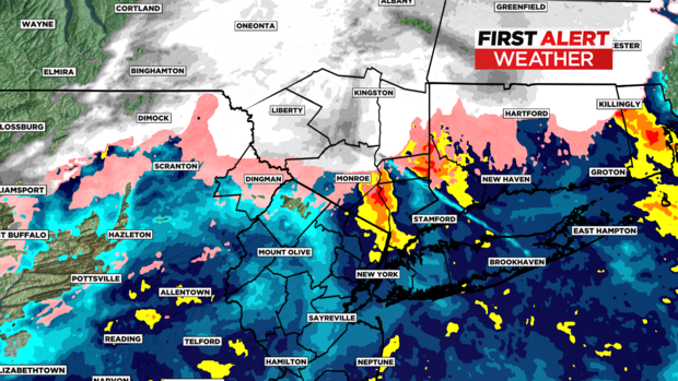
Tuesday night: Heavy rain is pushing north through Putnam and Orange counties in New York and has just overwhelmed Sussex County in New Jersey. Just to the north of the rain/snow line, Sullivan, Ulster and Dutchess counties are getting a decent clip of snow.
Long Island moving west to New York City and just about all of New Jersey are seeing moderate-to-heavy rain -- and chilly rain, at only 38 degrees.
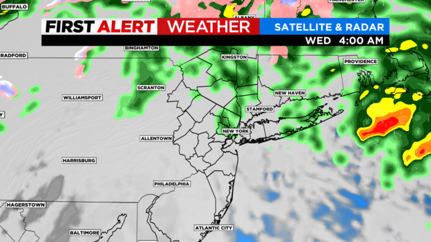
Overnight: The rain will continue to push north through the Catskills overnight and will start tapering down in intensity after 2-3 a.m. Wednesday.
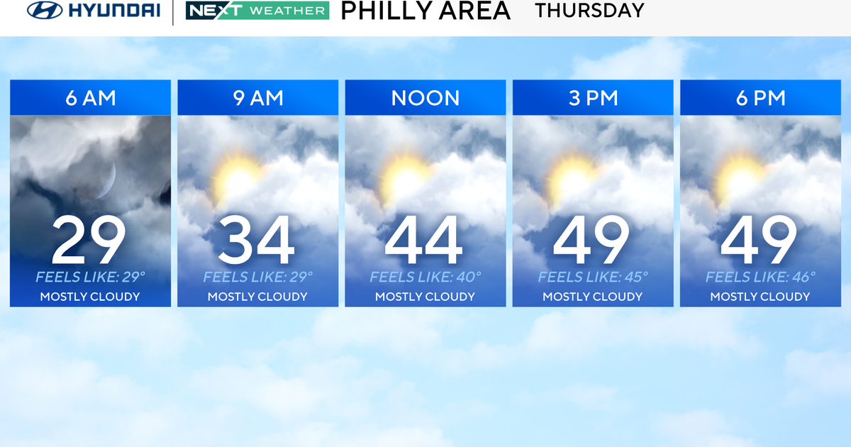
Wednesday morning: Because our temperatures are milder with this system, the morning commute should be mostly wet with some slick spots mainly north of I-84 and will likely be slowed due to the storm's remnants.
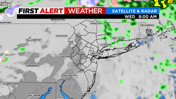
After 8 a.m., a west-northwest wind takes over and should see some sunshine hopefully by early afternoon with drying conditions.
Temperatures are near 50 Wednesday, which is the warmest of the next week.
We are looking at a cold wind Thursday with wind chills returning.
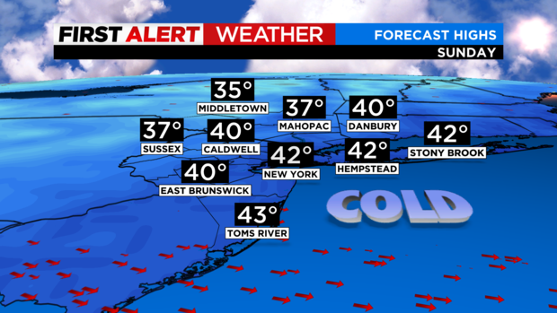
Unfortunately, we remain cold. By this weekend, some areas will have high temperatures in the 30s.