First Alert Weather: Flood Watch remains in effect across Tri-State Area
Alerts & advisories
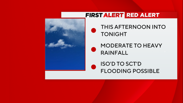
- Red Alert Wednesday afternoon until Wednesday night due to moderate to heavy rain, which may lead to flooding.
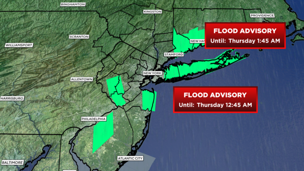
- Flood Advisory until 12:45 a.m. Thursday in Nassau and Suffolk counties and until 1:45 a.m. Thursday in Connecticut in Fairfield, Middlesex, New Haven and New London. Minor flooding from excessive rainfall is expected in low-lying and poor drainage areas.
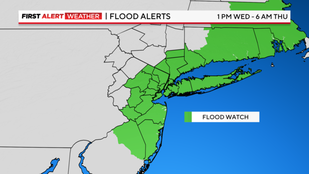
- Flood Watch from 1 p.m. Wednesday until 6 a.m. Thursday.
Forecast
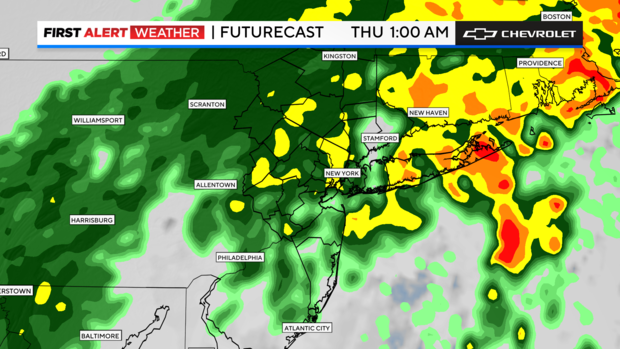
We're already seen flooded streets in Queens and on Long Island. So far, rainfall amounts are approaching 1 inch, with storm totals ranging from 1.5- 3 inches.
The strongest plume of rainfall is just east of New York City with stronger and heavier rain cells extending south. That arm of precipitation will continue to push east, which means Long Island will have a tougher night than New Jersey. Things should get quieter after 10 p.m. before another batch lashes Long Island.
Thursday: Once the rain clears the east end, expect clouds and a few lingering showers to impact the day. Temperatures will be right around 50.
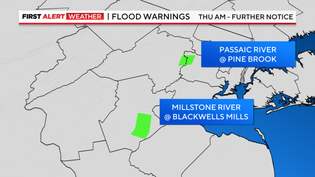
The National Weather Service issued Flood Warnings for the minor flood potential Thursday at the Passaic River at Pine Brook and the Millstone River at Blackwells Mills.
Looking ahead
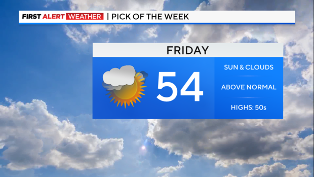
Friday (Pick of the Week): Partly sunny and mild with highs in the 50s.
Saturday: PM rain likely. Highs in the 40s.
Sunday: Leftover rain and blustery. Highs in the low 50s.