First Alert Weather: Red Alert Day as hot stretch continues; Potentially severe thunderstorms later tonight
Alerts/Advisories:
- Red Alert is in place through Thursday, and the Heat Advisory has been extended into Friday.
- Air Quality Alert is in place for Fairfield County, Connecticut from 11 AM to 11 PM.
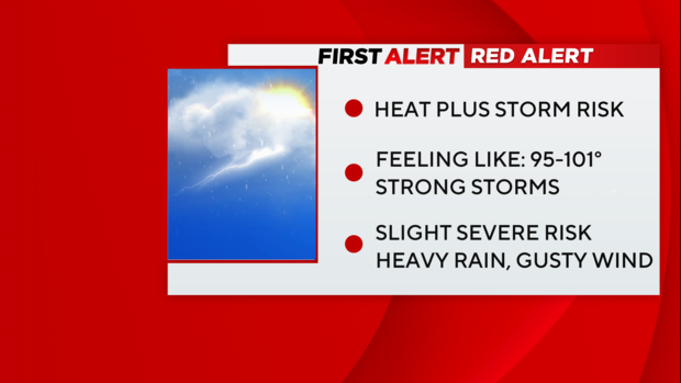
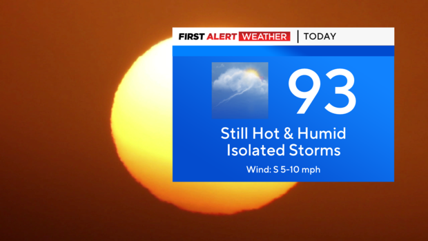
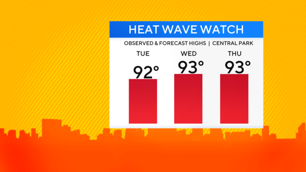
Today: Day 3 of the first official heat wave of 2023 is upon us. A few more record highs were set across the area on Wednesday, and Central Park tied its highest high of the year at 93. The warm overnight led to us tying a record for the highest low temperature on this date, with the morning low only reaching 79. The Heat Advisory has been extended into Friday, as heat indices may reach up to 102 degrees at times. Today we are expecting highs in the low to mid 90s under a mostly sunny sky. High humidity will make it feel more like 95-102 though.
As we progress through the afternoon and evening hours, the chance of thunderstorms returns. The greatest chance of storms lies north and west of the city. Some of the storms may be severe, with strong winds and hail being the greatest hazards.
Tonight: For tonight, the storms will gradually taper off by midnight, followed by clearing skies. Patchy fog is possible for areas that seen rain. It will be another very warm and muggy night with lows in the low to mid 70s for most of the area. Once again, we may break a record for highest minimum temperature as our forecast low of 77 is likely to exceed our current record high low of 76, which was set in 2015.
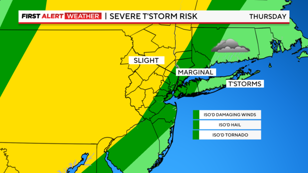
Tomorrow: Friday will see a continuation of the heat and humidity, just not as hot. We're forecasting a high of 88 in the city, with low 90s for central portions of New Jersey. Record highs are not highly likely, but also not impossible. Sunny skies will start the day, with a few more clouds in the afternoon. The clouds will lead to scattered afternoon thunderstorms that may last into the evening. The storms look to be more widespread in coverage than today. Severe storms are possible, with the greatest hazards being torrential rain and gusty winds.
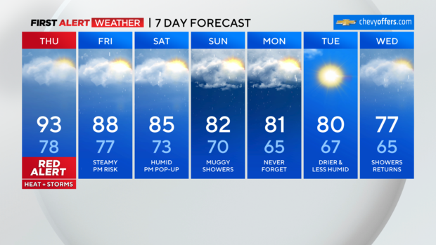
Looking ahead: The humidity will last through the weekend into Monday. Multiple chances of rain will be in place throughout the period as well. Though no day is a washout, heavy rain is likely at times.

Tropics update: Hurricane Lee is currently moving about in the Atlantic as a Category 1 storm. Lee is expected to intensify into a monster Category 4 storm by the weekend. This storm needs to be watched very carefully, as some forecast models still bring it dangerously close to the East Coast by late next week. In the very least, high surf, dangerous rip currents, and beach erosion will be observed at our local beaches.