First Alert Weather: Red Alert as winter storm clears out Sunday
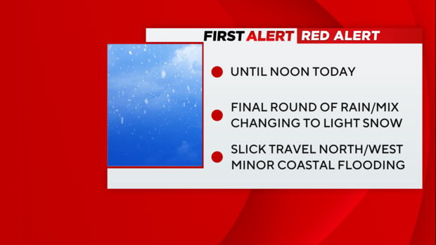
Our first winter storm of the season is winding down, but we remain on Red Alert through noon today.
The Latest
As low pressure pulls away, winds are shifting to the north/northwest and will bring in a final round of rain/snow showers on the backside. It'll all be on the light side, but another coating up to 1-2" up north is possible.
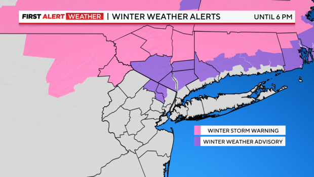
Some Winter Storm Warnings and Winter Weather Advisories remain in effect but will gradually expire as the system exits.
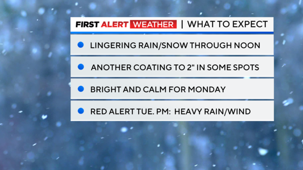
Once we get past noon, things really start drying out west to east and we'll be left with cloudy skies. Temps don't climb much today, hanging in the mid 30s.
How Much?
So how much snow did our area see? As of this morning, totals ranged from zero to over a foot! The top number so far is 14.6" up in Ulster Co. Numbers approached a foot down into parts of Orange, Sussex, and Warren. Elsewhere, totals generally ranged from 4-8" across northern NJ. A true snowstorm for many!
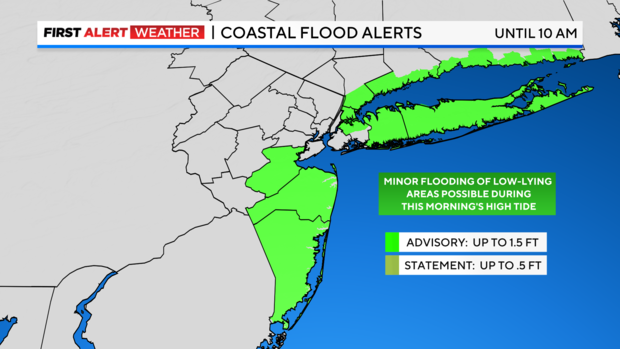
What about the city and coasts? This just wasn't our storm this time. A track too close to the coast allowed the warm air off the water to surge northward. So, much of the storm ended up as wet for half of the area.
Snow Starved!
We'll probably see some flakes flying this morning in the city before things wrap up, but it won't be enough to break our "snow starved" streak.
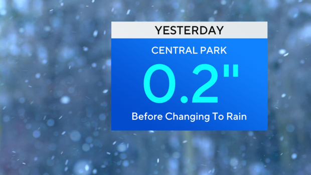
Central Park picked up 0.2" yesterday before the rain took over. Even if we get another few hundredths today, we won't hit an inch.
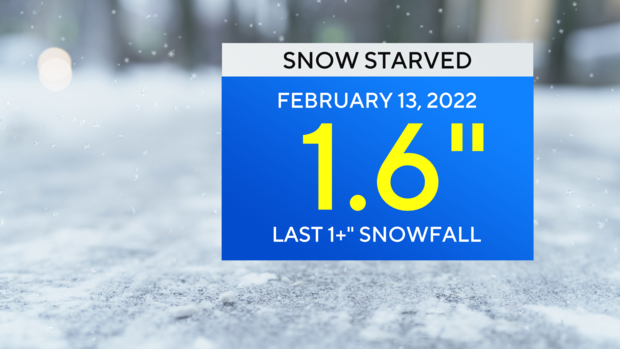
So, the streak continues! The last time we picked up 1"+ in the park was February 13, 2022.
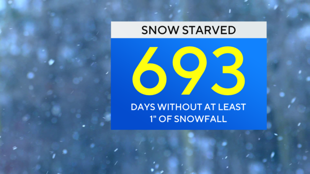
If you're counting... that's 693 days ago!
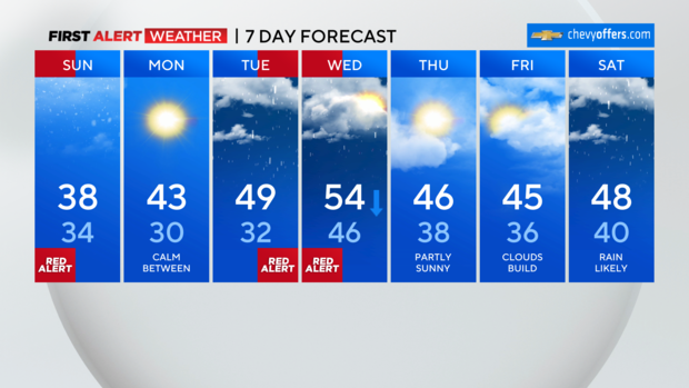
What's up next?
We'll gradually clear out tonight with lows falling into the 20s for most. Monday will be bright and brisk with highs in the low 40s. But once again... it's the calm before the NEXT storm.
Red Alert Tue. PM into Wed. AM
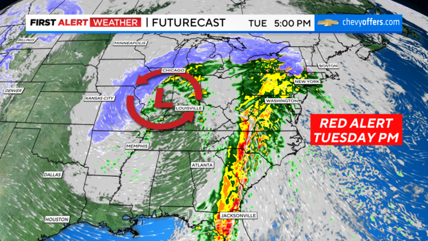
Our next system is looking to bring an even bigger impact to the area. This time around, the storm will travel to our west, putting us on the warm side of the storm. Temps will climb into the 40s and even 50s, but that comes with very heavy rain and strong, possibly even damaging wind gusts. Models are putting out a solid 2-4" across the area. But remember... northern NJ has 6-12" of snow that will be melting on top of that! All the water will be streaming into the streams/rivers, so inland flooding will be a much bigger concern with this one.
You'll want to stay tuned this week as we track this one closely and will bring you the latest.