First Alert Forecast: Chilly, feeling like 30s, flurries possible
After a stretch of days well above normal, temps are closer to where they should be for early January.
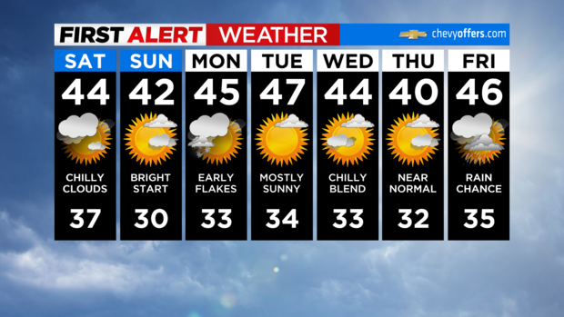
Today will feature more clouds than sun, although we'll get some brighter breaks at times. Some flurries are possible, especially to the north and west. Highs will be in the low to mid 40s.
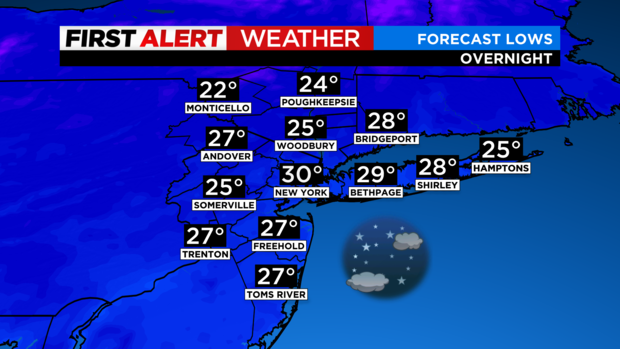
Tonight will be colder as well with lows falling to around 30 degrees in the city and the 20s in the suburbs. Partly cloudy skies early will give way to mainly clear skies overnight.
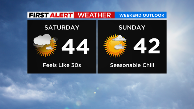
We'll start off brisk and bright Sunday. Some more high clouds will stream in during the afternoon hours, but daytime remains dry. It'll be a few degrees colder, topping out in the upper 30s and low 40s.
The average for this weekend is around 40 degrees - a seasonable chill.
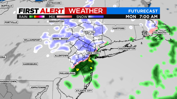
A weak system passes by to our south late Sunday night into Monday morning, bringing a quick swipe of rain and snow across parts of the area.
It's not looking like a lot but could produce a coating to an inch on colder surfaces north and west.
If the timing holds, the Monday morning commute could be slick in spots before everything clears out by midday. However, with marginal temps, we're not expecting any widespread impacts.
Have a great weekend!