Severe thunderstorms sweep through New York, New Jersey and Connecticut. Maps show where was hit hardest.
NEW YORK -- Severe thunderstorms swept through New York, New Jersey and Connecticut on Sunday.
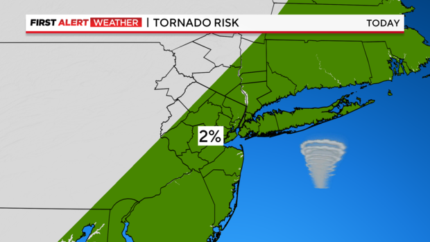
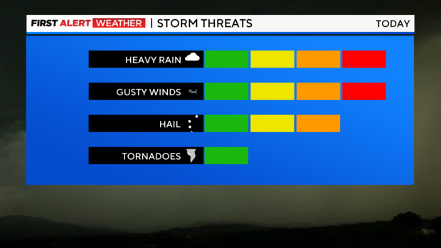
The storms packed torrential downpours, damaging winds, hail and threatened to trigger the formation of a tornado. Some areas were expected to see 2 to 3 inches of rainfall that could lead to flash flooding.
A severe thunderstorm warning issued for New York City expired at 5:15 p.m. The rest of the Tri-State Area was under a severe thunderstorm watch until 7 p.m.
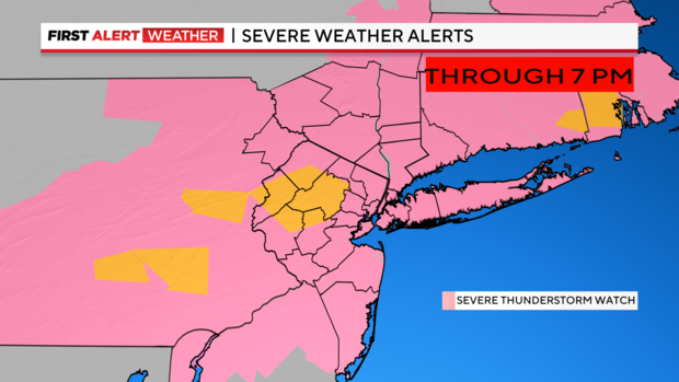
Severe thunderstorm warnings were also issued for parts of Morris, Sussex and Warren counties in New Jersey, Fairfield and New Haven counties in Connecticut and Putnam County, New York.
A flash flood warning was effect for Fairfield, New Haven and Putnam counties until 5:45 p.m.
Early reports of damages also came in from Dutchess, Sullivan and Ulster counties. Strong winds snapped trees in Fishkill in Dutchess, shutting down Route 82 at Lomala Road.
Trees and wires also came down across Lincoln Park, Napanoch and Lake Katrine in Ulster.
Red Alert, heat advisory & high rip current risk
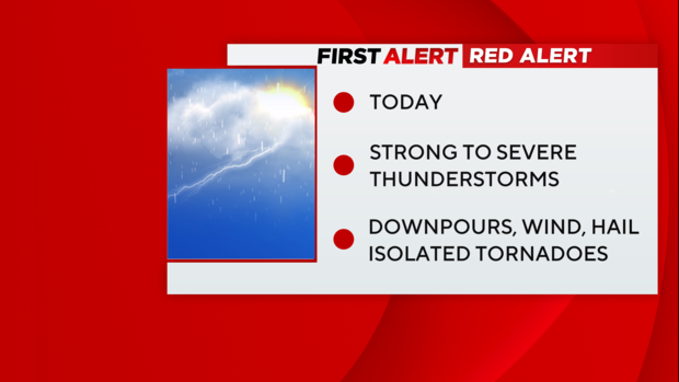
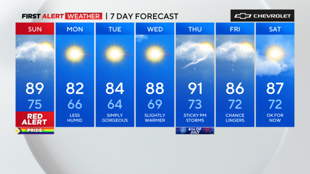
A Red Alert was in place through Sunday night due to the threat of severe thunderstorms. A severe thunderstorm watch was issued for much of the area through 7 p.m.
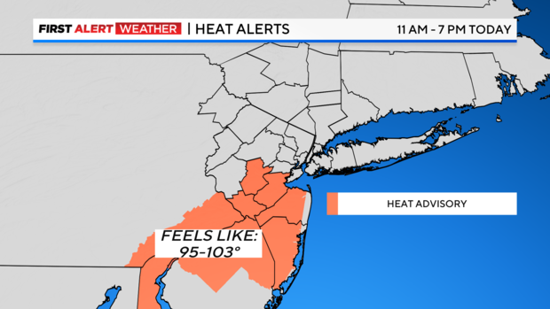
A heat advisory issued for Somerset, Middlesex, Monmouth and Ocean counties expired at 7 p.m. Sunday.
There was a high risk of rip currents at all south-facing beaches in New York through Sunday.
Timing out the storm
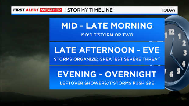
Sunday evening: The storms will come in rounds and may contain damaging winds, hail, torrential downpours, and even an isolated tornado or two. With a tropical airmass in place, the storms will be capable of producing copious amounts of rain, which should average around an inch for most areas, while isolated totals between 2-3 inches are possible. This may lead to some flash flooding.
Overnight: Clearing skies and lowering humidity will follow in the wake of the storms later tonight.
First Alert Weather maps
- Live Tri-State Area radar
- Live Long Island radar
- Live NYC northern suburbs radar
- Live Jersey Shore radar
- Tri-State temperatures
Stick with the First Alert Weather team for the latest forecast and weather alerts.