First Alert Weather: Red Alert for rain and snow Friday night into Saturday morning
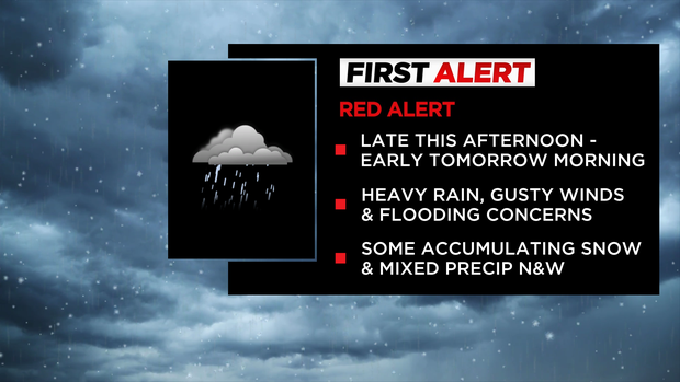
NEW YORK -- The CBS2 First Alert Weather Team has issued a Red Alert for Friday night through Saturday morning due to heavy rain, some snow and mixed precipitation.
The storm could cause minor flooding.
Click here for the latest forecast.
Check this live blog for updates.
Saturday morning update
The storm that brought us heavy rain, gusty winds, and even some snow to the north overnight is now moving away and things quiet down for the rest of today.
It'll still be windy at times, especially along the coasts and there's still a chance of some leftover rain or snow showers well to the north. But overall, we're drying out now.
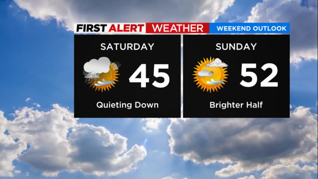
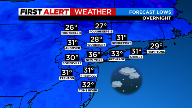
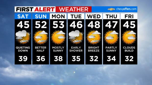
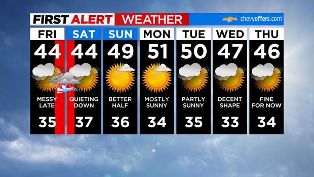
Expect mostly cloudy skies this afternoon with highs in the low to mid 40s. It'll be a much quieter night if you're headed out. We'll fall into the 30s for most, with some 20s to the N&W.
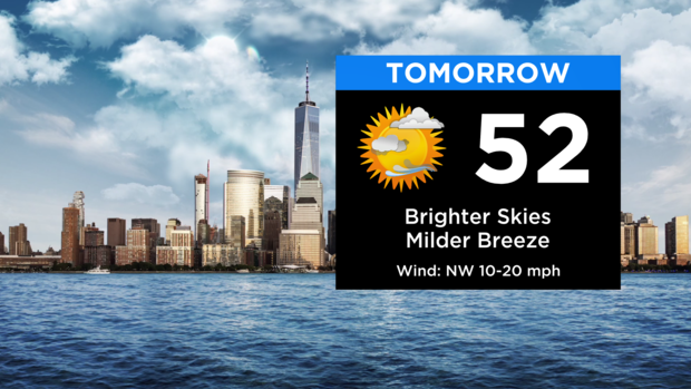
Sunday will be the better half of the weekend as we get brighter skies, less wind, and milder temps. Highs tomorrow afternoon will top out in the low 50s.
It's looking like a fairly quiet stretch into next week, although a weak clipper system may bring some rain/snow showers late Monday night into the first half of Tuesday.
Have a great weekend!
Friday 11 p.m. update
Friday 9:45 p.m. update
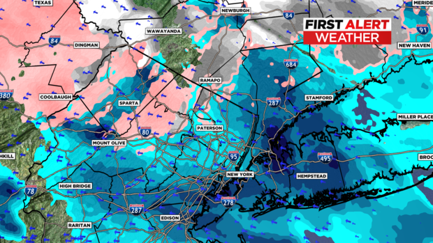
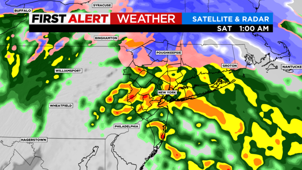
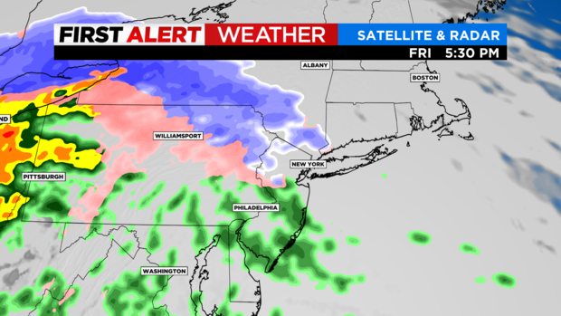
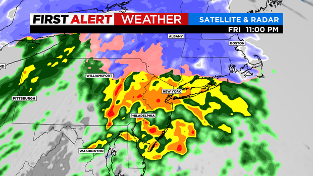
Rain is falling steadier around the area. We will have some breaks but we're also still on track for the heaviest precipitation and strongest winds to fall overnight after 11 p.m. The rain/snow line is already sliding north in concert with the heavier batch of rain.
The picture later tonight:
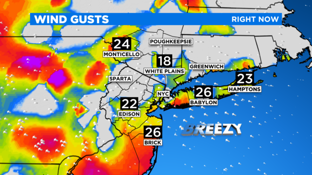
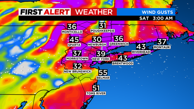
Winds are starting to pick up with gusts nearing 30 mph at the moment.
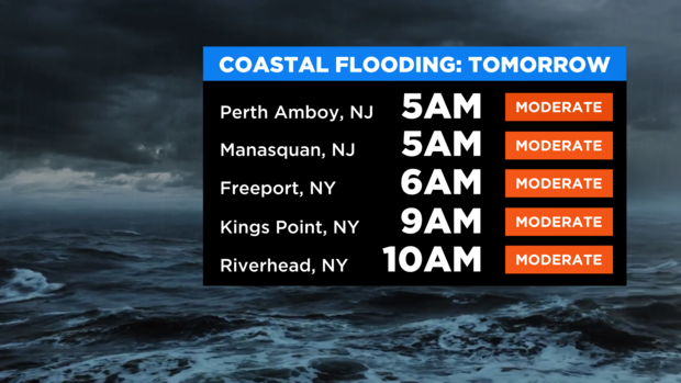
High tides in the morning are a good bet for some coastal flooding.
Long Island and the Jersey Shore could have some coastal flood issues and possibly some power problems; these winds are strong enough for damage.
The good news is after 5-6 a.m., we are much quieter, but some wraparound snow is likely north tomorrow. Sunday is much nicer with temps in the upper 40s under mostly sunny skies.
Friday 9:30 p.m. forecast
Friday 6 p.m. forecast
Noon forecast: Storm tracking slightly later
Red Alert for rain, wind and snow
Alerts: Red Alert late this afternoon into early tomorrow morning for heavy rain, snow and mixed precipitation (N&W), gusty winds, coastal flooding and some minor inland flooding.
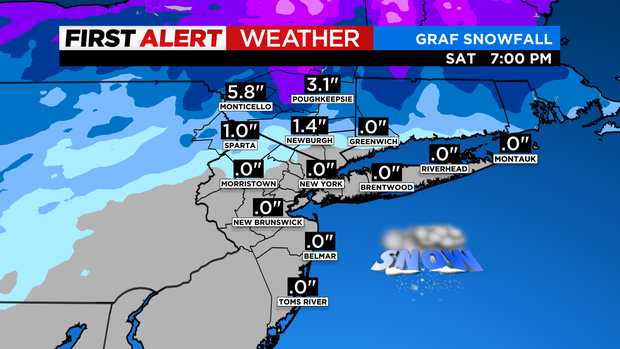
Forecast: Today starts dry, but rain/snow overspreads the area late this afternoon into tonight with snow/mixing N&W and rain elsewhere. Little or no snowfall is expected in the city; a coating - 3" is expected N&W before any changeover; and 3-6+" is expected up towards the Catskills.
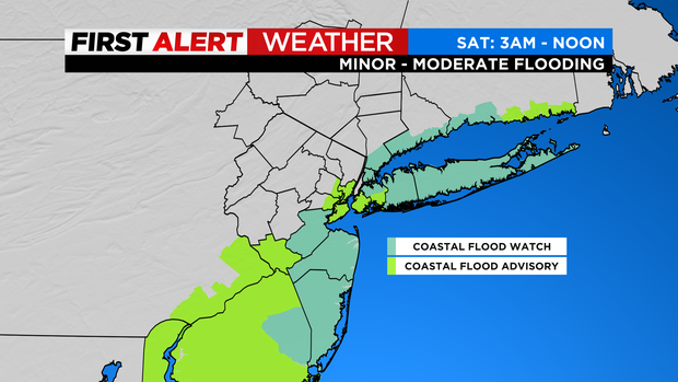
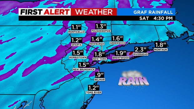
As far as rainfall goes, around 1-1.5" (locally more) is expected with some minor flooding not out of the question. Also, minor to moderate coastal flooding is expected late tonight into tomorrow morning.
Looking Ahead: Some snow/rain showers may linger into tomorrow morning, but mainly north of the city. Otherwise, expect mostly cloudy skies with highs in the 40s. As for Sunday, expect partly to mostly sunny skies with highs in the upper 40s to near 50.
Friday morning forecast
Thursday 11 p.m. forecast
Thursday evening weather update
Friday night's storm is still on track. The forecast looks like heavier rain, a little less snow and we now have Coastal Flood Alerts for late Friday into Saturday with a focus on Saturday morning's high tide locally. This is the same system that spawned Tornado Watches in Texas on Thursday, and the models are indicating a piece of that energy is heading to the Tri-State Area.
Friday starts dry, but rain/snow overspreads the area later in the afternoon with a light snow accumulation likely north and west into the evening. Little or no snowfall is expected in the city with a coating; 3 inches expected north and west before any changeover; 3-6-plus inches is expected up towards the Catskills.
The evening commute looks a little better than earlier runs. Some snow quickly turning to rain, but it is much drier than Wednesday.
Heavy rain looks to invade after 9 p.m. with some embedded thunderstorms possible. Moderate to heavy rain falls overnight dropping 1-2 inches.
Winds: Gusting over 40 mph at the coasts with sustained wind over 25 mph. Some models indicating gusts to 50 mph along the shoreline.
These winds paired with fresh rainfall and an already saturated ground could bring about some downed trees/limbs and maybe some power problems. The best bet for that looks like coastal areas around the Jersey Shore and Suffolk's South Shore.
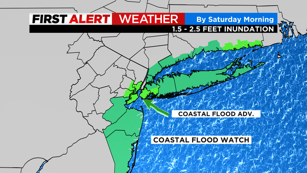
Regarding coastal flooding, the National Weather Service says there could be widespread minor-to-moderate coastal flooding for Saturday morning high tide.
The most vulnerable coastal communities of Long Island, much of coastal Connecticut, coastal Westchester and the Bronx and northern Queens will be under a Coastal Flood Watch and could see 1.5-2.5 feet of water above ground.
A Coastal Flood Advisory will be in effect in the most vulnerable coastal communities of New York/New Jersey Harbor and Jamaica Bay and southeastern Connecticut. Those areas could see up to 1.5 feet of water above ground.
