Maps show Helene's track: What to know about its path, storm surge and flood risk
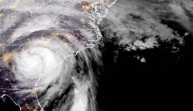
Fueled by extremely warm water in the Gulf of Mexico as it rapidly intensified, Hurricane Helene made landfall as a powerful Category 4 storm along Florida's Big Bend coast late Thursday night, then quickly lost punch and was downgraded to a tropical storm within hours, according to the National Hurricane Center.
The center described Helene as a "very dangerous and large major hurricane" with "damaging hurricane winds and catastrophic storm surge" when it came ashore, and said Helene was still causing a "life-threatening" storm surge, strong winds and heavy rain" hours later.
The storm was a major hurricane when it made landfall near Perry, Florida, at 11:10 p.m. Eastern Time Thursday with maximum sustained winds of 140 miles per hour.
As of 11 a.m. EDT, Helene was approximately 30 miles southwest of Bryson City, North Carolina and was racing north at 32 mph, the Miami-based hurricane center said. It was packing maximum sustained winds of 45 mph.
Path of Hurricane Helene
A map from the National Hurricane Center showed Helene heading north through Georgia early Friday, with its impacts being felt across South Carolina and parts of North Carolina as well.
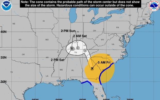
After landfall, Helene was "expected to turn northwestward and slow down over the Tennessee Valley on Friday and Saturday," the hurricane center said.
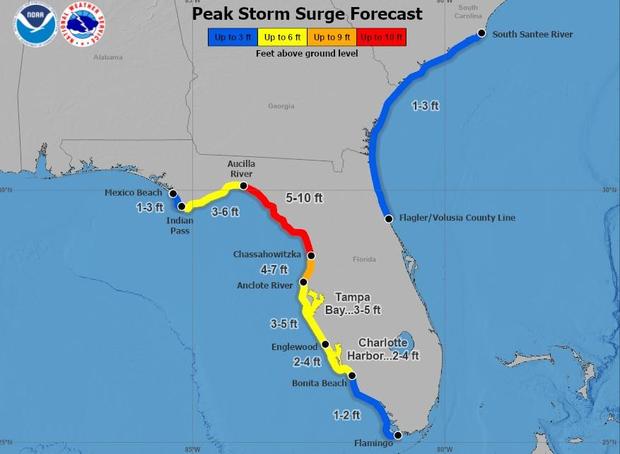
In northwest Florida, storm surge was a major concern as Helene arrived. Forecasters expected the storm surge to reach 5 to 10 feet from the Florida's Aucilla River to Chassahowitzka, Florida. Other areas could see anywhere from 3 to 7 feet of water, the hurricane center warned.
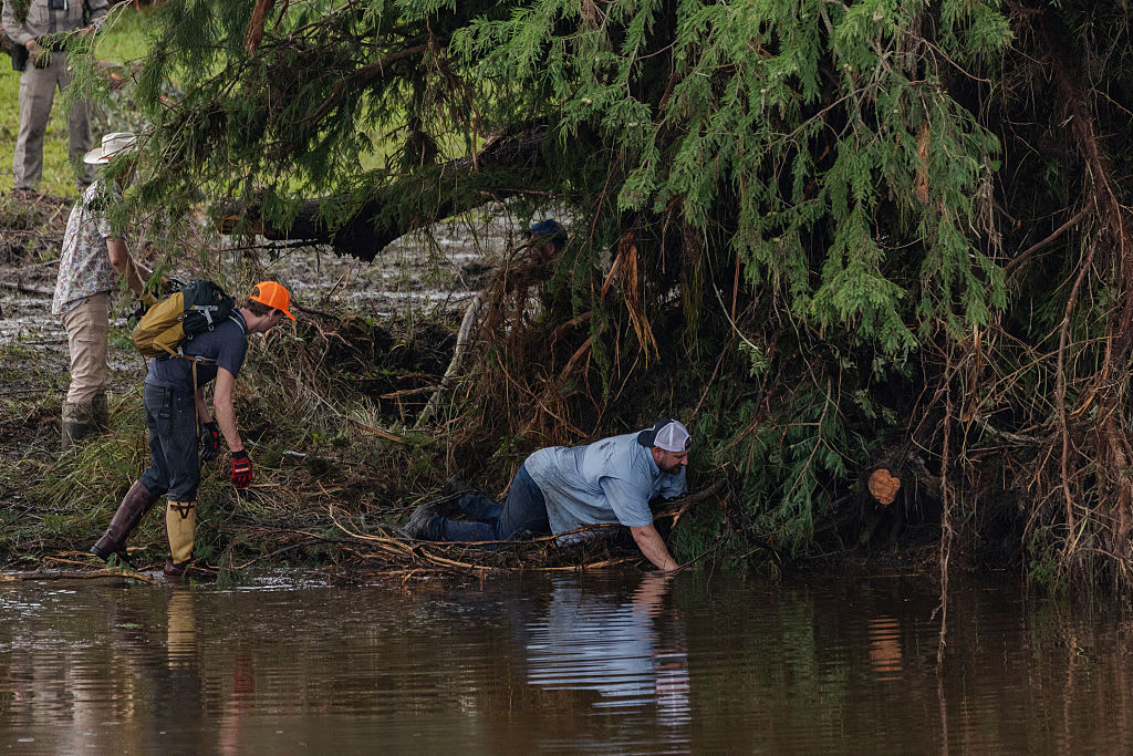
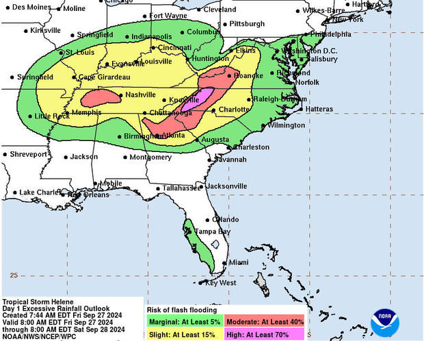
As the storm moves on, parts of the Southeast and Southern Appalachians could see total rain accumulations of 6 to 12 inches, with some areas getting up to 20 inches, forecasters said, bringing flooding across the region and a threat of landslides in steep terrain.
"We've already seen double-digit rainfall in western North Carolina and we could still get another half-foot or more. That means there's a risk of catastrophic and life-threatening flash flooding," meteorologist Stephanie Abrams of The Weather Channel said on "CBS Mornings" Friday, adding that flooding could stretch all the way to the Mississippi River.
"All of this water will cause rivers to rise, some of which could crush their records by several feet," Abrams said.
Ahead of its landfall, Helene rapidly intensified over the record-warm waters in the Gulf of Mexico. The high ocean temperature level at this location were made 200 times more likely due to climate change, according to analysis by Climate Central.
"This is the fourth hurricane to make landfall on the Gulf Coast this year. This has happened only five other times in history," Abrams noted.