Hurricane Helene prompts evacuations in Florida
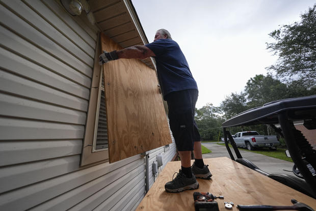
Residents along parts of Florida's Gulf Coast are evacuating and filling sandbags ahead of the arrival of Hurricane Helene, which was upgraded from a tropical storm on Wednesday and is forecast to rapidly intensify.
Helene formed Tuesday in the Caribbean Sea and is expected to cross the Gulf of Mexico and make landfall as soon as late Thursday. Hurricane watches have been issued for parts of Cuba, Mexico and part of the Florida coastline, including Tampa Bay. A tropical storm warning has been issued for parts of the Florida Keys.
Official projections from the National Hurricane Center indicate Helene is likely to become a devastating Category 3 hurricane with peak sustained winds of 115 mph at landfall.
On Tuesday, Florida Gov. Ron DeSantis expanded a state of emergency declaration to 61 counties. The state also issued voluntary and mandatory evacuation orders in 13 counties.
Federal authorities are positioning generators, food and water, along with search-and-rescue and power restoration teams, as President Biden also declared an emergency in Florida.
The storm is anticipated to be unusually large and fast-moving, meaning storm surge, wind and rain will likely extend far from the storm's center, the hurricane center said. Georgia Gov. Brian Kemp has declared a state of emergency. And states as far inland as Tennessee, Kentucky and Indiana could see rainfall.
Hal Summers, a restaurant worker in Mexico Beach, Florida, needed no reminding after he barely survived Hurricane Michael in 2018. DeSantis has said Helene is reminiscent of that Category 5 hurricane, which rapidly intensified and caught residents off guard before plowing a destructive path across the western Florida Panhandle.
When it hit, Summers waded with his cat in his arms as waters began rising rapidly in his parents' house. Their house and his home were destroyed.
"That was such a traumatic experience that that is not the place I needed to be for myself," he said Tuesday as he evacuated with a friend to Marianna, a town farther inland.
Many areas are forecast to see dangerous storm surges, especially between Panama City and Tampa. The coast stretching from Ochlockonee River to Chassahowitzka could see between 10 and 15 feet of water. Nearby areas could see between 5 and 10 feet of water, and the Tampa Bay area is forecast to experience between 5 and 8 feet of storm surge.
The Florida Keys may see between 1 and 3 feet of storm surge.
The Florida Division of Emergency Management's Know Your Zone map allows residents to input their address and learn their evacuation route in case of flooding or other disaster.


