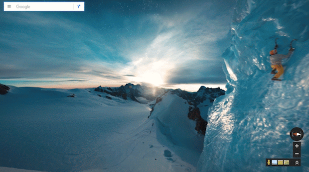
Google Street View lets you summit Mont Blanc without leaving your couch
Until now, Europe's highest peak, Mont Blanc, was reserved for world-class mountaineers and intrepid explorers. But thanks to Google, anyone with an Internet connection can now gaze at breathtaking views of reaching the summit through a special feature in Google Maps.
Google's Street View team trekked along with world-renowned alpine photographers, skiers, mountaineers, climbers, and runners to collect multidimensional views of Mont Blanc.
As the Google blog describes it: "Run on the summit with Kilian Jornet -- he holds the speed record for ascending and descending Mont Blanc in just 4 hours 57 minutes! Ice climb up a serac with record-setting alpine climber Ueli Steck, or go knee deep in powder alongside 14-time ski mountaineering champion Laetitia Roux and famed guide Patrick Gabarrou."
Google decided to capture 360-views of climbing Mont Blanc after the popularity of last year's first-ever vertical imagery collection of El Capitan in California's Yosemite National Park.
Google also did it for posterity. Mont Blanc's glaciers are receding as a result of climate change and Google wanted to create a digital record for future generations.
"You can learn more about how the rising temperatures are directly affecting the mountain from legendary guide Patrick Gabarrou, who describes the the glacial melt on the Mer de Glace. So this Street View imagery also serves as a digital record of Mont Blanc as it appears today, so future outdoor enthusiasts and scientists can look back at this time capsule to see how the mountain has changed," Google says on its blog.
